We're glad to share with you the January 2019 UN-SPIDER Monthly Updates.
Our latest Data Application of the Month provides a short overview of existing web mapping tools for flood monitoring. We also expanded our portofolio of step-by-step procedures on mapping hazards - our so-called Recommended Practices - by adding information about how to map burn severity with Landsat 8 and Sentinel-2 data in Google Earth Engine.
Below the updates, you'll also find an events calendar with upcoming conferences, workshops and seminars organized by the community. If you're interested in training opportunities, make sure to visit our external in-person training opportunities and online training opportunities overview pages.
Enjoy the read!
UN-SPIDER at a glance
- 25/01/2019Regional Support Offices involved: International Centre for Integrated Mountain Development (ICIMOD)
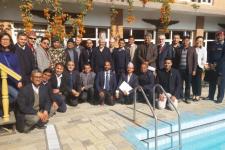
As part of the technical advisory support it provides to countries worldwide, UN-SPIDER carried out an Institutional Strengthening Mission to Nepal from 17 to 21 December 2018 upon the request of the government. The mission was a follow-up activity to the Technical Advisory Mission (TAM)… Read more
News from the community
- 28/01/2019
The Central Asia Hydrometeorology Modernization Project (CAHMP), funded by the World Bank and co-financed by United Nations agencies and other development partners, receives new funding… Read more
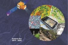
- 24th postgraduate programme in remote sensing and geographic system commences this summer at CSSTEAP28/01/2019
The Centre for Space Science and Technology Education in Asia and the Pacific (CSSTEAP), which is affiliated to the United Nations, will run its 24th postgraduate programme in Remote Sensing & Geographic… Read more
- 25/01/2019Regional Support Offices involved: Asian Disaster Reduction Center (ADRC)
The Japanese government is preparing to test a disaster early warning system that uses one of its Quasi-Zenith’s satellites this year. The system aims to better… Read more
- 25/01/2019
The International Charter “Space and Major Disasters” has been activated for floods in Brazil following the collapse of a mining dam. The activation was requested by the Brazilian Disaster and Risk Management National Centre (CENAD). The country’s Ministry of Regional Development is acting as project manager for the activation.
… Read more - 23/01/2019
A new Earth observation satellite developed by Viet Nam, which aims to enhance the country’s ability to respond to disasters and climate change, was launched into space on 18 January 2019. The MicroDragon satellite was put into orbit via an Epsilon-4 rocket, which lifted-off from the Uchinoura Space Centre in Kagoshima Prefecture in Japan.
The satellite is designed to monitor… Read more
- 23/01/2019
- 14/01/2019
The International Charter “Space and Major Disasters” has been activated for floods in Brazil by the Brazilian Disaster and Risk Management National Centre (CENAD). The country’s Ministry of National Integration is acting as project manager for the activation.
Mudslides and floods triggered by sudden… Read more
- 14/01/2019
The Group on Earth Observations (GEO) and Amazon Web Services (AWS) have teamed up to offer GEO member agencies and research organizations from developing countries access to cloud services. Selected organizations will receive AWS credits to host, process and analyze big data about the Earth to support sustainable development efforts.
The deadline for applications is… Read more
| Title | Organized by | City | Country | Date |
|---|---|---|---|---|
| Global Platform for Disaster Risk Reduction (GP2025) | United Nations Office for Disaster Risk Reduction (UNDRR) Government of Switzerland |
Geneva | Switzerland | 06/02/2025 to 06/06/2025 |
