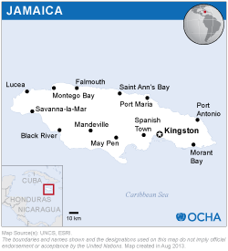
The mission team consisted of two UN-SPIDER experts, who were joined by an expert from the Panama-based Water Center for the Humid Tropics of Latin America and the Caribbean (CATHALAC) as well as an expert from the University of the West Indies in St. Augustine, Trinidad and Tobago (UWI). Both CATHALAC and UWI serve as UN-SPIDER Regional Support Offices. Experts from ODPEM and from the National Spatial Data Management Division (NSDMD) of the Office of the Prime Minister accompanied the mission team in all meetings.
Several meetings were held with representatives from various ministries, government agencies as well as with representatives from universities, the private sector and UNDP. In addition, the mission included an inter-institutional workshop targeting relevant stakeholders which took place on the premises of the Office of the Prime Minister.
The Mission was able to identify that access to and use of space-based information for a variety of purposes is not new in Jamaica. Several public and private institutions (such as the Forestry Department, The Mines and Geology Division (MGD), the Water Resource Authority (WRA), the Rural Physical Planning Division (RPPD), and the National Environment and Planning Agency (NEPA)) have accessed space-based data to generate useful information which is finding its way into sectoral development plans.
In 2001 a complete dataset of the IKONOS satellite imagery was acquired covering most of Jamaica. Many representatives of institutions are aware of the existence of the IKONOS 2001 imagery as well as other existing resources such as ASTER and Landsat imagery, and have made use of such information for a variety of purposes.
Recognizing the value of space based information, the Government of Jamaica has enacted policies to promote the generation and use of space based information to reduce the impact of natural phenomena such as hurricanes, floods or landslides.
In the context of geospatial information management, the Office for Disaster Preparedness and Emergency Management (ODPEM) has been able to secure the voluntary cooperation of staff from a variety of institutions that have skills on the use of Geographical Information Systems. This National Emergency Response GIS Team (NERGIST) conducts activities in the EOC whenever a disaster impacts the country.
ODPEM has also established the Hazard Management Group which has been preparing hazard maps. ODPEM is now conducting efforts to harmonize mapping efforts so that individual hazard maps can be combined particularly in those geographical regions which are exposed to multiple hazards simultaneously. The Group includes the Met Service, WRA, MGD, the Forestry Department, and the Earthquake Unit.
The National Spatial Data Infrastructure for Jamaica was established to facilitate the sharing of geo-spatial data and information among agencies of the government and the private sector. A geo-portal and metadata portal are currently being operated and further developed by the NSDMD to facilitate access to such information.
There are inter-institutional settings which have been set up by ODPEM to target efforts in the segments of disaster-risk reduction and emergency response.
Jamaica already disposes of a proper infrastructure for capacity building. A training center (including of computer laboratory) is operated under the auspices of the Land Information Council of Jamaica / National Spatial Data Management Division, under the Office of the Prime Minister.
In the particular context of space-based information, ODPEM is aware of the International Charter: Space and Major Disasters, and has tried requesting activations on two occasions in 2007 and 2008, but with somewhat unsuccessful results. In 2009, ODPEM began to take part in the Caribbean Flood Project, an initiative coordinated by the Canadian Space Agency (CSA), and the National Air and Space Administration of the United States (NASA). This initiative promotes the use of space-based information for flood-early warning, vulnerability assessment of banana crops for exportation, and wetlands in Jamaica.
ODPEM should improve its communication with the Charter and other similar mechanisms such as SERVIR, so that their activation can be requested in case of disasters in a timely way, in particular to take advantage of the provision of information by these mechanisms in the early warning phase.
ODPEM should also take advantage of the Technical Advisory Support provided by UN-SPIDER to gain access to data and information which are made available through this Programme. In addition, through UN-SPIDER, ODPEM should establish links with the space agencies of Brazil, Germany, China, Argentina and others that support efforts in all phases of the disaster management cycle.
ODPEM should make decision makers in agencies aware of the value of space-based information and take advantage of existing and emerging opportunities to access and to make use of such information. These capacities should be strengthened through the training of staff in Geographic Information Systems (GIS).
ODPEM should institutionalize NERGIST and enhance its capacities through training efforts.
ODPEM should create a strategy to target the assessment of vulnerability using space-based information in an inter-sectoral fashion.
A key recommendation has been made to the Land Information Council of Jamaica (LICJ) is to systematize the uses of imagery from IKONOS, LANDSAT, ASTER, and MODIS to deduct lessons learned, and to identify strategies to promote subsequent uses of such type of data to generate relevant and timely information in applications targeting all phases of the disaster cycle.


