National Workshop - 20 May 2024
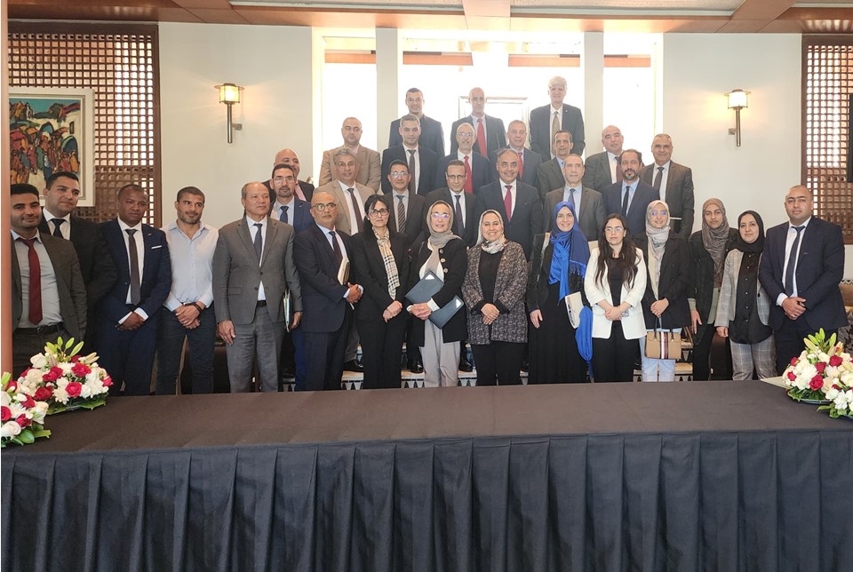
On 20 May 2024, the Disaster Risk Management Directorate of the Ministry of Interior of the Kingdom of Morocco organised a national workshop on the use of geospatial information in disaster risk management. More than thirty national government agencies, as well as UNOOSA and UN-SPIDER, were invited to the national workshop, which was held in Rabat. The workshop was organized to:
- Inform decision-makers about satellite applications during the different phases of risk and disaster management;
- Discuss methods and procedures to improve accessibility to satellite services for risk and disaster management;
- Collect feedback from stakeholders on user needs and experiences regarding the integration of the mentioned services;
- Formulate recommendations for improvement and optimal use of geospatial information
- Compile suggestions to elaborate a roadmap to enhance the use of geospatial information in disaster risk management applications in the short, medium and long term.
The welcoming remarks were made by the Director of the Disaster Risk Management Directorate of the Ministry of Interior, UNOOSA, the Fund of Solidarity against Disaster Events (FSEC), and the Royal Centre For Remote Sensing (CRTS). In his welcoming remarks the Deputy Director of UNOOSA stressed the importance regarding the usefulness of space-based and geospatial information in disaster risk reduction and disaster response efforts, and the benefits of interinstitutional collaboration to generate relevant information on a timely basis for its subsequent use.
The Disaster Risk Management Directorate and other government agencies shared information on their efforts to set up geospatial platforms to manage and visualize geospatial information on risks. UN-SPIDER shared information on examples of ways in which government agencies in other countries collaborate to generate space-based information in case of disasters and provided the example of the National Integrated Information System for Disaster Risk Management and Emergency Response established by the National Emergency Commission of the Dominican Republic.
After the presentations, participants made relevant and useful technical and organisational comments to optimise the use of geospatial information in disaster risk management, which led to several recommendations and key elements for the elaboration of the road map.
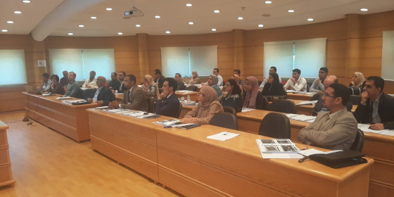
International Charter Project Manager Training - 21 & 22 May 2024
On 21 and 22 May 2024, the Royal Centre for Remote Sensing (CRTS) of the Kingdom of Morocco, UN-SPIDER, and the International Charter Space and Major Disasters organized a training course on the use of space-based information in case of disasters. The training course, organized with the support of the European Space Agency (ESA), the National Centre for Space Studies of France (CNES), and SERTIT, targeted more than 30 participants from CRTS and other government agencies and universities of Morocco.
The training course was held on the premises of CRTS and included presentations on the use of geospatial and space-based information in case of disaster response by CRTS, on the International Charter Space and Major Disasters, the procedures employed in its activations, and on the use of the Charter Mapper.
The experts from CRTS gave an introduction to the use of remote sensing in disaster management applications and presented examples of maps elaborated by CRTS in case of floods, earthquakes, and other types of events.
The expert from CNES gave participants an overview of the International Charter and its activations since it was launched in the year 2,000. The experts from SERTIT made participants aware of the procedures required for the activation of the Charter in case of disasters, the roles of the Authorised User, Project Managers and Value-Added Providers; and introduced them to the Charter Operating System version 2 (COS-2) that is used for this purpose. They also gave participants an overview regarding links between the International Charter and the Copernicus Emergency Management Service. The expert from ESA-PLES introduced participants to the Charter Mapper, presenting information on its layout, unique features, and the tools that have been incorporated to process satellite imagery in case of different types of hazards. The training course included a hands-on segment where participants were able to use the Charter Mapper to process satellite imagery in case of floods and earthquakes.