Zimbabwe - Technical Advisory Mission

At the request of the Ministry of Local Government, Public Works and National Housing of Zimbabwe, UN-SPIDER and the National Office of the United Nations Development Programme in Zimbabwe carried out a Technical Advisory Mission to Zimbabwe from 19 to 23 November 2018 to assess the current and potential use of space-based information in all aspects of disaster management in Zimbabwe. It also aimed to strengthen disaster management efforts in the country – including disaster risk management and emergency response aspects – by providing support in accessing and using space-based information for the full disaster management cycle. 

The mission was led by a programme officer from UN-SPIDER and conducted with the support of experts from the Regional Centre for Mapping of Resources for Development (RCMRD, the UN-SPIDER Regional Support Office in Kenya); from the Stuttgart University of Applied Sciences in Germany and from France. An expert from the Institut des Regions Arides, Tunisia, was consulted remotely.

As part of the mission, the team of experts visited 20 institutions including the Department for Civil Protection of the Ministry of Local Government, Public Works and National Housing, the Ministry of Lands, Agriculture, Water and Climate and Rural Resettlement – AGRITEX, the Ministry of Higher and Tertiary Education, Science and Technology Development, the Ministry of Health and Child Care, the Meteorological Services Department, the Zimbabwe National Water Authority, the SubAqua, Police Special Rescue Unit, the Scientific and Industrial Research and Development Centre, the Zimbabwe Red Cross, the University of Zimbabwe, the Bindura University of Science and Technology, the Higher Life Foundation of EcoNet and the NGO World Vision International. In addition, the mission team held meetings with the UN Resident Coordinator’s Office and with the country offices of UNDP, UNICEF, UNFPA, FAO, and WHO; as well as with the European Commission’s ECHO Mission team.

During the TAM, a one-day national workshop was organized on 22 November 2019. The workshop brought together between 65 and 70 participants, including the members of the TAM team and local stakeholders from ministries, government departments, academia, the private sector and international organizations. A wide variety of subjects were addressed during the workshop, including remote sensing applications for disaster management; availability of online satellite imagery resources and services covering drought, floods or fire monitoring; and the use of weather and climate information. Participants also discussed institutional arrangements, data exchange and sharing policies needed, and best practices in the use of space-based technology in other countries. The event was an occasion for awareness-raising about existing international mechanisms that make satellite information available to support disaster preparedness and emergency response.

-
Department for Civil Protection of the Ministry of Local Government, Public Works and National Housing Country/Region and the Country Office of UNDP.
  • Ms. Rose Waswa, Regional Centre for Mapping of Resources for Development, RCMRD, Kenya
  • Dr. Franz-Josef Behr, Stuttgart University of Applied Sciences, Germany
  • Ms. Alice Bourdet, Independent consultant, France
  • Dr. Essifi Bouajila, Institut des Regions Arides, Tunisia (on standby only)
  • Lorant Czaran, UN-SPIDER (Head of Mission)

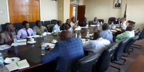
Five-day mission with a stakeholder workshop that brought together 65 to 70 participants from government agencies, universities, NGOs, UN agencies, other international organizations, and the private sector.


The mission team concluded that Zimbabwe has in place relatively good local capacity to work with geospatial and satellite data in several of the institutions visited; the capacity is especially strong at the universities visited. Universities could also support capacity-building efforts by expanding training in such skills to government staff. The mission team concluded that appropriate policy and legislative frameworks for disaster management and risk reduction – especially with respect to geospatial data production and sharing and the use of space-based information – could be quickly put in place through strong support from the ministers the TAM team interacted with during the visit to the country. In this context, the establishment and gradual implementation of a National Spatial Data Infrastructure (NSDI), similar to that of neighbouring countries, should also be encouraged and supported by the private sector as well as by United Nations organizations that are present in the country and implement relevant programmes or projects.

The key aspects of the recommendations that emerged are related to:

  • The need for a clear definition and implementation of a National Spatial Data Infrastructure (NSDI) with an identified leading agency, to allow mainstreaming the use of geospatial and space-based data in disaster management and in other national priority sectors (such as the sustainable development agenda and SDG-related monitoring).

  • More coordinated and collaborative approaches between the relevant national institutions when it comes to data and resource sharing, and commercial data licensing.

  • The use of national capacities in universities (such as the University of Zimbabwe or Bindura University) or in specific institutions to help train and build capacity in the use of remote sensing and GIS technologies for all governmental institutions with disaster management responsibilities.

  • The adoption and regular use by institutions of climate, flood, drought and other hazard and risk modelling or mapping methodologies based on existing applications and free online services.

  • Better information management and efficient leveraging of all donor-funded projects (including those from the private sector in the country and from other international organizations or donors) for generating and retaining geospatial and Earth observation data for the benefit of the national disaster management sector as a whole.