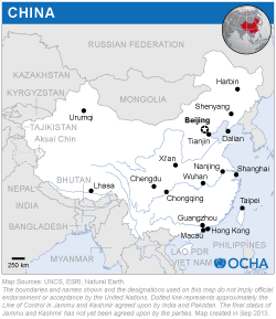
The International Training Course on Integration of Multisource Earth Observation Data for Disaster Damage Assessment was conducted back to back with the United Nations International Conference on Space-based Technologies for Disaster Risk Reduction - “Building Resilience through Integrated Applications” organized by the United Nations Office for Outer Space Affairs (UNOOSA), under the framework of UN-SPIDER, and the Ministry of Civil Affairs of the People’s Republic of China in Beijing, China from 23 to 25 October 2017.
Experts from the following institutions conducted the training:
- UNOOSA/UN-SPIDER
- National Disaster Reduction Centre of China (NDRCC)
- Centre for Space Science and Technology Education for Asia and the Pacific (CSSTEAP), India
- Regional Centre for Space Science Technology Education in Asia and the Pacific (RCSSTEAP), Beihang University
24 participants from the 15 countries’ disaster management agencies and stakeholder departments attended the training programme.
The aim of the training was to make participants conversant with use of Multi-source Earth Observation (including satellite and UAV, optical and microwave data, remote sensing and Geographical Information System, 3D modeling and other geospatial technology) in flood and earthquake damage assessment in particular. The training resulted in imparting skills to identify damaged infrastructure and learn about the methodology of damage assessment using integrated Multi-source Earth Observation technology. Following sessions (including hands on exercises) were offered during the training: Session 1: Basic Concepts of Remote Sensing and GIS and Chinese Open-source Space Data and Products Session 2: Theory and Practice on Direct Tangible Damage Assessment Caused by Earthquake Session 3: Theory and Practice on Flood Extent Mapping and Direct Tangible Damage Assessment Session 4: UAV Image Processing Session 5: Basic Concepts of DRR and Multisource Earth Observation Data for Earthquake Damage Assessment Session 6: Multisource Earth Observation Data for Flood Damage Assessment Session 7: Digital Analysis for Rapid Damage Assessment Session 8: Basic Concepts of GIS and Creation of GIS Database Session 9: 3D Modeling and Current Trends for Rapid Damage Assessment

