Yemen

country taxonomy block

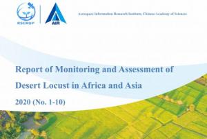
At the end of 2019, countries in the Horn of Africa began to suffer the impacts of locust swarms. Later, the locust migrated to regions in Southwest Asia. Unfortunately, the impacts on farmers are devastating. Furthermore, the combined impact of these locust plague and COVID-19 is having a toll of the livelihoods of many farmers in these regions. The Food and Agriculture Organization of the United Nations (FAO) has indicated that 42 million people are facing severe acute food insecurity because of this plague.

Since the end of 2019, the Aerospace Information Research Institute (ARI) of the Chinese Academy of Sciences (CAS) has been tracking the temporal and geospatial dynamics of the locust plague in the Horn of Africa, Eastern Africa, the Middle East and Southwest Asia. To track this plague, experts from the Vegetation Remote Sensing & Pest and Disease Application Research Team of ARI developed the Vegetation Pests and Diseases…

more
Publishing date 13/08/2020

The International Charter Space and Major Disasters has been activated for flooding in Yemen on 2 June.

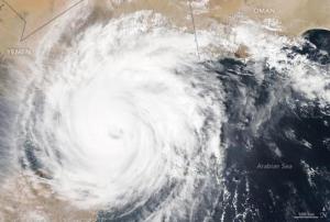
Cyclone Mekunu brought severe rainfall and winds causing flooding in areas of Yemen as it made landfall on 25 May. Local reports suggest that at least seven people have been killed and over 1,000 families have been displaced due to the flooding. The cyclone and floods have also damaged infrastructure and agricultural equipment in many districts of the Yemeni mainland. Some 120 fishing ships have reportedly been lost to the cyclone and a search is ongoing for missing fishermen.

One of the worst affected areas is the Yemeni island of Socotra in the Arabian Sea. Residents on the island are fleeing from torrential floods and more than 30 people are reported missing. Smaller islands off the coast of Socotra have also been heavily impacted and there is growing concern for the 2,500 families living on the islands of Abd Al Quri and Samhah as…

more
Publishing date 04/06/2018

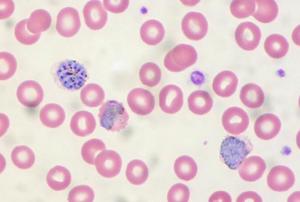
In May 2017, a team of scientists from West Virginia University used satellites to monitor temperatures, water storage, precipitation and land in order to predict a cholera outbreak in Yemen. After processing the satellite data in algorithms, the team was able to come up with a prediction model and ultimately to identify the particular areas that were most at risk for an outbreak several weeks before the event took place. The result of the successful test in Yemen highlights how public health technologies could benefit from the use of satellite data for disease forecasting.

According to the World Health Organization (WHO), cholera affects millions of people each year and it remains, to this day, a major public health risk in certain areas of the world. Due to the short incubation period of the disease, it often happens that communities become aware of an…

more
Publishing date 18/01/2018
The International Charter Space and Major Disasters has been activated to provide satellite-based emergency maps to local authorities in charge of response operations after Cyclone Chapala made landfall on 3 November 2015. The cyclone triggered storm surges, heavy rain, and flooding in coastal areas in Yemen. The request for activation was elevated to the Charter by UNITAR/UNOSAT on behalf of UNOCHA. 
 
Chapala is the strongest reported storm in Yemen’s recent history, representing a category four hurricane with “catastrophic damage” potential. Already on 1 November, Chapala caused three casualties on the island of Socotra before heading towards the mainland of Yemen. 
 
On November 3, Chapala made landfall in the Hadramaut region. Residents were ordered to evacuate, but…
more
Publishing date 05/11/2015