Glacial Lake Outburst
Definition
Facts and figures
Further information
UN-SPIDER Regional Support Offices with hazard-specific expertise
Related content on the Knowledge Portal
A new report by the world’s largest humanitarian aid network highlights global disasters, populations most vulnerable to them and the efforts of local institutions in preventing, preparing for and responding to them. The 2020 edition of the World Disasters Report, “Come Heat or High Water”, was launched virtually from the offices of the International Federation of Red Cross and Red Crescent Societies (IFRC) in Vienna on November 16. This year’s report discusses climate- and weather-related disasters and their humanitarian impact. It argues for the usefulness of smart financing and space-based information in disaster management support.
The report warns that the global effort to address climate change is leaving behind countries…
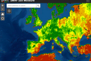
read more19/11/2020Officially launched in 2015 by the National Aeronautics and Space Administration (NASA), the SMAP mission is an orbiting satellite that measures the amount of wetness in the top layer of soil incrementally every 2-3 days. These Soil Moisture Active Passive (SMAP) measurements rely on radiation frequencies that point to different levels of moisture on the surface of earth’s soil and are useful for scientists because it allows them to construct maps indicating the level of soil moisture globally. Acknowledging the relevance and usability of this data for the field of disaster management, NASA recently integrated the SMAP data into its Disasters Mapping Portal.
The Disasters Mapping Portal has been developed by the Geographic Informations Systems (GIS) Team at NASA in an effort to make their…
read more25/11/2020The European Commission plans to rapidly expand its environmental monitoring programme Copernicus. For this purpose, the European Space Agency (ESA) recently pledged 2.55 billion Euros towards contracts to advance the production of six new Copernicus satellite missions. The final of the six contracts was signed last Thursday between ESA and Thales Alenia Space for a mission that will provide new and important information to climate research and disaster management.
The high-priority Copernicus Radar Observation System for Europe in L-band (ROSE-L) mission is planned to launch in 2028 for a period of 7.5 years. The ROSE-L mission will orbit Earth every few days at an altitude of 690km and will carry a L-Band synthetic aperture radar (SAR). With a wavelength of approximately 23cm, an…
read more18/12/2020The Disasters programme unit at the National Aeronautics and Space Administration (NASA) recently joined a newly launched online platform aimed at placing anticipatory action on the humanitarian agenda. NASA’s involvement in the Anticipation Hub and the subsequent incorporation of Earth observation (EO) tools, serves to improve the capabilities of anticipatory action globally and demonstrates the potential of utilizing satellite-driven data for anticipatory action in disaster management.
Anticipatory action in the humanitarian context describes disaster mitigation activities based on in-depth forecast information and risk analysis. This approach has gained traction amongst the humanitarian community in recent years as it is viewed as a more efficient and affordable alternative…
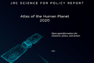
read more02/02/2021A new report outlines the impact of Global Human Settlement Layer (GHSL) data on various policy areas. The 2020 edition of the “Atlas of the Human Planet”, recently published and launched virtually by the Joint Research Centre (JRC) of the European Commission as a deliverable to the Group on Earth Observations (GEO) Human Planet Initiative, explores the impact of GHSL data on various policy areas, including disaster risk management.
GHSL data refers to “global spatial information, evidence-based analytics and knowledge describing the human presence on the planet”. This data relies on spatial information from Landsat 8, Sentinel-1 and Sentinel-2. It is mainly cost-free and…
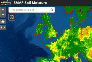
read more18/02/2021Officially launched in 2015 by the National Aeronautics and Space Administration (NASA), the SMAP mission is an orbiting satellite that measures the amount of wetness in the top layer of soil incrementally every 2-3 days. These Soil Moisture Active Passive (SMAP) measurements rely on radiation frequencies that point to different levels of moisture on the surface of earth’s soil and are useful for scientists because it allows them to construct maps indicating the level of soil moisture globally. Acknowledging the relevance and usability of this data for the field of disaster management, NASA recently integrated the SMAP data into its Disasters Mapping Portal.
The Disasters Mapping Portal has been developed by the Geographic Informations Systems (GIS) Team at NASA in an effort to make their satellite…
read more25/11/2020A new report by the world’s largest humanitarian aid network highlights global disasters, populations most vulnerable to them and the efforts of local institutions in preventing, preparing for and responding to them. The 2020 edition of the World Disasters Report, “Come Heat or High Water”, was launched virtually from the offices of the International Federation of Red Cross and Red Crescent Societies (IFRC) in Vienna on November 16. This year’s report discusses climate- and weather-related disasters and their humanitarian impact. It argues for the usefulness of smart financing and space-based information in disaster management support.
The report warns that the global effort to address climate change is leaving behind…
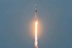
read more19/11/2020The Argentinean SAOCOM 1B satellite [was successfully launched](https://www.argentina.gob.ar/noticias/argentina-lanzo-el-satelite-saocom-1b-y-completo-la-mision-espacial-mas-importante-del-pais) into orbit on 30 August 2020. Developed by the National Argentinean Space Commission (CONAE), this new satellite will join SAOCOM 1A and four Italian COSMO-SkyMed to complete the joint Italian-Argentinean Satellite System for Emergency Management (SIASGE). Like its predecessor, SAOCOM 1B was built in Argentina through a joint effort with private companies and universities. It will operate at an elevation of 620 kilometers above the surface of the Earth. A SpaceX Falcon 9 booster launched the satellite from Space Launch Complex 40 at Cape Canaveral Air Force Station in Florida, United States of America. The SAOCOM 1B satellite has been fitted with a Synthetic Aperture Radar (SAR) sensor that makes use of microwaves in the electromagnetic L-band, which goes through clouds and works without…
read more14/09/2020According to the latest issue of an annual disaster statistics report, floods were the deadliest type of disasters in 2019, followed by extreme temperature, while storms affected the highest number of people. Published by the Centre for Research on the Epidemiology of Disasters (CRED), “Natural disasters 2019 - Now is the time to not give up” draws on data recorded in the Emergency Events Database (EM-DAT), which saw the addition of 396 disasters that affected a total of 95 million and caused $103 billion in economic losses around the world.
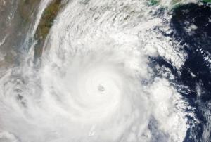
Accounting for 40 per cent of disaster events, Asia suffered the highest impact with 45 per cent of deaths and 74 per cent of total affected. India, which saw cyclone Fani cause destruction in 2019, was the country most…
read more20/08/2020- read morePolar regions have experienced the most rapid rates of warming in recent years and its expected impacts will exceed those forecasted for many other regions in the planet resulting in local, regional and globally significant consequences affecting natural ecosystems and human activities.This workshop aims at assessing the latest advancement in the use of EO technology for Polar science, exploring the main challenges and opportunities for the coming decade and consulting with the community to contribute to define a common scientific agenda for the future.Workshop Objectives:
- Reviewing the progress and latest results in polar science with major focus on EO- advances in the domain of polar research and applications
- Identifying the major Polar scientific challenges, observation gaps and research needs for the coming years
- Exploring effective mechanisms to promote networking and…


