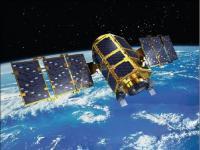
KOMPSAT-2 (Korea Multi-Purpose Satellite-2), also referred to as Arirang-2 by South Korea, has been developed by KARI (Korea Aerospace Research Institute) to continue the observation program of the KOMPSAT-1 mission.
The main mission objectives of the KOMPSAT-2 system are to provide a surveillance of large scale disasters and its countermeasure, acquisition of independent high resolution images for GIS (Geographic Information Systems), composition of printed maps and digitized maps for domestic and overseas territories, balanced development of Korean territories, survey of natural resources, and continuation of satellite earth observation after KOMPSAT-1.
Instrument: MSC (Multispectral Camera)
- resolution: 1m panchromatic, 4m multispectral
- swath width: approx. 15km
