• English
  • Español
  • Français

United
Nations


Office for Outer Space Affairs
UN-SPIDER Knowledge Portal

  • Inicio
  • Sobre nosotros
    • Sobre ONU-SPIDER
    • Acerca de UNOOSA
    • Publicaciones
    • Ofertas de trabajo
    • Conozca el Equipo
    • Contacto
  • Aplicación Espacial
    • Guías Tecnológicas
    • Mecanismos de Emergencia
    • Mecanismos de Recuperación
    • Red Internacional de Alerta de Asteroides
    • Grupo Asesor para la Planificación de Misiones Espaciales
    • Iniciativa Internacional sobre Meteorología Espacial
    • Tecnologías Espaciales en la ONU
    • Historias de Usuarios
  • Enlaces y Recursos
    • Aplicación de datos del mes
      • Disaster Recovery
    • Fuentes de Datos
    • SIG y Software de Percepción Remota
    • Recursos de capacitación en línea
    • Instituciones
  • Riesgos y Desastres
    • Gestión del Riesgo de Desastres
    • Alerta temprana
    • Gestión de Desastres y Emergencias
    • Amenazas Naturales
    • El Proceso de la Reducción de Desastres Post-2015
    • La ONU y la Gestión del Riesgo de Desastres
    • La ONU y Alerta Temprana
    • La ONU y la Gestión de Desastres
  • Asesoría
    • Misiones de Asesoría
    • Apoyo en caso de Emergencia
    • Asesoría Virtual
    • Prácticas Recomendadas
    • Actividades de Entrenamiento
    • Usos Prácticos
  • Redes
    • Oficinas Regionales de Apoyo
    • GP-STAR
    • IN-MHEWS
    • IWG-SEM
  • Proyectos
    • SPEAR
    • FOSAT-S
    • EvIDENz
    • Flood GUIDE
  • Noticias y Eventos
    • Noticias
    • Eventos
    • Eventos pasados

Breadcrumb

  • Home
  • Taxonomy Pages
  • Taxonomy Pages

Belarus

country taxonomy block

New remote sensing satellite to be developed by Russia and Belarus
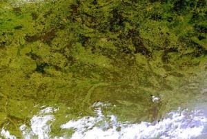
Belarus satellite image (Image: NASA)

Russia and Belarus announced that they are aiming to develop a new remote sensing satellite in two or three years. This Earth Observation satellite will replace a currently operating satellite whose service life will shortly come to an end.

The new satellite will capture images with a resolution of less than one meter, so it will be more precise than the existing two meter resolution satellite and will be used by several Belarusian authorities, such as the Emergencies Ministry, the Agriculture and Food Ministry, the Natural Resources and Environmental Protection Ministry, and the Forestry Ministry.

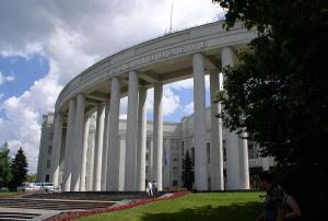
The agreement was signed by Igor Komarov, head of the Russian space agency Roscosmos, and Vladimir Gusakov, Chairman of the Presidium of the National Academy of Sciences of Belarus (NASB).
 

Publishing date 24/06/2015
Ukraine RSO participates in UNOOSA Workshop on Space Technology Applications
Two experts of the Ukraine UN-SPIDER RSO delivered presentations.

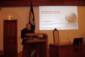
Representatives of the UN-SPIDER Regional Support Office in Ukraine (SRI NASU-SSAU) took part in the United Nations/Belarus Workshop on Space Technology Applications for Socio-Economic Benefits. This workshop was jointly organized by UN Office for Outer Space Affairs (UNOOSA) and the Government of Belarus and took place from 11 to 15 November 2013, in Minsk (Belarus).

The workshop was hosted by the Belarusian State University on behalf of the Government of Belarus, and it was cosponsored by the Secure World Foundation (SWF). Ukrainian experts delivered presentations on “Flood Monitoring Activities in the UN-SPIDER RSO-Ukraine” (Prof. N. Kussul, Space Research Institute National Academy of Sciences of Ukraine and State Space Agency of Ukraine) and "Satellite Agricultural Monitoring in Ukraine" (Prof. A. Shelestov, National University of...

more
Publishing date 02/12/2013
Regional Support Offices mentioned:
Ukraine Regional Support Office
Belarus: Plans for communication satellite
Academy of Sciences of Belarus, Minsk, Belarus

The Belarusian Telegraph Agency (BeITA) reported that Belarus has started a project for the creation of a communication satellite. BeITA names Sergei Zolotoi, Director of the enterprise Geoinformation Systems of the National Academy of Sciences of Belarus, as the source for this announcement. The project will be carried out by China Great Wall Industry Corporation (CGWIC), with the contract being underway.

In 2012, Belarus launched its first remote sensing satellite into space. Belarus aims at expanding its space programme by developing it for space-based remote sensing, national satellite communication and a geostationary satellite to support a common navigation system.

Publishing date 11/04/2013
GLONASS: Belarus and Russia sign satellite navigation agreement
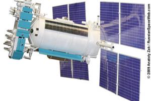
GLONASS-K, the latest satellite of the radio-based satellite navigation system

Belarusian network operator SKB Kamerton and Russia’s non-profit partnership Agency for Development and Use of Navigation Technology, NP GLONASS, have signed a cooperation agreement in the field of satellite navigation and the use of GLONASS technologies in Belarus and Russia. The document was signed by heads of the two organizations Alexander Kutko and Alexander Gurko at the 3rd international congress ERA-GLONASS, BelTA learnt from the Russian company.

The cooperation agreement envisages the use of the emergency response system on the territory of Belarus, harmonization of this system with Europe’s eCall, unobstructed and safe movement of vehicles and cargo along international transport corridors passing through the territory of Belarus and Russia. The two countries plan to develop compatible navigation and information systems using GLONASS satellite navigation solutions.

“This strategic partnership in the field of navigation solutions will contribute to formation...

more
Publishing date 13/03/2013
Belarus

National Academy of Sciences of Belarus

Contact Person

Mr Aleksandr Tuzikov

Tel/fax – (37517) 284 21 75

Email: tuzikov@newman.bas-net.by

 Web: http://www.ac.by/

Footer menu

  • Contact
  • Terms of Use

User account menu

  • Log in