Europa

country taxonomy block

New technologies have sometimes had very harmful effects, but in many cases the early warning signs have been suppressed or ignored. The second volume of Late Lessons from Early Warnings published by the European Environment Agency (EEA) investigates specific cases where danger signals have gone unheeded, in some cases leading to deaths, illness and environmental destruction.

The first volume of Late Lessons, published in 2001, was a ground breaking report detailing the history of technologies subsequently found to be harmful. The new 750-page volume includes 20 new case studies, with far-reaching implications for policy, science and society.

The report outlines the following key recommendations:

  • Key recommendations Science should acknowledge the complexity of biological and environmental systems, particularly where there may be multiple causes of many different effects, the report says. It is increasingly difficult to isolate a single agent and...

more
Publishing date 24/01/2013

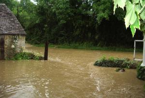
In the context of the heavy rains and floods that affected the UK lately, the need for methods how to more accurately predict heavy rainfall over land surface has become evident. Existing computer models used in the UK cannot show exactly where the rain will accumulate and cause problems.

Professor Paul Bates from the University of Bristol has been working on this problem for much of the last decade. He and his colleague, Dr Ad de Roo from the EU Joint Research Centre in Italy, decided to rethink the physics behind the complex and expensive computer models. "Instead of loading more and more physical processes into the prediction model we decided to turn it on its head and find a simpler way," says Bates. The pair worked out the minimum amount of physics needed to improve the model's predictive skill over a large area and at high resolution.

Bates and de Roo developed a new two-dimensional flood inundation programme which they have improved over the years, creating a...

more
Publishing date 05/12/2012

The potential of GMES for crisis management and environmental monitoring is highlighted in a new publication with users demonstrating the importance of Earth observation data to European regions. The publication was presented at an event held on 10 October at the European Parliament in Brussels.

The joint ESA-NEREUS (Network of European Regions Using Space Technologies) publication is a collection of articles that provide insight into how the Global Monitoring for Environment and Security (GMES) programme is being used in new applications and services across Europe. The articles, prepared by regional end-users, research institutes and industry providers from 17 different European countries, were received following an open call for papers.

Papers were grouped according to the thematic GMES domains land, maritime, atmosphere, climate and emergency management. They highlight a wide range of uses, needs and benefits of the initiative for regional organisations. Among the...

more
Publishing date 16/10/2012

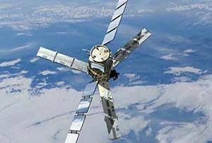
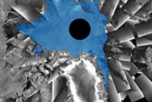
This year, satellites saw the extent of Arctic sea ice hit a record low since measurements began in the 1970s. ESA's SMOS and CryoSat satellites are now taking a deeper look by measuring the volume of the sea-ice cover. Measurements from Soil Moisture and Ocean Salinity (SMOS) mission show that ice has thinned significantly in the seasonal ice zones, with extensive areas less than half a metre thick.  Although not originally designed for looking at ice, the SMOS satellite's data are being evaluated to monitor Arctic sea ice. The results reveal that radiation emitted by the ice allows SMOS to penetrate the surface, yielding ice-thickness measurements down to 50 cm - mainly the thinner and younger ice at the edge of the Arctic Ocean. This allows improved evaluation of the volume of the young ice, which is the basis of old ice in subsequent years....

more
Publishing date 09/10/2012

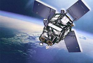
Indra agreed with the European Space Agency (ESA) the definition of the requirements for the system that will manage the Spanish satellite Ingenio. The technological company leads the development, implementation and start-up of the ground segment for the future Spanish ground-based optical observation satellite, which will be ready to enter into service in 2015. With this important milestone, Indra, along with the consortium, firmly undertakes the review of the preliminary design for the second half of the year. Indra has been awarded a contract to lead the project by the Ministry of Industry and became responsible for the integration, installation, testing and start-up of the ground segments for the two satellites in the Spanish National Earth Observation Programme (PNOT): the Ingenio optical satellite and the...

more
Publishing date 28/09/2012

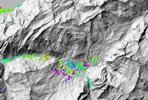
Archived radar data from the Envisat mission are playing an important role in mapping landslides in Switzerland. The mission’s vast archives continue to prove useful for mapping ground deformation. Landslides are a natural hazard of special relevance in Alpine regions. Earth-observing satellites – specifically those equipped with radars – can help scientists to map and monitor ground movement. From their orbits some 800 km above the ground, satellite radars can detect these ground deformations down to within centimeters. When two or more radar images of the same area are combined, positional changes are revealed. This technique, called Differential Interferometric Synthetic Aperture Radar – or DInSAR – has become a useful tool for detecting ground deformation. The Swiss corporation Gamma Remote Sensing began using DInSAR on Swiss landslides with data from ESA’s ERS missions in 2000. Following Envisat’s launch in 2002, they continued to...

more
Publishing date 27/09/2012
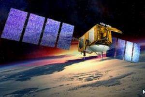
A major reassessment of 18 years of satellite observations has provided a new, more detailed view of sea-level change around the world. Incorporating the data from a number of spacecraft, the study re-affirms that ocean waters globally are rising by just over 3mm/yr. Measuring ocean surface shape from satellites has a relatively short history. Routine observations began with Europe's ERS-1 spacecraft in 1991, and this has subsequently been followed up by a series of international missions. The benchmark today is arguably Jason/Poseidon - a cooperative venture between the US and Europe (principally France). Now in its third incarnation, the Jason satellite circles the globe making a topographic map of 95% of the Earth's ice-free oceans every 10 days. To do this, it uses a radar altimeter, which constantly bounces microwave pulses off the sea surface.
Publishing date 25/09/2012

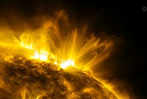
The United Nations is holding a Symposium on Data Analysis and Image Processing for Space Applications and Sustainable Development: Space Weather in Graz, Austria, from 18 to 21 September 2012. This is the first event in a new series of annual symposia that will address the use of space-derived data analysis and image processing tools in support of sustainable development. Organized by the United Nations Office for Outer Space Affairs (UNOOSA), in cooperation with the Government of Austria and supported by the European Space Agency (ESA), the 2012 Symposium focuses on Space Weather data, a timely topic in light of the predicted maximum solar activity during the 2012-2013 period, and the impact that it could have globally. It aims at promoting an active cooperation among the various data collection networks, easier use of specific data collections for better understanding of space weather and solar-terrestrial interactions, and identification of joint activities at the international...

more
Publishing date 20/09/2012

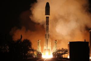
The second Metop satellite was launched yesterday, 17 September 2012 from the Baikonur cosmodrome, in Kazakhstan, atop a Russian Soyuz launcher, as planned. Metop-B will ensure the continuity of the weather and atmospheric monitoring service provided by its predecessor Metop-A, which has been circling the globe from pole to pole, 14 times a day, since 2006 and has now exceeded its design lifetime. The Soyuz-Fregat vehicle lifted off at 16:28 GMT on Monday, 17 September. The Fregat upper stage manoeuvred to release the satellite into a polar orbit at an altitude of 810 km some 69 minutes later, over the Kerguelen Archipelago, in the Indian Ocean. Metop-B, developed for EUMETSAT’s polar satellite system, is now under the control of ESA’s Operations Centre in Darmstadt, Germany.

ESA’s Director General Jean-Jacques Dordain states “This is a...

more
Publishing date 18/09/2012

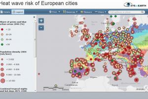
The European Environment Agency (EEA) unveiled on 4 September 2012 an interactive map that shows the heatwave risk for European cities; this and other maps are included in a recently published EEA report entitled “Urban adaptation to climate change in Europe”.

The interactive maps allow users to explore data from more than 500 cities in Europe and get a quick impression of some of the adaptation challenges in Europe’s cities.

Southern Spain, parts of southern France, Italy, Greece, Serbia and western Turkey are the most exposed regions, which are likely to have more than 50 days in a year with higher temperatures than 35 degrees Celsius.

Users can combine different datasets from the report, for example combining the heat wave map with information regarding vulnerability like the share of elderly people who are more sensitive to heat

more
Publishing date 05/09/2012

In the early hours of 1 March 2002, the largest Earth observation satellite ever built soared into orbit from ESA’s launch base in Kourou, French Guiana. For a decade, Envisat has been keeping watch over our planet. The eight-tonne satellite has doubled its planned five-year lifetime, circling Earth more than 50 000 times. With ten sophisticated optical and radar sensors, the satellite is continuously observing and monitoring Earth’s land, atmosphere, oceans and ice caps. An estimated 2000 scientific publications have been based on this information. Envisat’s largest instrument is the Advanced Synthetic Aperture Radar, which can be used day or night because it sees through clouds and darkness. This is particularly useful over polar regions, which are prone to long periods of bad weather and extended darkness. Last summer, the radar monitored record-low sea ice cover in the Arctic.

The Medium Resolution Imaging Spectrometer – or MERIS – captures...

more
Publishing date 05/03/2012

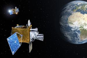
Thales Alenia Space today signed a contract with the European Space Agency (ESA) to supply Meteosat Third Generation (MTG) satellites for Eumetsat, the European meteorological satellite organization.

Thales Alenia Space is prime contractor for this large-scale program, in partnership with German company OHB. The first phase of this program started in November 2010, and has now been definitively approved by the ESA industrial policy committee. Thales Alenia Space has built Meteosat satellites since the beginning of geostationary weather forecasting systems in Europe, more than 30 years ago. ESA and Eumetsat issued a request for proposals for the development of the third-generation satellites, and Thales Alenia Space was able to propose industrial partnerships meeting ESA’s geographical return rule, from both the qualitative and quantitative standpoints. The Thales Alenia Space’s proposal not only delivers the performance expected by users, but...

more
Publishing date 29/02/2012

Europe’s next fleet of meteorological satellites is set to debut in 2017, following today’s signing of the development contract. While Meteosat Third Generation will ensure full continuity with the current Meteosat satellite family, it will also introduce significant improvements. At an event held today at ESA’s headquarters in Paris, the contract between ESA and Thales Alenia Space for developing the new Meteosat Third Generation (MTG) family of satellites was signed. Following on from Meteosat Second Generation, MTG is a cooperative venture between Eumetsat and ESA, and will ensure continuity of high-resolution meteorological data to beyond 2037. The cooperation on meteorological missions between Eumetsat and ESA is a success story that started with the first Meteosat satellite in 1977 and continues today with Meteosat Second Generation and the polar-orbiting MetOp series.

The new series will comprise six satellites: four MTG-I imaging and two MTG-S...

more
Publishing date 29/02/2012

PR 34 2011 - Council underlined the importance of space systems for security. They drew attention to the role of satellite systems – particularly Galileo, EGNOS and GMES – as the backbone for improving Europe’s response to emergencies.

Pre-operational Global Monitoring for Environment and Security (GMES) services are already available. The ministers from EU and ESA Member States urged the European Commission to accelerate the transition to full operations, in support of EU external actions.

The ministers reaffirmed GMES as a priority for the EU, and urged the European Commission to take the necessary and timely actions to secure the continuity of the programme and the services it supplies to users.

Ministers highlighted the fact that the policy governing the availability of GMES data is crucial to the secure use of services and to the development of sustainable markets in the value-adding sector.

GMES will work hand-in-hand with...

more
Publishing date 07/12/2011

Eight member states have raised concerns about future funding for the EU's GMES space programme.

The countries used a letter to the commission to lodge a formal protest against what some believe could be possible funding reductions for the EU-wide scheme.

The move comes after the commission proposed funding for GMES 'outside' of the multiannual financial framework for the spending period from 2014-2020.

In addition, the commission has announced recently that it is considering regulating the funding of GMES by an intergovernmental agreement.

Both proposals have raised concerns in some quarters that future funding for the programme may be cut or at best frozen.

The letter is signed by France, Germany, Finland, Italy, Spain, Sweden, the Netherlands and the UK.

It was sent to commission vice-president for industry and entrepreneurship Antonio Tajani, budget and financial programming commissioner Janusz Lewandowski, and M...

more
Publishing date 21/11/2011

Emergency services working in the immediate aftermath of disasters will benefit from fast access to pan-European mapping created from interoperable, geospatial data thanks to an agreement between EuroGeographics and the European Environment Agency (EEA).

The agreement, signed on 16th November 2011 at the Group on Earth Observation (GEO) plenary in Istanbul, Turkey, will improve access to data from national mapping and cadastral agencies in Europe to help provide a common operational picture for those involved in crisis management to work from. Civil protection agencies, national and local emergency services, humanitarian aid organisations and European Union bodies will all be able to use the rush-mode mapping and damage assessment maps created as part of the GMES emergency management service. This service may be activated on any day at any time and aims to provide reference maps just six hours after gaining access to earth observation data and damage...

more
Publishing date 17/11/2011

Broader and improved access to satellite data is boosting the Global Monitoring for Environment and Security programme.

The aim of the Global Monitoring for Environment and Security (GMES) programme is to provide accurate, timely and easily accessible information. This will improve the management of the environment, understand and mitigate the effects of climate change and support decision-making in emergency and crisis situations.

To achieve these goals, the EU-led initiative relies on a wide range of satellite data from over 40 European and international space missions, along with other environmental datasets, provided through the Data Access system of the GMES Space Component.

With this GMES Space Component Data Access scheme, Earth observation data are made available in a unified manner to European service providers on Earth’s land, oceans and atmosphere, climate, security and emergency response management.

Since the beginning of...

more
Publishing date 13/10/2011

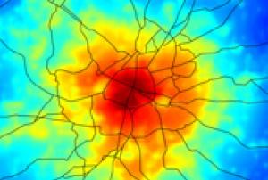
Satellites are helping to forecast the location of urban areas most affected during heat waves, helping planners to design cooler, more comfortable cities.

The temperature in densely urbanised areas can be several degrees higher than in nearby rural areas – a phenomenon known as the ‘urban heat island’ effect. These ‘heat islands’ are particularly noticeable at night. During the day, cities accumulate solar radiation and release the energy after the Sun sets. The negative effects of this increase in urban temperatures are multiple: health problems, higher energy demand, air pollution and water shortages.

At their final review held at ESA’s ESRIN site Frascati, Italy, the Urban Heat Islands and Urban Thermography team presented its findings on how remote sensing allows the continuous monitoring of thermal radiation emitted by urban surfaces. Monitoring thermal radiation can help city planners to design more ‘liveable’...

more
Publishing date 29/09/2011

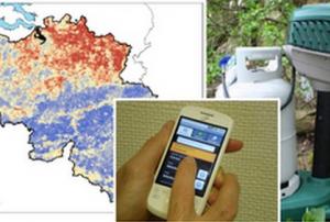
ESA is helping to take the bite out of mosquitoes and their deadly diseases by tracking their distribution and habitat via observation satellites, satnav, and mobile communications.

The Vecmap initiative is testing the accurate mapping of mosquitoes in Europe, in particular, mosquitoes carrying diseases, for public health agencies and regional mosquito controllers. Testing began in 2009 in the Netherlands, the UK, Belgium, France, Switzerland and Italy. Transmitters of disease such as mosquitoes are known as vectors.
With this information, the insects can be kept below the level where they become a nuisance or able to spread disease.

“Diseases such as Dengue or West Nile fever that are carried by mosquito vectors are an increasing public health concern in many European countries, yet very little is known about the distribution of either the diseases or the vectors that transmit them to humans,” says Michiel Kruijff, ESA’s technical...

more
Publishing date 25/05/2011

Improving the safety and daily lives of European citizens thanks to radio navigation, guiding tractors by satellite for high-yield crops, optimizing response to humanitarian crisis…This crucial role of space is reflected in the European Commission communication as a first step of an integrated Space Policy to be developed with the new legal basis provided by the Lisbon Treaty. The new Communication aims at reinforcing Europe’s space infrastructure and calls for increasing support for research to increase European technological non-dependence, foster cross-fertilisation between the space sector and other industry sectors, and boost innovation as a driver of European competitiveness.
Faced with important economic, societal and strategic challenges, today’s communication sets out priorities for the future EU space policy:


  • Pursue the achievement of the European navigation satellite programmes Galileo and EGNOS. For example, a...
more
Publishing date 06/04/2011

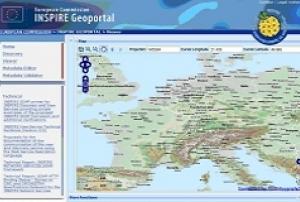
Planetek Italia is starting the activities to set up the INSPIRE Geoportal, the central portal for environmental information in the European Union. The company has been awarded the tender for the "Development of the technical components of the INSPIRE Geoportal at European Level", of the Joint Research Centre (JRC) - Institute for Environment and Sustainability.

The INSPIRE Geoportal is the unique access point to global European Environment Geoinformation resources shared and made available by all member states within the framework of the "Infrastructure for Spatial Information in the European Community" (INSPIRE) Directive.

The main objective of this project is to provide the operational version of the INSPIRE Geoportal at European level, including integration interfaces for discovery and view services from member state portals and thus to foster the harmonization of member states' national Geoportals implementations through the adoption of open...

more
Publishing date 30/03/2011

When a major disaster strikes in remote parts of the world, knowing if the area is populated, and how densely, is crucial for the effective organisation of humanitarian operations. The Global Human Settlements Layer (GHSL), developed by the European Commission's Joint Research Centre (JRC), will soon provide this detailed information for the first time on a global scale. The breakthrough is new advanced algorithms, developed by the JRC, that allow automatic analysis of medium resolution data provided by European satellites. The first test results confirm that the combined use of ICT technologies permit fast and precise mapping of built-up areas, anywhere in the world. In addition, the algorithms allow massive datasets to be processed more efficiently and rapidly, making it possible to monitor the changes in human settlements regularly and equally importantly, to collect the same information from heterogeneous satellite data. This can help to reduce risks in areas that experience...

more
Publishing date 22/02/2011

The University of Leicester (UK) is going to launch a "Centre of Excellence in Earth Observation Research Training" with the aim of teaching and training young researchers to use the latest satellite technologies to tackle environmental issues. The centre is supported by the "Initial Operations Network for Earth Observation Research Training" (GIONET) project and funded by the European Commission within the Seventh Framework Programme (FP7) and the Marie Curie Programme.

GIONET project seeks to develop new and better methods for research, for addressing disaster relief, as well as for monitoring climate change, environmental disasters and land cover change. Besides, it is expected to satisfy the demand for more researchers and skilled personnel for the EU’s observation programme "Global Monitoring for Environment and Security" (GMES).

More information is available at:

...

more
Publishing date 26/01/2011

Satellite information on snow cover is now available through ESA’s GlobSnow project soon after it snows. Understanding snow conditions helps us to predict floods and advance climate studies. Seasonal changes in snow cover mostly occur in the northern hemisphere. The one-year, near-real time demonstration service makes information about snow cover and snow amount publicly available online on the GlobSnow website.
 

For more information, please visit ESA or Finnish Meteorological Institute

more
Publishing date 05/11/2010