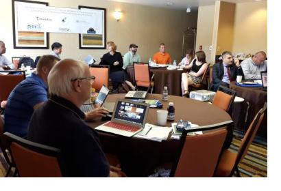
From 07-10 October 20015 the United Nations Platform for Space-Based Information for Disaster Management and Emergency Response (UN-SPIDER) in collaboration with the Geospatial Information and Technology Association (GITA), SharedGeo, the Secure World Foundation and Delta State University (DSU) sponsored an international workshop in Jackson (USA) on the use of geographic information systems (GIS), remote sensing in emergency management and response practices established at Mississippi Emergency Management Agency.
Funded participants from Georgia, Vietnam, Mozambique, Japan, USA and UN-SPIDER took part within seminars on the emergency management life-cycle, the incident command system, the application of open source software to emergency management, data gathering techniques using crowd-sourcing and a tour and exercise at the Mississippi Emergency Management Agency.
The international workshop trained the participating emergency managers on the awareness and use of spatial technologies and space imagery for disaster risk reduction in developing countries. With an analysis on what areas are potentially affected, where response resources are located and how to limit the spread of a disaster, participants received first information towards successful emergency management.
Mr. Jaime Neto, Member of Parliament and Chair of the parliamentary select committee on environment, DRR and CCA, Mozambique commented the outcome of the workshop “It was very good and useful exposure for me and will help on my job as a politician and also has provided me with instruments to help improve INGC’s (National Institute of Disaster Management) tasks”.

