• English
  • Español
  • Français

United
Nations


Office for Outer Space Affairs
UN-SPIDER Knowledge Portal

  • Inicio
  • Sobre nosotros
    • Sobre ONU-SPIDER
    • Acerca de UNOOSA
    • Publicaciones
    • Ofertas de trabajo
    • Conozca el Equipo
    • Contacto
  • Aplicación Espacial
    • Guías Tecnológicas
    • Mecanismos de Emergencia
    • Mecanismos de Recuperación
    • Red Internacional de Alerta de Asteroides
    • Grupo Asesor para la Planificación de Misiones Espaciales
    • Iniciativa Internacional sobre Meteorología Espacial
    • Tecnologías Espaciales en la ONU
    • Historias de Usuarios
  • Enlaces y Recursos
    • Aplicación de datos del mes
      • Disaster Recovery
    • Fuentes de Datos
    • SIG y Software de Percepción Remota
    • Recursos de capacitación en línea
    • Instituciones
  • Riesgos y Desastres
    • Gestión del Riesgo de Desastres
    • Alerta temprana
    • Gestión de Desastres y Emergencias
    • Amenazas Naturales
    • El Proceso de la Reducción de Desastres Post-2015
    • La ONU y la Gestión del Riesgo de Desastres
    • La ONU y Alerta Temprana
    • La ONU y la Gestión de Desastres
  • Asesoría
    • Misiones de Asesoría
    • Apoyo en caso de Emergencia
    • Asesoría Virtual
    • Prácticas Recomendadas
    • Actividades de Entrenamiento
    • Usos Prácticos
  • Redes
    • Oficinas Regionales de Apoyo
    • GP-STAR
    • IN-MHEWS
    • IWG-SEM
  • Proyectos
    • SPEAR
    • FOSAT-S
    • EvIDENz
    • Flood GUIDE
  • Noticias y Eventos
    • Noticias
    • Eventos
    • Eventos pasados

Breadcrumb

  • Home
  • Benefits of Satellite Information To Forecast Landslides
  • Benefits of Satellite Information to Forecast Landslides

Benefits of Satellite Information to Forecast Landslides

Geohazard TEP video screenshot. Courtesy of ESAGeohazard TEP video screenshot. Courtesy of ESA

Satellite archives information combined with a new cloud computing platform offer early warning of landslides. An example of this is Carmenes del Mar resort, in the south coast of Spain, that suffered from landslides leaving homes destructed. Combining radar images from various satellites, a team of Spanish researches from the group Analisis del Relieve y Procesos Activos (ARPA) could detect motion of less than a centimeter per year.

Minimal shifts are highlighted in rainbow-like patterns when consecutive radar images of the same site are combined. Traditionally the detection of imperceptible changes was particularly complex requiring a longer period of time. Now it is possible to use new computing services supported by ESA which allow easier and faster use of satellite information.

The online Geohazards Explotation Platform permits the flawless, browsing, access and processing of vast amounts of satellite data. Furthermore there are software tools that extract helpful knowledge and share the results.

The benefit of this technological advancement is that researches can dedicate more time to their core work: information analysis and interpretation; while the data collection and the results production is done in an automated way. 
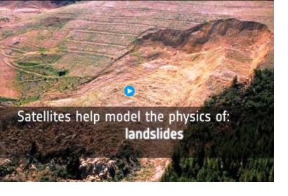
Early warning from space of homes on the slide
Tue, 29 Nov 2016 - 07:20
Spain

Footer menu

  • Contact
  • Terms of Use

User account menu

  • Log in