![]()
United
Nations
Sea Level Rise Viewer
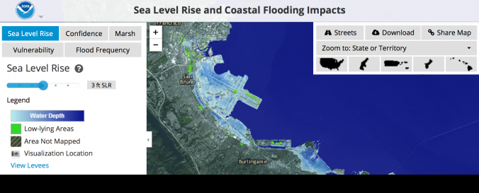
| Description: | Use this web mapping tool to visualize community-level impacts from coastal flooding or sea level rise (up to 10 feet above average high tides). Photo simulations of how future flooding might impact local landmarks are also provided, as well as data related to water depth, connectivity, flood frequency, socio-economic vulnerability, wetland loss and migration, and mapping confidence. |
| Software type: | SIG en línea (solo visual) |
| Accessibility: | En línea |
| Requirements: | Features
|
| Computer System: | En línea |
| Scope: | Visualización |
| Graphical user interface: | Sí |
| Costs: | Gratis |
| Tutorials: |
![]()