![]()
United
Nations
MERIT Hydro (University of Tokyo)
| Data provided by: | The University of Tokyo |
| Data accessibility: | Exportar datos, Visualización de datos (ej. web SIG o monitoreo en tiempo real) |
| Link to the data: | |
| Data type: | Datos sobre el use suelo, cobertura del terreno |
| Hazard: | Hydrological, Flood |
| Disaster cycle phase: | Gestión des Riesgo por Desastres, Respuesta, Recuperación |
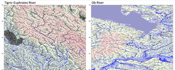
| Space-based Information: | MERIT Hydro is a global hydrography datasets, developed based on the MERIT DEM and multiple inland water maps. It contains flow direction, flow accumulation, hydrologically adjusted elevations, and river channel width., High-resolution raster hydrography maps are a fundamental data source for many geoscience applications. Here we introduce MERIT Hydro, a new global flow direction map at 3 arc-second resolution (~90 m at the equator) derived from the latest elevation data (MERIT DEM) and water body datasets (G1WBM, GSWO, and OpenStreetMap). We developed a new algorithm to extract river networks near-automatically by separating actual inland basins from dummy depressions caused by the errors in input elevation data. After a minimum amount of hand-editing, the constructed hydrography map shows good agreement with existing quality-controlled river network datasets in terms of flow accumulation area and river basin shape. The location of river streamlines was realistically aligned with existing satellite-based global river channel data. Relative error in the drainage area was smaller than 0.05 for 90% of GRDC gauges, confirming the accuracy of the delineated global river networks. Discrepancies in flow accumulation area were found mostly in arid river basins containing depressions that are occasionally connected at high water levels and thus resulting in uncertain watershed boundaries. MERIT Hydro improves on existing global hydrography datasets in terms of spatial coverage (between N90 and S60) and representation of small streams, mainly due to increased availability of high-quality baseline geospatial datasets. The new flow direction and flow accumulation maps, along with accompanying supplementary layers on hydrologically adjusted elevation and channel width, will advance geoscience studies related to river hydrology at both global and local scales. |
| Satellites and Sensors: | SRTM (SIR-C) |
| Spatial coverage: | Global |
| Spatial resolution: | ~90 m at the equator |
| Temporal coverage: | Archivado |
| Content dates: | MERIT Hydro is held by the developers, 2019 |
| Technical Specifications: | |
| Costs: | Gratis |
| Contact: | Dai YAMAZAKI |
| Tutorials on the use of data: | MERIT Hydro world tour on Google Earth |
| Restrictions/ Citation of the dataset: | Citation to the paper is adequate if you simply use the MERIT Hydro. If you asked help for additional handling/editing of the dataset, or your research outcome highly depends on the product, the developer would request co-authorship. or: Yamazaki D., D. Ikeshima, J. Sosa, P.D. Bates, G.H. Allen, T.M. Pavelsky MERIT Hydro: A high-resolution global hydrography map based on latest topography datasets
|
Provider
![]()