On 1 March 2022 the newest geostationary satellite (GOES-18) of the National Oceanic and Atmospheric Administration (NOAA) launched. Equipped with the Advanced Baseline Imager (ABI, 16 channels), it measures energy at different wavelengths in the electromagnetic spectrum to obtain information about Earth’s atmosphere, land, and ocean.
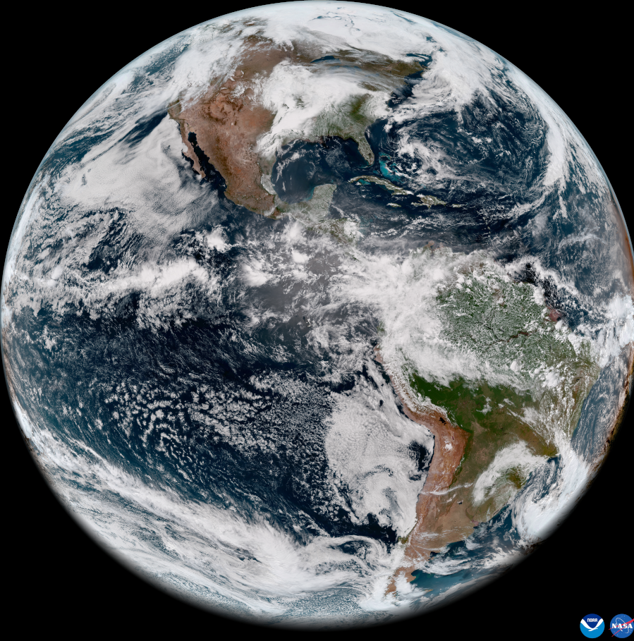
On 11 May 2022 NOAA shared the first images of the Western Hemisphere, taken by the GOES-18 Satellite.
GOES-18 orbits 22,236 miles above the equator at the same speed the Earth rotates (geostationary). This allows the satellite to constantly view the same area of the planet and track weather conditions and hazards as they happen.
The ABI provides high-resolution imagery and atmospheric measurements for short-term forecasts and severe weather warnings. ABI data is also used for detecting and monitoring environmental hazards such as wildfires, dust storms, volcanic eruptions, turbulence, and fog.
Data from multiple ABI channels can be combined to create imagery that approximates what the human eye would see from space—a result known as GeoColor. Combining data from different channels in different ways also allows meteorologists to highlight features of interest.
GOES-18 will assist GOES-17 with GOES West operations in late summer 2022 and again in early fall. NOAA plans for GOES-18 to replace GOES-17 as GOES West in early 2023. Imagery from GOES-18 during the post-launch testing phase should be considered preliminary and non-operational.