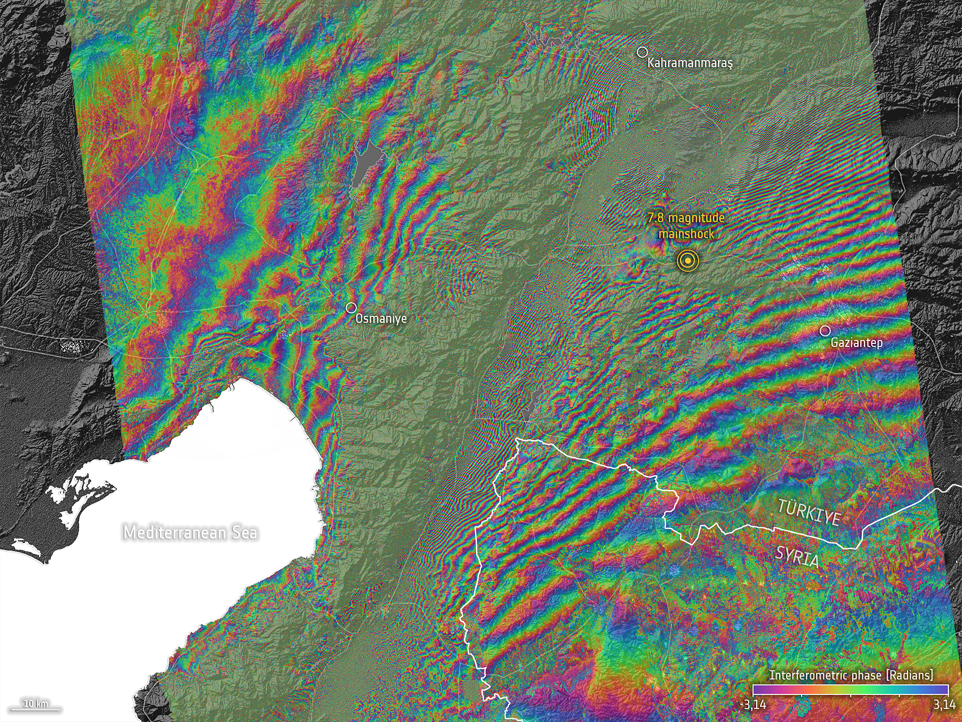
In the early hours of 6 February 2023, a major earthquake of magnitude 7.8 struck the sourthern region of Türkiye. The epicentre was located 23 kilometres east of Nurdagi (Gaziantep Province). The earthquake also affected neighbouring Syria and was followed by very strong aftershocks.
The space community is contributing to provide critical information and support disaster response efforts. Through the activation of the International Charter on Space and Major Disasters, and the Copernicus Emergency Management Service, the space community is playing an important role in the response and recovery efforts. Other space agencies are also contributing to map the areas affected by the earthquake.
One of the products that can be elaborated processing radar imagery before and after an earthquake is an interferogram that depicts the displacement of the surface triggered by such an earthquake. The European Space Agency carried out an analysis of satellite imagery to extract information on impacts, and extracted an interferogram of this earthquake in Türkiye. This interferogram is shown in the image above. More information on these efforts by ESA is available here.
The use of high-resolution satellite imagery is also allowing experts from the space community to locate damaged and destroyed infrastructure.
At the request of UN-SPIDER, experts from Colombia and Germany elaborated a map indicating the location of potential landslides triggered by the earthquake in mountainous rural areas around the epicentre of the earthquake. The identification of potential landslides was done using Sentinel 1 and Sentinel 2 imagery. Moreover, a Chinese SAR operator contacted UN-SPIDER to offer post-disaster imagery to support relief efforts.
More information on the activation of the International Charter related to this earthquake is available here.
More information on the activation of the Copernicus Emergency Management Service - Mapping is available here.
More information on the earthquake through Reliefweb is available here.
More information on the products developed by NASA is available here.
| Attachment | Tamaño |
|---|---|
| Location of potential landslides near roads | 646.05 KB |
