
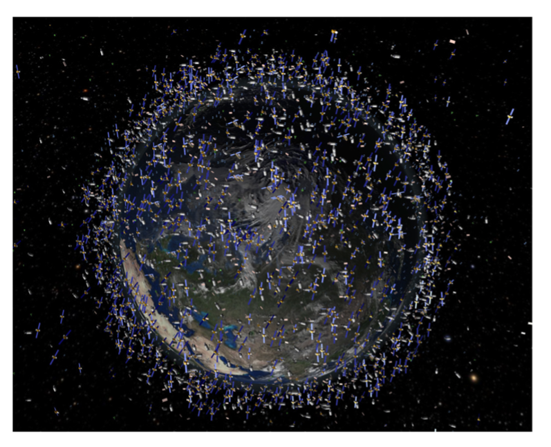
Earth Observation for a Sustainable World Publication
The 2030 Agenda for Sustainable Development, adopted by all United Nations Member States in 2015, is a shared blueprint for peace and prosperity for people and the planet. At its heart are the 17 Sustainable Development Goals (SDGs), an urgent call for action by all countries— developed and developing—in a global partnership. As we navigate the critical "Decade of Action," the global community faces a significant hurdle: the data gap. Traditional statistical systems, while fundamental, are often constrained by high costs, infrequent updates, and limited spatial coverage, leaving decision-makers with an incomplete picture of the complex, transboundary challenges we face. In this context, Earth Observation (EO) emerges not as a technological novelty, but as a fundamental pillar of the modern global data ecosystem.
“From the vantage point of space, satellites provide an objective, continuous, and borderless view of our changing planet—capturing the pulse of our environment and the footprint of human activity, from the health of forests and agricultural lands to the rapid expansion of urban settlements and the impacts of climate change.”
For this reason, UNOOSA launches the Earth Observation for a Sustainable World Book on the 23rd of July 2026.
This book is the result of a collaborative effort by a diverse international team of experts dedicated to advancing the use of Earth Observation for sustainable development. It has been produced by an editorial team comprising writers, researchers, and specialists from the United Nations Office for Outer Space Affairs (UNOOSA), the United Nations Global Service Centre (UNGSC), the United Nations Office on Drugs and Crime (UNODC), and the United Nations Secretariat for Global Geospatial Information Management (UN-GGIM).
The Role of Earth Observation
Despite its immense potential, EO technology is not a "one-size-fits-all" solution; it requires a nuanced understanding of technical constraints. The choice of platform shapes spatial and temporal resolution—satellites offer global coverage but may be limited by revisit times, whereas drones provide centimetre-level detail over smaller areas. Optical imagery, while intuitive, cannot penetrate cloud cover—a significant limitation in tropical regions—necessitating radar (SAR) data. Socio-economic data gaps pose further challenges. While EO excels at monitoring physical landscapes, deriving socio-economic insights often requires careful validation with ground-truth data to avoid misinterpretation. Issues of data accessibility, cost, and technical capacity in developing nations must also be addressed to prevent a digital divide.
To guide users through these complexities, the Earth Observation for a Sustainable World book employs a systematic "Traffic Light System" to evaluate the readiness of EO for each SDG indicator, represented through three stages:
(i) can be calculated systematically using EO (green color)
(ii) can be done locally using additional data (yellow color)
(iii) small/no role of EO in this target (red color)
The Structure of this the Earth Observation for a Sustainable World Book
This book is organised into four comprehensive sections designed to take the reader from basic principles to advanced applications.
Section 1: Sustainable Development Goals and Earth Observation
Section 2: Introduction to Remote Sensing
Section 3: Results of Earth Observation and Application for SDGs
Section 4: Map Use Environments & Future Outlook
The Sustainable Development Goals
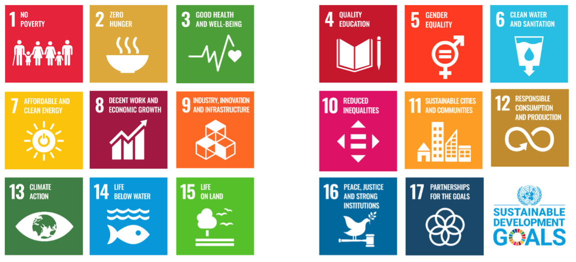
The Sustainable Development Goals (SDGs) are a collection of 17 global goals designed to be a “blueprint to achieve a better and more sustainable future for all”. They were adopted in 2015 by all United Nations Member States to address global challenges, such as poverty, inequality, climate change, environmental degradation, and peace. Each goal consists of specific targets and indicators that provide a framework for monitoring progress. The implementation of the Sustainable Development Goals (SDGs) is monitored through the Global Indicator Framework, which includes over 230 unique indicators developed by the Inter-Agency and Expert Group on SDG Indicators (IAEG-SDGs). These indicators are used to track advancements and challenges at national, regional, and global levels.
The SDG framework emphasises the crucial role of robust and disaggregated data, including geographic location and Earth Observation (EO) data, in monitoring progress and ensuring no one is excluded. The UN’s 2024 report shows that data demand has driven innovation and the integration of a variety of data sources, particularly remote sensing and EO data. Despite this, the report contains few references to geospatial information and EO, underscoring the need for this book. Ongoing international cooperation and robust data collection are crucial for identifying gaps, informing policy decisions, and accelerating progress towards achieving the SDGs by 2030.
“EO plays a crucial role in supporting the monitoring of the Sustainable Development Goals (SDGs). Through satellite imagery, remote sensing technologies, and geospatial data, EO provides accurate, timely, and comprehensive information that enhances the capacity to track and analyse various SDG indicators.”
What is Earth Observation?
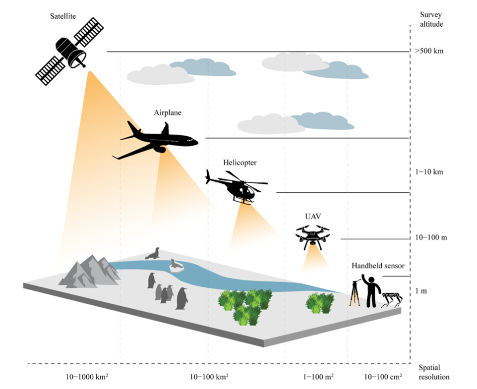
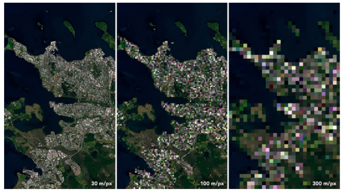
Earth Observation (EO) refers to obtaining information about Earth’s surface, waters, and atmosphere using platforms such as satellites, aerial platforms, and drones. These platforms are equipped with sensors that capture observations and Global Navigation Satellite System (GNSS) systems, such as the Global Positioning System (GPS), to calculate spatial coordinates and thus determine which part of Earth's surface is captured in the data. The combination of platforms and sensors defines the characteristics of the data captured and their utility for different purposes. Common platforms include satellites, aerial platforms, and Unmanned Aerial Systems (UASs), also known as drones. The choice of a platform greatly influences the spatial detail (=spatial resolution) of the data that is captured, as well as how often data can be captured. Platforms closer to the Earth’s surface will capture more spatially detailed information but cover a smaller area. It therefore takes longer to capture large areas, potentially increasing the time between observations.
The Potential and the Challenges of Earth Observation
EO Potential
EO provides several advantages for monitoring, implementing, and evaluating SDGs. These include spatial and temporal scalability, timeliness, rapid data extraction, availability of satellite imagery, enhanced decision-making, and cost- effectiveness, as compared to traditional methods.
- Scalability
- Timeliness
- Availability
- Improved Decision-Making
- Cost-Effectiveness Compared to Traditional Methods
For example, EO technology plays an instrumental role in many conservation efforts, such as by detecting deforestation zones or wildlife monitoring.
EO Limitations
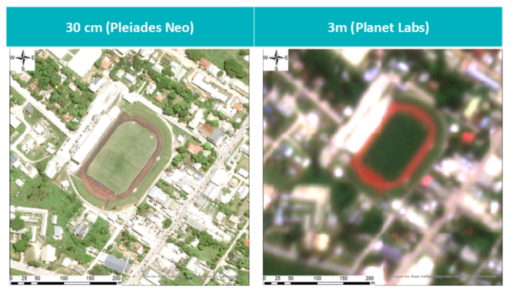
There are several limitations to the use of EO for monitoring SDGs. This includes both technical and ethical limitations, such as risk of overlooking important socio-economic data, questions of access and high costs if the very high-resolution satellite data is procured, privacy and legal issues, lack of technical capacity, limited awareness surrounding EO technology and data, and the fact that the legislative framework for the acquisition and use of such data is not always well defined in many countries.
- Gaps in Socio-economic Data
- Access and Cost
- Privacy, Legal Issues and Data Sovereignty
- Limited Technical Capacity
- Limited Awareness and Understanding of EO data
These challenges emphasise the need for further capacity-development efforts, knowledge transfer, and awareness-raising surrounding the use and potential of these technologies, further highlighting the importance of this book.
Conclusions of the Earth Observation for a Sustainable World Book
This book began with a simple observation: satellites now watch our planet with unprecedented detail, yet many of those responsible for guiding progress on the Sustainable Development Goals are only beginning to see how Earth Observation can help them do so. The 2030 Agenda enters its final five years amid stubborn data gaps, and space-based information is one of the tools best placed to close them. This publication is an attempt to make that potential legible to a wider audience — statisticians, ministry officials, researchers, and civil society practitioners for whom remote sensing is not a daily instrument, but who increasingly need to know what it can, and cannot, do.
In organising the material, we set ourselves three constraints. It had to be honest about the limits of EO — hence the traffic-light system, and the deliberate omission of indicators where EO plays no meaningful role. It had to be grounded in real practice, drawing on operational work by United Nations entities and their partners rather than aspirational demonstrations. And it had to be readable end-to-end by someone whose primary expertise lies outside Earth Observation. We have not perfectly achieved any of these ambitions; we have tried, and we have learned in the process.
Three reflections from that process are worth sharing. The first concerns the pace of change, as by the time this book reaches you, some of the platforms it describes will have been superseded and some of the datasets updated. The second, and least comfortable, concerns access. Free and open Earth Observation data have expanded remarkably over the past decade, but the analytical capacity, computing infrastructure, and trained personnel required to turn those data into decisions remain unevenly distributed. Finally, the third concerns the limits of any single lens. Earth Observation excels at describing physical landscapes, but sees socio-economic reality only obliquely. Poverty, gender inequality, decent work, and peaceful institutions are not visible from orbit; they are inferred, at best, from proxies. This is not a shortcoming of the technology but a boundary condition. The SDG indicators that matter most rarely reduce to a single data source, and the most convincing applications in these pages are those where satellite data are combined with in-situ and statistical information under a clear policy question.
Therefore, this book does not present itself as a final word. Instead, it is a snapshot of what a diverse editorial team could distil in the middle of the 2020s, at a moment when the technical possibilities of Earth Observation are expanding faster than most institutions can absorb them, and when the shared task of leaving no one — and no place — behind has never felt more urgent. If this book helps a colleague in a statistical office, a ministry, a research group, or a community organisation ask a better question of a satellite image, they will have done what the editorial team hoped.
The vantage point is space. The work is here on Earth. We hope you will join us.
For more detailed information about Earth Observation for each SDG, please find the Earth Observation for a Sustainable World book here.
