United
Nations
Office for Outer Space Affairs
UN-SPIDER Knowledge Portal
Satellite images have been essential for helping relief efforts in Japan following the massive quake that struck on 11 March. Now scientists are using ESA’s space radars to improve our understanding of tectonic events.
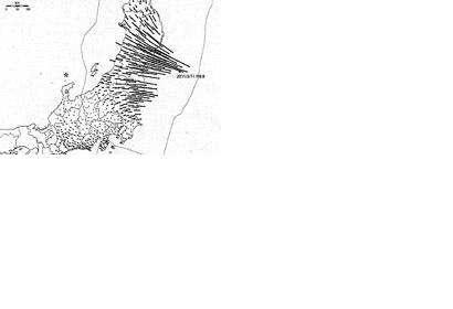
Scientists from Italy’s Istituto Nazionale di Geofisica e Vulcanologia have used the same Envisat data to show a large portion of the surface displacement, with a maximum shift of 2.5 m. These first results, covering an 800 km-long strip over Sendai and Tokyo, show movement far away from the epicentre (denoted by the red star in the top image) in the Pacific Ocean.
The complex technique being used by the scientists is known as ‘InSAR’ – synthetic aperture radar interferometry. It combines before and after radar images of the same ground location from the same position in space in such a way as to detect ground motion down to a few millimetres. The initiative is stimulating international efforts and fostering collaboration between space agencies, in-situ data providers and users to further our understanding of geological risks.
