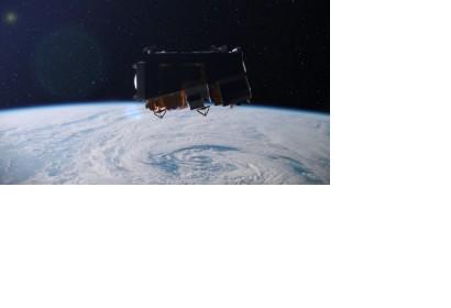
In the predawn hours last Friday, the National Polar-Orbiting Operational Environmental Satellite System Preparation Project satellite (let’s just call it NPP for short) was launched from Vandenberg Air Force Base in California, five years after its originally scheduled launch date. The SUV-sized satellite, a joint effort between NASA and NOAA, features five new instruments that will collect more detailed information about Earth’s atmosphere, land, and oceans and contribute to both weather and climate forecasting.
While the NPP launch should be applauded by scientists, forecasters, and anyone who relies on accurate weather and climate data, it’s important to note the NPP is just a stopgap– the satellite is designed to test new monitoring instruments and serve as a bridge between NOAA’s current polar orbiting satellites and the next generation, the Joint Polar Satellite System (JPSS), which is tentatively scheduled for launch in 2017 pending funding. But that is a huge unknown.
As we’ve elucidated before, many of the weather satellites currently in orbit are aging beyond their life expectancies and experiencing technical problems. Unless the JPSS is fully funded, our ability to predict and prepare for extreme weather events will be compromised. NPP is designed with a life expectancy of just five years, meaning NOAA still expects there to be a gap in coverage:
The originally planned launch of JPSS has been set back due to delays in funding over the past couple of years. This means there will be a data gap between the time NPP begins to degrade from the harsh space environment and the time JPSS is successfully placed into operation. The length of that gap depends on future years funding and the agency remains optimistic that current year Congressional support will carry over into a final appropriation and outyear funding. NPP is the first probe ever designed to collect data for both short-term weather forecasting and long-term climate monitoring, and never before has such data been so critical.
NOAA Administrator Dr. Jane Lubchenco explained, “This year has been one for the record books for severe weather … The need for improved data from NPP and the next generation satellite system under development by NASA and NOAA has never been greater. They will enhance our ability to alert the public with as much lead time as possible.”
Between severe drought and widespread wildfires across Texas, Hurricane Irene, devastating tornado in Missouri, overwhelming flooding throughout the Midwest, and many others, by September 2011 we had already set the record for most Federal Emergency Management Agency declared disasters.
Each disaster comes with an astronomical price tag. A study released earlier this year by the National Center for Atmospheric Research estimates that the bottom-line cost of the nation’s increasingly severe and destructive weather is an astounding $485 billion per year in the US alone, as much as 3.4% of the country’s GDP.
The current iterations of the House and Senate spending bills that fund NOAA and NASA include a boost of hundreds of millions of dollars for NOAA’s satellite program for fiscal year 2012, but both fall well short of the nearly one billion dollars the agency has requested. Worse yet, while the Senate bill isn’t quite as stingy as its House counterpart, both pillage NOAA’s ocean programs, including fisheries, coastal zone management, and response and restoration, to fund the satellite program.
Just like a homeowner must dip into the reserve bank account and pay for the necessary repairs when he has a leaky roof, Congress must bite the bullet and fully fund the purchase of these new critical pieces of forecasting equipment without compromising the other critical services NOAA provides to our nation’s economy and our environment.

