The mission was led by two experts from UN-SPIDER with the support of experts from the National Disaster Reduction Centre of China (NDRCC), the Office for the Coordination of Humanitarian Affairs of the United Nations Secretariat (OCHA), the Asian Disaster Reduction Center (ADRC), the Centre for Space Science and Technology Education in Asia and the Pacific (CSSTEAP), the Space and Upper Atmosphere Research Commission of Pakistan (SUPARCO) and the Asia-Pacific Space Cooperation Organization (APSCO).
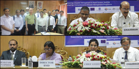
The mission included meetings with representatives from 11 governmental institutions as well as from United Nations agencies and a workshop jointly organised by UN-SPIDER, the Ministry of Food and Disaster Management and the Comprehensive Disaster Management Programme. It was attended by over 60 representatives from various Government and United Nations agencies to discuss cross-cutting issues related to the use of geographic and space-based information for disaster risk reduction and emergency response.
- The disaster risk management structure is well established in Bangladesh and it covers all phases of the disaster cycle;
- Many governmental institutions possess an excellent capacity to use space technology, among them the Bangladesh Metrological Department, the Space Research and Remote Sensing Organization, the Centre for Environmental and Geographic Information Services, the Survey of Bangladesh, the Flood Forecasting and Warning Centre and the Institute of Water Modeling);
- Space-based information has been already been used in the prediction of cyclones;
- Key decision makers are well aware of the potential of space-based information;
- There is a deficiency in the coordination among government institutions in the area of disaster-risk reduction.
The coordination between departments of the Ministry of Defence (technology providers) and the Ministry of Food and Disaster Management (technology users) should be enhanced in order to ensure cooperation at the working level with the aim of incorporating space-based information as a common resource for the purpose of disaster management and ensuring that space technology providers make their services accessible to end-users.
There is a need to raise the awareness of decision makers regarding the usefulness of using space-based information to support disaster management.
All stakeholders should have access to the national spatial data infrastructure templates, baseline data and operational disaster-related databases. Such access should ensure the timely availability of appropriate satellite and geospatial data and a strong data policy should be in place to conform with the data standards and formats.
Early warning efforts (flood and cyclone predictions) can be further strengthened by providing better access to the space-based information and related technologies.
Data- and information-sharing policies, standards and coordination mechanisms need to be developed to support disaster risk reduction at the national level, based on the principle that data are a national property and need to be shared openly, in particular in the event of a disaster. To facilitate data-sharing, the data catalogue and sharing platform should be created based on existing resources. Information products should cater to the precise requirement of end-users.
