United
Nations
Office for Outer Space Affairs
UN-SPIDER Knowledge Portal
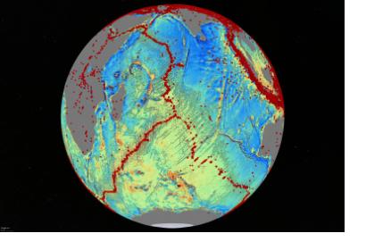
Scientists at the Scripps Institution of Oceanography at the University of California created a new seafloor map based on satellite data that discloses previously unaccessible features on global earthquakes, spreading ridges and faults.
The new instrument explores the deep oceans' structure and ongoing geophysical processes by capturing gravity measurements of the seafloor, which are derived from altimery data recorded from ESA's CryoSat-2 and NASA's Jason-1 satellites. The authors state that "the map provides a new window into the tectonics of the deep oceans".
The innovative insight of the Marine Gravity from Satellite Altimery illustrates the plate tectonic history and highlights previously untapped signatures of fracture zones and gravity anomalies of the ocean seafloor.
