![]()
United
Nations
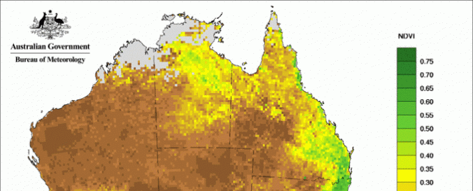
NDVI and rainfall for Australia (Australian Government, Bureau of Meteorology)
| Data provided by: | Australia Government Bureau of Meterology |
| Data accessibility: | Exportar datos, Exportar mapa, Datos estadísticos (ej. gráficos), Visualización de datos (ej. web SIG o monitoreo en tiempo real) |
| Link to the data: | |
| Data type: | Datos sobre amenazas específicas |
| Hazard: | Drought |
| Disaster cycle phase: | Gestión des Riesgo por Desastres |
| Satellites and Sensors: | NOAA-15 |
| Spatial coverage: | Australia |
| Temporal coverage: | Archivado, Prognosticado, Casi en tiempo real |
| Content dates: | one month, three months and six months |
| Technical Specifications: | |
| Costs: | Gratis |
Provider
![]()