• English
  • Español
  • Français

United
Nations


Office for Outer Space Affairs
UN-SPIDER Knowledge Portal

  • Inicio
  • Sobre nosotros
    • Sobre ONU-SPIDER
    • Acerca de UNOOSA
    • Publicaciones
    • Ofertas de trabajo
    • Conozca el Equipo
    • Contacto
  • Aplicación Espacial
    • Guías Tecnológicas
    • Mecanismos de Emergencia
    • Mecanismos de Recuperación
    • Red Internacional de Alerta de Asteroides
    • Grupo Asesor para la Planificación de Misiones Espaciales
    • Iniciativa Internacional sobre Meteorología Espacial
    • Tecnologías Espaciales en la ONU
    • Historias de Usuarios
  • Enlaces y Recursos
    • Aplicación de datos del mes
      • Disaster Recovery
    • Fuentes de Datos
    • SIG y Software de Percepción Remota
    • Recursos de capacitación en línea
    • Instituciones
  • Riesgos y Desastres
    • Gestión del Riesgo de Desastres
    • Alerta temprana
    • Gestión de Desastres y Emergencias
    • Amenazas Naturales
    • El Proceso de la Reducción de Desastres Post-2015
    • La ONU y la Gestión del Riesgo de Desastres
    • La ONU y Alerta Temprana
    • La ONU y la Gestión de Desastres
  • Asesoría
    • Misiones de Asesoría
    • Apoyo en caso de Emergencia
    • Asesoría Virtual
    • Prácticas Recomendadas
    • Actividades de Entrenamiento
    • Usos Prácticos
  • Redes
    • Oficinas Regionales de Apoyo
    • GP-STAR
    • IN-MHEWS
    • IWG-SEM
  • Proyectos
    • SPEAR
    • FOSAT-S
    • EvIDENz
    • Flood GUIDE
  • Noticias y Eventos
    • Noticias
    • Eventos
    • Eventos pasados

Breadcrumb

  • Home
  • Imaging And Geospatial Information Highlighted At IGTF 2015
  • Imaging and geospatial information highlighted at IGTF 2015

Imaging and geospatial information highlighted at IGTF 2015

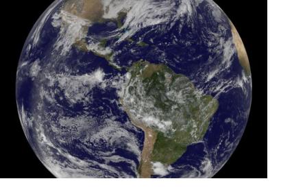
Imaging and geospatial technology as main focus of the IGTF 2015 taking place in Florida, USA (Image: NASA)Imaging and geospatial technology as main focus of the IGTF 2015 taking place in Florida, USA (Image: NASA)

The Imaging and Geospatial Technology Forum (IGTF) is took place from 4 to 8 May 2015 in Florida, USA, to present new trends, products and general enhancements related to imaging and geospatial data.  

The conference had already been held in past years but under the name of ASPRS annual conferences. This former denomination referred to the event organizer, the American Society for Photogrammetry and Remote Sensing (ASPRS).

Geospatial information improvements, new trends in remote sensing systems and geological resource applications were some of the main topics to be presented in the IGTF 2015. Within the programme of the conference, the JACIE Workshop highlighted combining a general session and special technical sessions throughout the week and focusing on the synergy of high, medium and low resolution imagery and remote sensing technologies used by the US Government.

Among the participants were international mid- and upper-level imaging and geospatial managers from corporations, government agencies, consultants, educators, researchers, students and field surveyors. 
IGTF 2015
Wed, 6 May 2015 - 14:06
United States of America

Footer menu

  • Contact
  • Terms of Use

User account menu

  • Log in