Germany

country taxonomy block

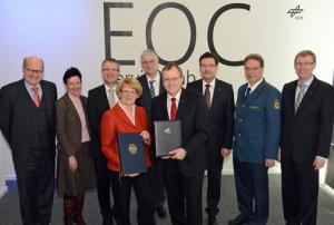
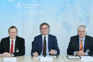
The German Aerospace Center (DLR) and the United Nations University (UNU) have agreed to continue to strengthen their cooperation. Johann-Dietrich Wörner, Chairman of the DLR Executive Board, and Jakob Rhyner, Vice Rector of UNU in Europe and Director of UNU Institute for Environment and Human Security (UNU-EHS) in Bonn, signed an agreement to this effect on 23 February 2015.

DLR and UNU expect that their agreement will result in even closer ties between science and practice, additional joint projects in the field of Earth observation and climate change as well as sustainable resource protection. The two organizations will also collaborate on satellite communication and navigation, with the goal of increasing knowledge and knowledge transfer. This may also include exchange programmes for experts and the joint supervision of PhD and Master students. The German Remote Sensing Data Center (Deutsche Fernerkundungsdatenzentrum; DFD) at DLR is already cooperating with some of UNU…

more
Publishing date 26/02/2015

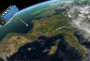
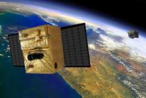
In October 2015, Germany will launch the Berlin Infrared Optical System (BIROS), a microsatellite capable of monitoring forest fires from Space. The microsatellite was partly developed by the Institute of Optical Sensor Systems in Berlin of the German Aerospace Agency (DLR). BIROS will be launched from the Satish Dhawan Space Centre in India.

As part of the FIREBIRD mission, with its on-board infrared camera on board, BIROS will link up with TET-1 for accurate, timely detection of forest fires. TET-1 is previous German microsatellite, which was sent into space in 2012.

“Small satellite technology has taken major development hurdles in recent years,” said Dr. Rainer Sandau, technical director for satellite technology and space applications at DLR. “Measurements of the Earth, its atmosphere, oceans and land previously reserved for large satellites is now available for small satellites developers.”

Publishing date 18/02/2015

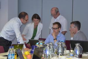
From the 10-11 of December 2014, the United Nations University's Institute for Environment and Human Security (UNU-EHS) held a workshop on decision making and knowledge management in disaster risk reduction (DRR). This workshop was conducted within the frame of the KNOW-4-DRR project (Enabling knowledge for DRR in integration to climate change adaptation), funded by the European Commission and coordinated by the Politecnico di Milano.

The presentations held during the workshop are now available for download on the UNU-EHS website.

The 11 project partners of KNOW-4-DRR represent 7 countries with a European focus and deal with DRR from different perspectives, ranging from science to practitioners and professional communicators. The overall aim of the project is to contribute to an improved use of knowledge and co-operation among the different actors in the field of DRR and…

more
Publishing date 03/02/2015

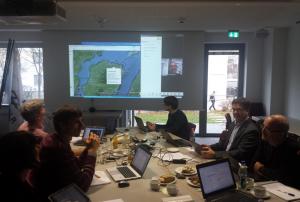
UN-SPIDER participated in the autumn meeting of the International Working Group on Satellite-based Emergency Mapping (IWG-SEM). The group convened in Oberpfaffenhofen, Germany on the premises of the German Aerospace Centre (DLR) on 25 and 26 November 2014. DLR is the current chair of the Working Group.

18 participants from international and national agencies and organizations joined the meeting in person or via telephone/video chat, including DLR, the European Commission's Joint Research Centre (JRC), UN-SPIDER, the US Geological Service (USGS), the World Bank, ITHACA, the Japan Aerospace Exploration Agency / Asian Institute of Technology and SERTIT.

The participants exchanged views and heard presentations about real-time mapping cooperation including the joint elaboration of a GeoRSS feed as well as about post disaster needs assessment and damage and loss assessments.

Another item on the agenda were the…

more
Publishing date 26/11/2014

The UN-SPIDER team warmly welcomes our new colleague in the Bonn Office, Dr. Joachim Post. Joachim joined UN-SPIDER in September and he will be providing technical and scientific support to the Programme. He will mainly support the Bonn Office in its activities, including the further development of the UN-SPIDER Knowledge Portal, Technical Advisory Support, and the establishment of partnerships.

Joachim is a seconded expert from the German Aerospace Center (DLR). He has worked at DLR's German Remote Sensing Data Center (DFD) since 2006 as a research scientist on risk assessment. His work included the development and implementation of tsunami risk assessment and knowledge for early warning in Indonesia (GITEWS project). Additionally, he was involved in several international projects including in Southern and Western Africa, South East Asia, South America and Europe, dealing with applied risk analysis research.

more
Publishing date 01/10/2014

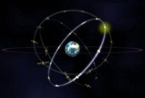
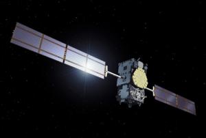
Europe's Galileo satellite navigation system will soon increase: European Space Agency (ESA) announced the coming launch of Galileo SATs 5-6 on 21 August 2014, from Europe's Spaceport in French Guiana.

These two satellites, becoming operative in autumn, will join the four satellites already orbiting: two were launched in October 2011 and two one year later.

ESA and its partner, France's "Centre National d'Etudes Spatiales" (CNES), submitted the satellites to multiple end-to-end system compatibility tests, while the Launch and Early Operations Phase is run from ESA’s Space Operations Centre in Darmstadt, Germany.

Galileo SATs 7-8 are scheduled for the end of 2014, after which the program anticipate launching between 6 to 8 satellites per year.

more
Publishing date 18/08/2014

UN-SPIDER, together with representatives of the German Aerospace Center (DLR), the European Commission (EC), SERTIT, ITHACA and the US Geological Survey (USGS), participated in a meeting of the International Working Group on Satellite-based Emergency Mapping (IWG-SEM) in Oberpfaffenhofen, Germany. The meeting took place from 20 to 21 May 2014 under the chairmanship of ITHACA. On the last day of the event, the chairmanship was handed over to DLR according to IWG-SEM's rotating principle.

In their biannual meeting, the group discusses international harmonization and improvement of cooperation efforts in the domain of emergency mapping, mainly during major, wide area disaster events of global concern. Currently, the group is working on the elaboration and refinement of basic Emergency Mapping guidelines.

The IWG-SEM is the voluntary group of organizations involved in…

more
Publishing date 17/06/2014

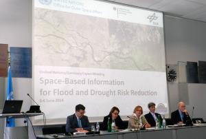
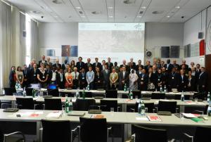
UNOOSA/UN-SPIDER and its partners, the German Aerospace Center, the German Ministry of Economics and Energy and Secure World Foundation, successfully held the "United Nations/Germany Expert Meeting on Flood and Drought Risk Reduction" in Bonn, Germany from 5 to 6 June 2014. The event brought together more than 60 international experts from Asia, Africa, America and Europe, who are involved in disaster risk management, remote sensing, and hydrology and drought management. The meeting concluded with the presentation of a set of recommendations regarding how best to promote the use of space-based applications as a way to reduce the impacts and effects of floods and droughts worldwide.

In her opening remark, UNOOSA's director, Ms Simonetta Di Pippo, highlighted the relevance of the topic of the conference: "As you are aware, disasters affect all regions of the world, and hydrometeorological disasters such as floods and droughts are the most recurrent types of…

more
Publishing date 05/06/2014

The Secretary General of the United Nations, Mr. Ban Ki-moon, visited the UN premises in Bonn, Germany, on 31 January 2014, where one of UN-SPIDER's offices is located. The Secretary General met with high-level representatives of Bonn-based UN agencies, including the Directors of UNFCCC, UNCCD, UNV and the Head of the UN-SPIDER Bonn Office, and addressed the UN staff in a town hall meeting. He particularly highlighted three topics that are of high relevance to the Bonn-based organisations, namely the achievement of the Millennium Development Goals (MDGs) by 2015, the on-going process concerning the elaboration of the Sustainable Development Goals (SDGs), and the on-going process regarding a new global climate change agreement.

The Secretary General recognized the important work that agencies in Bonn are carrying out on themes related to the sustainable use of the environment, disaster risk reduction and disaster management. These topics are particularly relevant in the…

more
Publishing date 31/01/2014

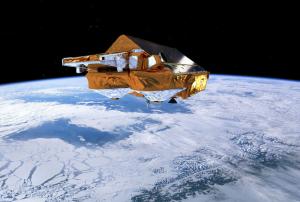
During 5 and 6 December 2013, a major storm passed through northern Europe coinciding with a period of high tides in the North Sea and resulting in extremely high sea levels – a ‘storm surge’. The effects of the storm surge resulted for the United Kingdom in the highest sea levels since the 1953 North Sea Floods, while parts of Hamburg were flooded in Germany. ESA’s CryoSat satellite passed over Kattegat and its radar altimeter measured the storm surge, providing an estimate of total water levels. The observations collected matched predictions, which helped to confirm the models.

Realistic storm surge models can play a crucial role when natural disasters strike. Proof of their importance was recently demonstrated by the devastation caused by Typhoon Haiyan in south Asia. “Even a small improvement to a storm surge model can have a significant impact in terms of the accuracy of warnings, and the potential to protect lives and property,” noted Kevin Horsburgh from the UK’s…

more
Publishing date 13/12/2013

In November 2013 Germanwatch published the 9th edition of the Global Climate Risk Index for which the most recent data available —from 1993 to 2012— were taken into account. The Global Climate Risk Index 2014 analyses to what extent the impacts of weather-related loss events have affected countries around the globe.

This year's edition of the Climate Risk Index reconfirms that less developed countries are generally more affected than industrialised countries. In the year of 2012 Haiti, the Philippines and Pakistan were the most affected countries, while for the period that goes from 1993 to 2012 Honduras, Myanmar and Haiti rank highest.Furthermore, weather-related loss events are called to become more frequent or more severe due to climate change, further increasing current vulnerability in some regions.

Concerned about climate change and the increasing loss and damage, the climate summit 2013 held in Warsaw, Poland, is a defining moment and should mark a turning point…

more
Publishing date 12/11/2013

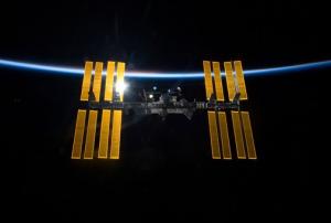
The German Aerospace Center (DLR) and its partner Teledyne Brown Engineering signed an agreement on 1 October 2013 to develop an instrument for the Multi-User System for Earth Sensing (MUSES), which will be mounted on the International Space Station (ISS).

"Aerospace has no greater task than to observe Earth and its ecosystems from space. It is effective to use existing platforms, such as the ISS, as carriers of Earth observation instruments," explained Professor Johann-Dietrich Wörner, Chairman of the DLR Executive Board. "We are delighted at the formation of this partnership between science and industry, which through its very existence will be a catalyst in the ongoing development of new Earth observation systems."

DLR further explains in a press release: "MUSES, the first commercial Earth-sensing platform on the ISS, will further increase the Space Station's research capabilities. The instruments installed on the platform – including high-resolution digital…

more
Publishing date 09/10/2013

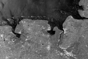
The German TerraSAR-X radar satellite, operated by the German Aerospace Center (DLR) and Astrium, has been switched into a new wide-angle view mode allowing the satellite to record image strips over 200 kilometres wide. "The satellite does so by sweeping this large area in multiple stages, very quickly pivoting the radar beam numerous times across the direction of flight," explains DLR mission manager Stefan Buckreuss. For example, the image of the German Bight shows the Frisian Islands from Borkum to Wangerooge and cities such as Wilhelmshaven and Bremen. This new ‘wide-angle’ mode is of particular interest to oceanographers, who will be able to use it to investigate the tidal range, changes to mudflats, shipping movements, wave patterns, ice floes and wind levels.

TerraSAR-X was launched to space on 15 June 2007 and has already outlived its original lifespan for one and a half years. Since its launch, the satellite has delivered over 120,000 images of a width up to 100…

more
Publishing date 16/09/2013

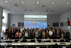
The report for the UN-SPIDER Expert Meeting on the use of space-based information for Early Warning Systems is now available. Having taken place from 24 to 26 June 2013, the meeting had brought together fifty two space technology and disaster management experts representing national, regional and international organizations, internationally active private companies and included representatives of UN-SPIDER Regional Support Offices in Bonn Germany.

The report outlines the outcomes of the meeting, including the results of the discussion breakout groups on which a great emphasis had been placed for this meeting. The participants had discussed ways in which space applications and geo-spatial information technologies can improve the functionality of early warning systems targeting a variety of hydrometeorological, geological and biological hazards. Several experts…

more
Publishing date 12/08/2013

Yesterday, UNOOSA/UN-SPIDER, the German Aerospace Center (DLR) and the Association of Space Explorers (ASE) alongside other UN agencies located in Bonn discussed with 80 astronauts about how space technologies can contribute to sustainable development and the environment.

Two key note presentations and a panel comprised of astronauts and UN experts emphasized that Space-based information allow for detailed insights into the development on our planet for example regarding climate change, land degradation, biodiversity or natural hazards. The experts pointed out how we can track and monitor sea level rise, glacier melting, land use and land cover changes, urban development, disaster impacts or deforestation. Experts from the United Nations Convention to Combat Desertification (UNCCD), the Convention on Migratory Species (UNEP/CMS) and the World Health Organisation (WHO) explained how satellite data can help track land degradation, routes of migratory species and health issues.…

more
Publishing date 05/07/2013

On 26 June 2013, the UN-SPIDER Programme wrapped up a two-day expert meeting focusing on space-based applications in Early Warning Systems. Taking into consideration the role of early warning systems in minimizing damages and losses in case of disasters, UN-SPIDER co-organized the meeting with the Government of Germany and the German Aerospace Center (DLR); with the support of Secure World Foundation (SWF) and the German Federal Office of Civil Protection and Disaster Assistance (BBK).  The Expert Meeting brought together fifty two space technology and disaster management experts representing national, regional and international organizations, internationally active private companies and included representatives of UN-SPIDER Regional Support Offices.

The goal of the meeting was to share experiences and lessons learned regarding use of space-based information in early warning systems; to identify needs and to discuss knowledge management strategies to improve existing…

more
Publishing date 26/06/2013

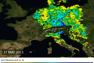
Massive floods have heavily affected regions in Germany, Austria, Czech Republic and other European countries over the past days taking at least five human lives and causing damages of a yet undetermined extent. In order to better prepare for such floods in the future, satellites such as ESA's SMOS could help to improve the accuracy of flood prediction by measuring the soil moisture. Prior to the torrential rains, SMOS showed that soils in Germany were showing record levels of moisture – in fact, the highest ever observed. The picture shows the wet soils in blues and the dryer soils in yellows.

ESA's Soil Moisture and Ocean Salinity (SMOS) mission monitors the amount of water held in the surface layers of the soil and the concentration of salt in the top layer of seawater. This information is helping scientists understand more about how water is cycled between the oceans, atmosphere and land – Earth’s water cycle. It is also helping to improve weather forecasts.

ESA…

more
Publishing date 07/06/2013

The International Charter Space and Major Disasters was activated for Germany in order to provide current satellite information for the floods in Saxony and Bavaria. Torrential rainfall in the South of Germany had caused rapid increase of river levels over the weekend.

A state of emergency has been declared in the cities of Passau and Rosenheim. The Bavaria flood alert service forecasts heavy rains to worsen, affecting the Danube and Inn rivers. Other affected states are Saxony, Thuringia and Baden-Wuerttemberg. Emergency and rescue efforts are under way, and the army has been deployed to support flood affected areas after reaching record levels of flooding.

The German Federal Office for Civil Protection and Disaster Assistance (BBK) and the German Joint Information and Situation Centre (GMLZ) are the requestors of the activation, the project management will be carried out by DLR's Centre for Satellite-based Crisis Information (ZKI)

Publishing date 03/06/2013

Bureaucracy-free assistance in the event of an emergency – this is the aim of the 15 space agencies united within the International Charter 'Space and Major Disasters'. The German Aerospace Center (Deutsches Zentrum für Luft- und Raumfahrt; DLR) has been a member of this network since October 2010, and, on 16 April 2013, will take over as chair of the Charter for six months.

"With its expertise in Earth observation, Germany is an important contributor to disaster management on an international level, for instance in the 'Universal Access' initiative, launched by the Charter in the autumn of 2012. This was a milestone; until then, Charter assistance had only been available to authorised users from around 40 countries and United Nations agencies. 'Universal Access' effectively opens the door to every national disaster management authority around the world," emphasises Johann-Dietrich Wörner, Chairman of the DLR Executive Board and the most senior…

more
Publishing date 16/04/2013

From the research stage to full operation – The Center for Satellite Based Crisis Information (ZKI) is now on call around the clock. This service facility established in 2004 provides up-to-the minute satellite-based maps for activities related to natural and environmental disasters, humanitarian aid, and civil security worldwide. It is a service of DLR’s German Remote Sensing Data Center. On 22 January 2013 DLR in cooperation with the Federal Ministry of the Interior (BMI) officially launched regular ZKI operations.

"Civilian earth observation satellites, like our TerraSAR-X and TanDEM-X radar satellites, continuously supply data of a quality which makes possible entirely new applications. For example, oil films on the ocean, flooded areas, slope collapse and damage to buildings can be mapped from space. ZKI provides these services for institutions like the Federal Office of Civil Protection and Disaster Assistance, Germany's disaster aid organization THW, and the German…

more
Publishing date 25/01/2013

Astrium is preparing a new technology mission for the maintenance and disposal of satellites. At the ILA Berlin Air Show, the German Aerospace Centre (DLR) Space Administration announced that Astrium (Friedrichshafen) will be prime contractor for the definition phase of the DEOS (German orbital servicing mission) project. The DEOS project will for the first time demonstrate technologies for the controlled in-orbit disposal of a defective satellite. The definition phase is the last, decisive step before construction begins on the space vehicles themselves.

Publishing date 21/09/2012

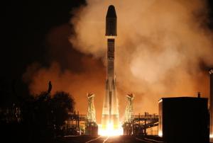
The second Metop satellite was launched yesterday, 17 September 2012 from the Baikonur cosmodrome, in Kazakhstan, atop a Russian Soyuz launcher, as planned. Metop-B will ensure the continuity of the weather and atmospheric monitoring service provided by its predecessor Metop-A, which has been circling the globe from pole to pole, 14 times a day, since 2006 and has now exceeded its design lifetime. The Soyuz-Fregat vehicle lifted off at 16:28 GMT on Monday, 17 September. The Fregat upper stage manoeuvred to release the satellite into a polar orbit at an altitude of 810 km some 69 minutes later, over the Kerguelen Archipelago, in the Indian Ocean. Metop-B, developed for EUMETSAT’s polar satellite system, is now under the control of ESA’s Operations Centre in Darmstadt, Germany.

ESA’s Director General Jean-Jacques Dordain states “This is a…

more
Publishing date 18/09/2012

On 15 June 2007, the German TerraSAR-X radar satellite was launched from Russia's Baikonur Cosmodrome in Kazakhstan marking the beginning of a new era in German remote sensing. In its fifth year in space TerraSAR-X has served its planned life-span, but is expected to continue functioning for several years. "TerraSAR-X has now been operating almost flawlessly for five years. The satellite's propellant consumption has been low, the solar arrays and radar instrument are in good condition, and all of the redundant systems are still available. We could not have hoped for more," states Michael Bartusch, TerraSAR-X mission Project Manager at the German Aerospace Center (DLR).

TerraSAR-X can survey Earth regardless of cloud coverage or weather conditions thanks to its on-board Synthetic Aperture Radar (SAR) system. It can provide imagery with resolutions of one meter allowing the provision of high quality data for science, disaster and risk management and commercial…

more
Publishing date 18/06/2012

Germany has had a long tradition in the area of geological hazards (earthquakes, volcanic eruptions, mass movements, subsidence). The Royal Prussian Geological Survey was established in 1873, and by 1975 the Survey was transformed into the Federal Institute for Geo-Sciences and Natural Resources of Germany (BGR). Over the decades, BGR has provided technical advisory support to many countries in Asia, Africa and Latin America regarding risks related to geological hazards.

Recognizing the technical expertise of BGR when it comes to such geologic risks; UN-SPIDER conducted a visit to BGR to explore opportunities for cooperation. The visit allowed UN-SPIDER to present its activities to staff of BGR, and to become aware of on-going and planned activities by BGR scientists in Pakistan, Indonesia and Latin America; as well as to become aware of examples regarding the use of remote sensing techniques in a variety of applications including geo-risks in Germany and elsewhere. In…

more
Publishing date 02/05/2012

On 13-15 March 2012 high-ranking worldwide speakers from industry, science and governments dealing with satellite navigation came together for the Munich Satellite Navigation Summit. The summit included plenary discussions among invited speakers and presentations on the main activities in worldwide satellite navigation systems. Emphasizing a future trend in satellite navigation, this year's summit focused on GNSS and security in the user segment. The discussions were held on the long term plans to provide increased benefits from multiple constellations and alternate position navigation and time sources.

Over the past decade, the summit has established itself as the premier European venue for high-level discussion of the world's GNSS programs and policies. During that time the conference in Germany, which concluded its most recent iteration on March 15, has reflected the relative fortunes of the various systems in often dramatic form, such as the…

more
Publishing date 23/03/2012