
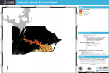
The objective of this step-by-step procedure is to identify potentially damaged buildings and streets, as well the number of potentially displaced persons for two different flood events in Africa. This information can be used for future contingency planning and to improve the design of preventive measures.
The presented QGIS plug-in was developed jointly by the Indonesian Disaster Management Organization (BNPB), the Australian Government and the World Bank (GFDRR). It was created as free and open source software (FOSS) and is available in the QGIS plug-in library. The use cases provided on the website of InaSAFAE are primarily related to disasters in Indonesia such as floods in the city of Jakarta. For this Recommended Practice, two use cases in Africa have been chosen. The first one focuses on a past flood event in Beira, Mozambique, whereas the second one addresses the larger area of Accra, Ghana, and makes use of a 100-year returning flood layer from the Global Flood Awareness System (GloFAS) of the Joint Research Center (JRC) of the European Commission (EC).
Both case studies provided show several options to adapt the calculations to other case studies. However, the plugIn does not give the exact number of people as the calculations are rather basic. This allows for faster processing, but also means that values are only an estimate of the expected damage and never an exact number. This practice should raise awareness about risk prevention and provide incentives to improve preparation and planning processes.