![]()
United
Nations
Drought Monitoring (EOSDIS Worldview - NASA)
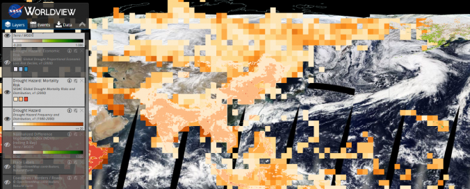
| Data provided by: | National Aeronautics and Space Administration (NASA) |
| Data accessibility: | export data, export map, visualization of data (e.g. web GIS or real time monitoring) |
| Link to the data: | |
| Data type: | hazard specific data |
| Hazard: | Drought |
| Disaster cycle phase: | Disaster Risk Management, Response, Recovery |
| Space-based Information: | MODIS, AIRS |
| Spatial coverage: | Global |
| Temporal coverage: | Archive, Near-real time |
| Content dates: | 2012-today |
| Technical Specifications: | |
| Costs: | free |
| Tutorials on the use of data: | FAQ Worldview |
| Restrictions/ Citation of the dataset: |
Provider
![]()