![]()
United
Nations
USGS FireDanger
| Data provided by: | United States Geological Survey (USGS) |
| Data accessibility: | export map, statistical data (e.g. graphs), visualization of data (e.g. web GIS or real time monitoring) |
| Link to the data: | |
| Data type: | hazard specific data, satellite data or aerial image |
| Hazard: | Forest Fire |
| Disaster cycle phase: | Disaster Risk Management, Response, Recovery |
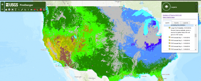
| Space-based Information: | Vegetation-based fire indicators: expected number of fires per predictive service area: number of fires predicted (1000+ acres west, 500+ acres east) or the coming 7 days, with a probability estimate for exceeding the prediction. |
| Spatial coverage: | United States of America |
| Spatial resolution: | 1 km resolution |
| Temporal coverage: | Archive, Forecasted |
| Technical Specifications: | |
| Costs: | free |
| Contact: | Contact |
Provider
![]()