![]()
United
Nations
USGS FireDanger
| Data provided by: | United States Geological Survey (USGS) |
| Data accessibility: | Exportar mapa, Datos estadísticos (ej. gráficos), Visualización de datos (ej. web SIG o monitoreo en tiempo real) |
| Link to the data: | |
| Data type: | Datos sobre amenazas específicas, Datos satelitales o imágenes aéreas |
| Hazard: | Forest Fire |
| Disaster cycle phase: | Gestión des Riesgo por Desastres, Respuesta, Recuperación |
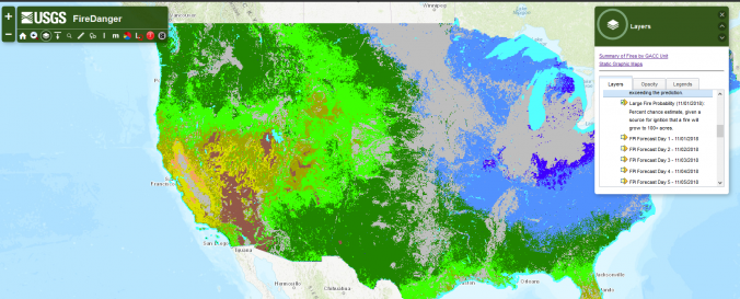
| Space-based Information: | Vegetation-based fire indicators: expected number of fires per predictive service area: number of fires predicted (1000+ acres west, 500+ acres east) or the coming 7 days, with a probability estimate for exceeding the prediction. |
| Spatial coverage: | United States of America |
| Spatial resolution: | 1 km resolution |
| Temporal coverage: | Archivado, Prognosticado |
| Technical Specifications: | |
| Costs: | Gratis |
| Contact: | Contact |
Provider
![]()