In recent years, the frequency and severity of natural hazards has increased dramatically. This development has escalated the risk of disasters and their devastating impact on the environment and communities around the world. Earth observation (EO) data has the potential to mitigate the risks of disasters and support all phases of the disaster management cycle. The international community has created various mechanisms to facilitate the use of EO data for disaster management, such as the International Charter Space and Major Disasters. The Algerian Space Agency (ASAL) has provided EO data to the International Charter for almost two decades.
The International Charter refers to a consortium of space agencies, national and regional disaster monitoring organizations that utilize EO data for disaster management efforts. Activating the Charter “allows resources and expertise to be coordinated for rapid response to major disaster situations” in an effort to support humanitarian relief efforts worldwide. In total, the Charter has been activated over 700 times. More information on the International Charter and the activation of the Charter can be found here.
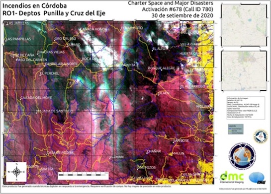
ASAL, one of the UN-SPIDER Regional Support Offices, has been a partner of the International Charter since 2002. In its role, the space agency provides the International Charter with imagery from various EO satellites. A satellite to recently become part of a constellation that the International Charter uses for disaster monitoring is Alsat-1B. Since 2018, Alsat-1B has provided satellite imagery to the International Charter for disaster management support. The Alsat-1B satellite was most recently used for imagery of Forest fires in the Argentinean province of Cordoba that occurred between August and September 2020 and the eruption of the Merapi volcano in Indonesia in November 2020.


