• English
  • Español
  • Français

United
Nations


Office for Outer Space Affairs
UN-SPIDER Knowledge Portal

  • Home
  • About Us
    • What is UN-SPIDER?
    • About UNOOSA
    • Publications
    • Jobs
    • Meet the Team
    • Contact
  • Space Application
    • Satellite Technology
    • Emergency Mechanisms
    • Recovery Mechanisms
    • International Asteroid Warning Network
    • Space Mission Planning Advisory Group
    • International Space Weather Initiative
    • Space Technologies in the UN
    • User Stories
  • Links & Resources
    • Data Applications
      • Disaster Recovery
    • Data Sources
    • GIS and Remote Sensing Software
    • Online Learning Resources
    • Institutions
  • Risks & Disasters
    • Disaster Risk Management
    • Early Warning Systems
    • Emergency and Disaster Management
    • Natural Hazards
    • Sendai Framework
    • The UN and Disaster Risk Management
    • The UN and Early Warning
    • The UN and Disaster Management
  • Advisory Support
    • Advisory Missions
    • Emergency Support
    • Virtual Advisory Support
    • Recommended Practices
    • Training Activities
    • Practical Uses
  • Network
    • Regional Support Offices
    • GP-STAR
    • MHEWS
    • IWG-SEM
  • Projects
    • SPEAR
    • SEWS-D
    • EvIDENz
    • Flood GUIDE
  • News & Events
    • News
    • Events Calendar
    • UN-SPIDER Events Archive

Breadcrumb

  • Home
  • News and Events
  • View Active News
  • Centre For Geospatial Information Science Opens At Edo State Polytechnic In Nigeria
  • Centre for Geospatial Information Science opens at Edo State Polytechnic in Nigeria

Centre for Geospatial Information Science opens at Edo State Polytechnic in Nigeria

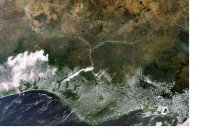
This Envisat image highlights the lower Niger River system in the West African country of Nigeria, where the Niger River (left) and the Benue River merge. Image: ESAThis Envisat image highlights the lower Niger River system in the West African country of Nigeria, where the Niger River (left) and the Benue River merge. Image: ESA

The Edo State Polytechnic, Usen, has concluded preparations to unveil the Centre for Geospatial Information Science (CGIS), a research and teaching unit that will utilize computer software and tools such as geographic information systems among others, to gather information for use in mining, agriculture, urban planning and health care.

CGIS will provide training and consulting services in the area of geographic information system (GIS) and other remote aerial technology sensors to gather geographic information.

The rector of the institution, Prof. Abiodun Falodun, unveiled, during an interview, that CGIS will train specialists to produce maps, tables, reports and other such materials using GIS technology. It will also offer extended courses on deployment of advanced technology in mapping and managing geographic information organizations and short introductory programmes for secondary school students..

During the 3rd Public Lecture of the Institution, Dr. Bello, an expert in satellite data management at the National Space Research and Development Agency (NASRDA), host of the UN-SPIDER Regional Support Office in Nigeria, said that the setting up of CGIS at this critical time is a step in the right direction for governments as many lack understanding of geospatial data value and importance within the context of the sustainable development agenda.
Obaseki’s reforms: Edo Poly set for professional courses, as new center for Geo…
Wed, 27 Feb 2019 - 10:12
Nigeria
Nigeria Regional Support Office

Footer menu

  • Contact
  • Terms of Use

User account menu

  • Log in