United
Nations
Office for Outer Space Affairs
UN-SPIDER Knowledge Portal
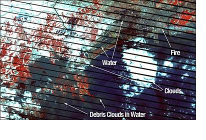
During and after the Earthquake in Japan, Earth observation technology including buoys, satellites and other imaging devices have allowed scientists and the media to visualize and track the impact of the event, mitigating loss of life and property and supporting effective rescue efforts. Citizen scientists, using cameras, cell phones, video cameras and other tools also have provided valuable visual insights.
Commercial and government managed satellites are becoming key tools for analyzing earthquake and tsunami damage and allocating resources for recovery. By comparing processed before-and-after images of the Japanese landscape and coastline, Japanese officials are able to evaluate the impact of flooding at specific locations. At the same time, organizations which aggregate imagery are working in collaboration with national and international relief organizations to provide timely analysis of situations including the deteriorating status of the nuclear reactors in Japan. The earthquake has been officially upgraded to a magnitude of 9.0.
