• English
  • Español
  • Français

United
Nations


Office for Outer Space Affairs
UN-SPIDER Knowledge Portal

  • Home
  • About Us
    • What is UN-SPIDER?
    • About UNOOSA
    • Publications
    • Jobs
    • Meet the Team
    • Contact
  • Space Application
    • Satellite Technology
    • Emergency Mechanisms
    • Recovery Mechanisms
    • International Asteroid Warning Network
    • Space Mission Planning Advisory Group
    • International Space Weather Initiative
    • Space Technologies in the UN
    • User Stories
  • Links & Resources
    • Data Applications
      • Disaster Recovery
    • Data Sources
    • GIS and Remote Sensing Software
    • Online Learning Resources
    • Institutions
  • Risks & Disasters
    • Disaster Risk Management
    • Early Warning Systems
    • Emergency and Disaster Management
    • Natural Hazards
    • Sendai Framework
    • The UN and Disaster Risk Management
    • The UN and Early Warning
    • The UN and Disaster Management
  • Advisory Support
    • Advisory Missions
    • Emergency Support
    • Virtual Advisory Support
    • Recommended Practices
    • Training Activities
    • Practical Uses
  • Network
    • Regional Support Offices
    • GP-STAR
    • MHEWS
    • IWG-SEM
  • Projects
    • SPEAR
    • SEWS-D
    • EvIDENz
    • Flood GUIDE
  • News & Events
    • News
    • Events Calendar
    • UN-SPIDER Events Archive
  • Admin
    • SAM Items

Breadcrumb

  • Home
  • News and Events
  • View Active News
  • ESRI Maps For Monitoring Wildfires In Western US
  • ESRI maps for monitoring wildfires in Western US

ESRI maps for monitoring wildfires in Western US

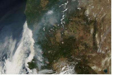
Wildfires blazing in North California (Image: NASA)Wildfires blazing in North California (Image: NASA)

ESRI has developed two interactive maps for wildfire monitoring in the Western coast of the United States, which can be shared and embedded into the end users' websites: the Wildfire Public Information Map and the 2015 California Wildfire Activity Map.

The first one offers updated data on wildfires (locations, perimeters, fire potential areas, global burn areas, wind conditions, and precipitation) from several agencies, such as the USDA Forest Service, Fire Modeling Institute of the US Geological Survey. Moreover, it provides weather information from the National Oceanic and Atmospheric Administration (NOAA) and AccuWeather.

The second one is used for tracking fires in California with up to date statistics from the National Interagency Fire Center (NIFC) Situation Report.

You can embed both maps into your website with the following codes:

-Wildfire Public Information Map:

<iframe width="100%" height="640px" src="http://www.arcgis.com/apps/PublicInformation/index.html?appid=4ae7c683b9574856a3d3b7f75162b3f4" frameborder="0" scrolling="no"></iframe>

- California Wildfire Activity Map:

<iframe width="100%" height="800px" src="http://disasterresponse.maps.arcgis.com/apps/MapJournal/index.html?appid=f9b70e3782ba43ba9d8d54667607a2cd" frameborder="0" scrolling="no"></iframe>
Geoconnexion
Fri, 7 Aug 2015 - 12:09
United States of America

Footer menu

  • Contact
  • Terms of Use

User account menu

  • Log in