• English
  • Español
  • Français

United
Nations


Office for Outer Space Affairs
UN-SPIDER Knowledge Portal

  • Home
  • About Us
    • What is UN-SPIDER?
    • About UNOOSA
    • Publications
    • Jobs
    • Meet the Team
    • Contact
  • Space Application
    • Satellite Technology
    • Emergency Mechanisms
    • Recovery Mechanisms
    • International Asteroid Warning Network
    • Space Mission Planning Advisory Group
    • International Space Weather Initiative
    • Space Technologies in the UN
    • User Stories
  • Links & Resources
    • Data Applications
      • Disaster Recovery
    • Data Sources
    • GIS and Remote Sensing Software
    • Online Learning Resources
    • Institutions
  • Risks & Disasters
    • Disaster Risk Management
    • Early Warning Systems
    • Emergency and Disaster Management
    • Natural Hazards
    • Sendai Framework
    • The UN and Disaster Risk Management
    • The UN and Early Warning
    • The UN and Disaster Management
  • Advisory Support
    • Advisory Missions
    • Emergency Support
    • Virtual Advisory Support
    • Recommended Practices
    • Training Activities
    • Practical Uses
  • Network
    • Regional Support Offices
    • GP-STAR
    • MHEWS
    • IWG-SEM
  • Projects
    • SPEAR
    • SEWS-D
    • EvIDENz
    • Flood GUIDE
  • News & Events
    • News
    • Events Calendar
    • UN-SPIDER Events Archive

Breadcrumb

  • Home
  • News and Events
  • View Active News
  • International Charter Activated For Floods In Colorado, USA
  • International Charter activated for floods in Colorado, USA

International Charter activated for floods in Colorado, USA

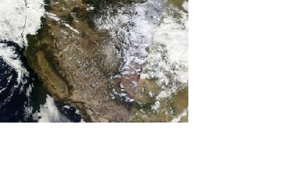
Western and Midwest USA seen from space on 15 September 2013 (Aqua/Terra MODIS dWestern and Midwest USA seen from space on 15 September 2013 (Aqua/Terra MODIS data)

On Friday, 13 September 2013, the International Charter "Space and Major Disasters" was activated for the ongoing heavy floods in the US state of Colorado. The mechanism to provide up to date satellite imagery was activated by USGS on behalf of National Guard Bureau/State of Colorado. USGS will also do the project management for this activation.

Storm rains had caused the flooding. Thousands of people have been advised to evacuate and at least three people have been killed. Boulder County has been most affected, where water levels are continuing to rise and roads have been cut off by floodwaters and debris. Houses have been inundated or demolished by the powerful streams of water and it has been reported that some towns have been isolated by the flooding, including Jamestown, Lyons and Longmont which have been turned into islands by the sheer amount of water.
International Charter
Mon, 16 Sep 2013 - 16:42

Footer menu

  • Contact
  • Terms of Use

User account menu

  • Log in