
The International Water Management Institute (IWMI), a UN-SPIDER Regional Support Office, has won an award for its innovative work using remote sensing technology to help nations monitor and mitigate the impacts of drought. The Institute received the GeoSpatial World Excellence Award 2020 in recognition of the positive impact of its South Asia Drought Monitoring System (SADMS). Since IWMI launched SADMS in 2014, the system has guided national, state and district-level authorities in India and Sri Lanka to take timely action to prepare for drought.
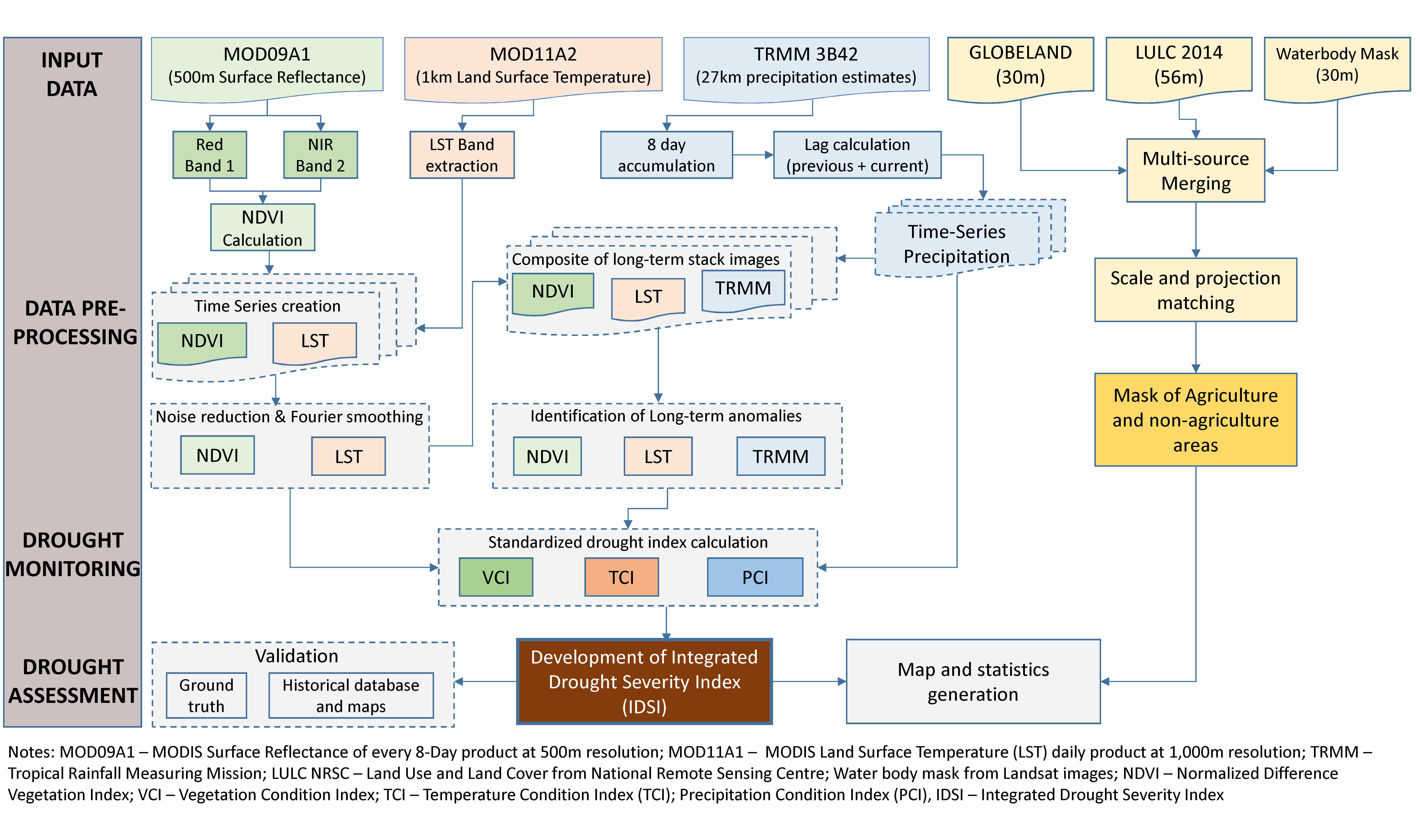
Through the South Asia Drought System, users can explore the sptial condition of ground vegeration throughout the region at the level of specific districts in respective countries and at the level of specific pixels of 0.5 by 0.5 km. The default spatial image shows the distribution of drought condition over a district, sub-district administrative boundaries if any exist and some landmarks, including rivers/canals, roads and or settlements.
In addition, users can also create online time-series graphs of drought-related vegetation characteristics and study the deviation of those from the long-term mean for a district or pixel. The graphs can be built for a time period selected by the user, allowing the developing deficits of vegetation density and vigor to be detected and quantified online. Images of the the calculated drought indices can be downloaded.
In 2018, South Asia suffered a particularly severe drought, which affected 250 million people across an agricultural area of 66.5 million hectares. In India, the SADMS framework was adopted by the Central Research Institute for Dryland Agriculture, a national research institute under ICAR, to disseminate drought information at subnational level for contingency planning. In Sri Lanka, the World Food Programme and national partners used the system to produce a climate and food security bulletin.
Since joining the network of UN-SPIDER Regional Support Offices in 2015, IWMI has supported the prgroamme in a wide range of activities, with a focus on Asia.