United
Nations
Office for Outer Space Affairs
UN-SPIDER Knowledge Portal
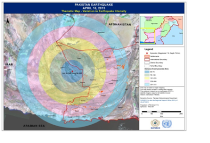
A strong earthquake measuring 7.8 magnitudes on the Richter scale struck Southern Iran close to Pakistan-Iran border on April 16, 2013 at 1044 Hours GMT. The earthquake epicenter was 76 km deep and affected south-western bordering areas of Pakistan near Iranian border.
The National Disaster Management Authority (NDMA) of Pakistan requested SUPARCO - the National Space Agency of Pakistan and UN-SPIDER's Regional Support Office - to monitor and assess the damages caused by the earthquake. Within hours of the earthquake, SPOT-6 satellite was programmed over the affected area and images were acquired the very next day. Rapid maps based on pre and post-earthquake (SPOT 5 & SPOT 6) satellite imageries were generated. In the Rapid analysis most affected settlement in two districts and damaged building structures were quickly identified. The maps were delivered to National Disaster Management Authority and Provincial Disaster Management Authorities on the same day for coordinating relief/rescue efforts.
