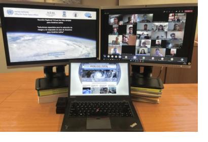
In order to discuss and promote the use of space technologies in addressing natural hazards such as forest fires and landslides in Latin America, UN-SPIDER conducted a virtual regional expert meeting on the topic of “Space-based Solutions for Disaster Risk Reduction and Emergency Response in Latin America” from 22 to 24 September 2020. The meeting was jointly organized with UN-SPIDER Regional Support Offices from Argentina (National Space Activities Commission, CONAE), Brazil (Federal University of Santa Maria, UFSM), Colombia (Geographic Institute Agustin Condazzi, IGAC), and Mexico (Mexican Space Agency, AEM).
In Latin America, UN-SPIDER and its Regional Support Offices have regularly carried out regional expert meetings, training courses and other joint efforts since 2011. The last Regional Expert Meeting took place in 2017 in Mexico.
The meeting, which consisted of three two-hour-long sessions, brought together a total of over 200 disaster management stakeholders from about 70 institutions across 14 countries of the region, in addition to representatives of international and regional organizations such as the Food and Agriculture Organization (FAO) of the United Nations, the United Nations Development Programme (UNDP), the Centre for the Coordination of Natural Disaster Prevention in Central America (CEPREDENAC), the Central American Integration System (SICA) and the Regional Centre for Space Science and Technology Education for Latin America and the Caribbean (CRECTEALC).
The topics addressed in the three sessions were “Space technologies for risk reduction: opportunities and lessons learned”, “Integrating data sources for disaster preparedness and early warning systems” and “Space technologies for disaster response and recovery”.
Presentations delivered at the event as well as recordings of each session are available on the event page.
This virtual regional expert meeting allowed participants:
- To take note of the progress made by Latin American institutions in the use of space technologies and space-based information in risk reduction management, preparedness, recovery and disaster response.
- To give continuity to the efforts carried out by UN-SPIDER and its Regional Support Offices in Latin America.
- To disseminate new applications of satellite technologies for the development of hazard maps, in early warning systems and disaster response operations.
Participants agreed on the following recommendations:
- Conducting additional webinars to continue taking note of the progress made by Latin American institutions in the use of space technologies and space-based information in risk reduction management, preparedness, recovery and disaster response.
- To establish a regional technical group of professionals and experts who can contribute to disaster response efforts in Latin America through the processing of satellite imagery in a coordinated fashion in case of large disasters.
- To explore opportunities for cooperation to develop satellites, including for meteorology, and to take advantage of opportunities made available by UNOOSA and the space community.

