
Disaster Overview
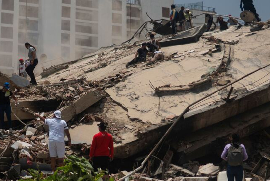
On 24 June 2026, northern Venezuela was struck by two powerful earthquakes approximately 40 seconds apart—a magnitude 7.2 foreshock followed by a magnitude 7.5 mainshock. The shallow earthquakes generated severe ground shaking across northern Venezuela, making them the strongest recorded in the country in more than 125 years.
The earthquakes caused extensive damage to homes, hospitals, schools, transportation infrastructure, and other critical facilities. Numerous communities experienced building collapses and disruptions to essential services, while thousands of people were displaced. Urban Search and Rescue (USAR) teams were immediately mobilized to support search and rescue operations while national authorities continued to assess the full extent of the damage.
International Humanitarian Response
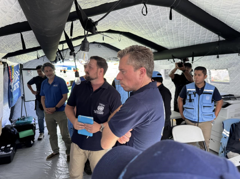
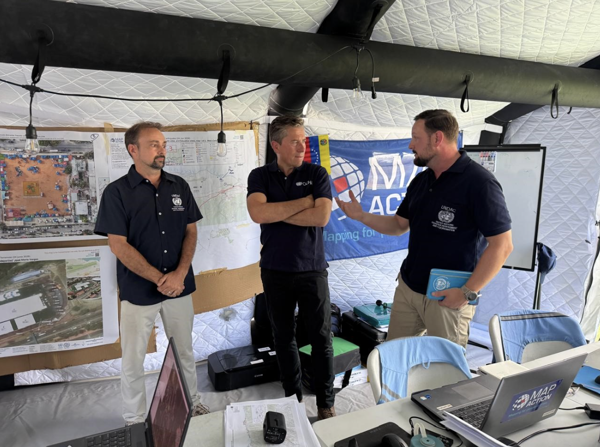
Following the earthquakes, the Government of Venezuela requested international assistance. The United Nations Office for the Coordination of Humanitarian Affairs (UN OCHA) activated its international coordination mechanisms to support the response, including the deployment of a United Nations Disaster Assessment and Coordination (UNDAC) team and the activation of the Assessment and Analysis (A&A) Cell. These mechanisms facilitate the coordination of international humanitarian assistance, information management, and technical support to national authorities during large-scale emergencies.
Impressions from the UNDAC team in Venezuela:
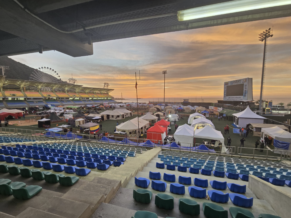
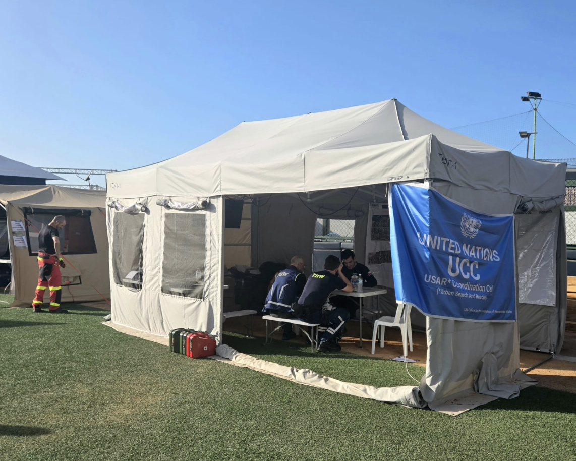
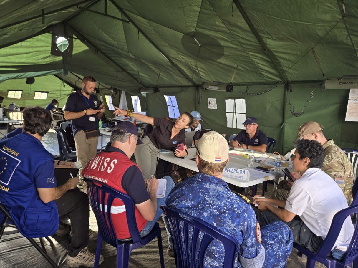
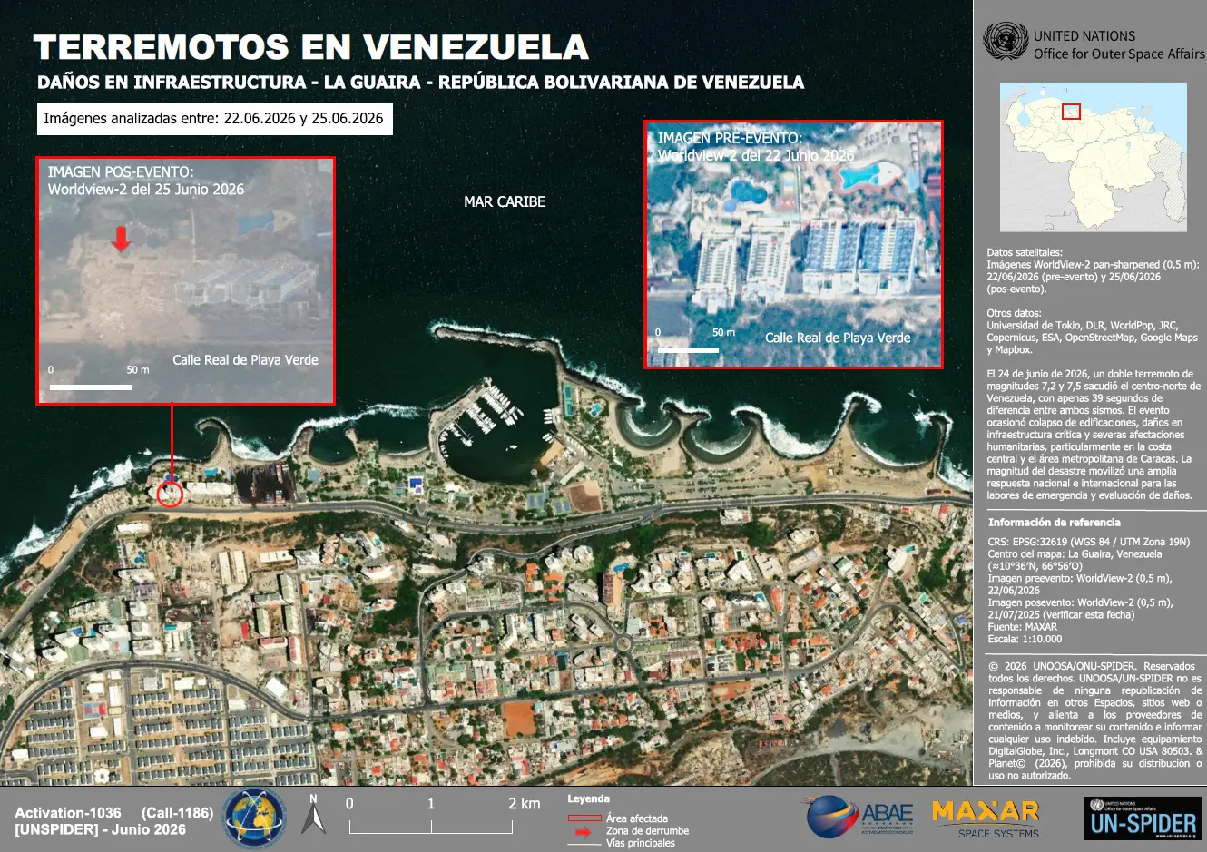
Within the international geospatial community, established international mechanisms, such as the International Charter: Space and Major Disasters and the European Union’s Copernicus Emergency Management Service (CEMS), were activated to support the response. The Bolivarian Agency for Space Activities (ABAE) was appointed to act as Project Manager (PM) in the charter activation, as the primary space agency in Venezuela, responsible for managing the country's space program and policies. The UN-SPIDER programme, as part of the Office for Outer Space Affairs (UNOOSA), started to support the response in close collaboration with UN OCHA and the Charter PM through the acquisition of satellite imagery and geospatial information. Acting as a bridge between the space community and humanitarian responders, UN-SPIDER engaged satellite data providers to acquire very high-resolution imagery across the affected areas and coordinated the distribution of imagery and derived products to humanitarian partners supporting emergency response operations. Particularly noteworthy was the rapid support provided by the UN-SPIDER Regional Support Office (RSO) in Colombia, the Agustín Codazzi Geographic Institute (IGAC), which produced and released one of the first loss and damage overview maps (see map) under the Charter activation.
Following the activation of the A&A Cell, an additional “Satellite Imagery Analysis Subgroup” was established due to the exceptionally high number of stakeholders involved. Within this environment, UN-SPIDER provided technical support to facilitate the rapid acquisition and dissemination of satellite imagery for the humanitarian response. The main objectives of this mission were:
- Rapid Satellite Imagery Acquisition: Coordinate with international satellite operators and commercial imagery providers to obtain the latest very high-resolution imagery covering the affected areas.
- Imagery Coordination and Distribution: Serve as a central coordination point for collecting, organizing and distributing satellite imagery to humanitarian organizations and technical partners involved in the response.
- Support Damage Assessment: Enable responders to assess the extent of damage to buildings, transport infrastructure and other critical facilities through timely access to Earth observation data.
- Support Humanitarian Decision-Making: Provide satellite-based information to support situational awareness, operational planning and the prioritization of humanitarian assistance.
Acquisition, dissemination, and impact of satellite imagery
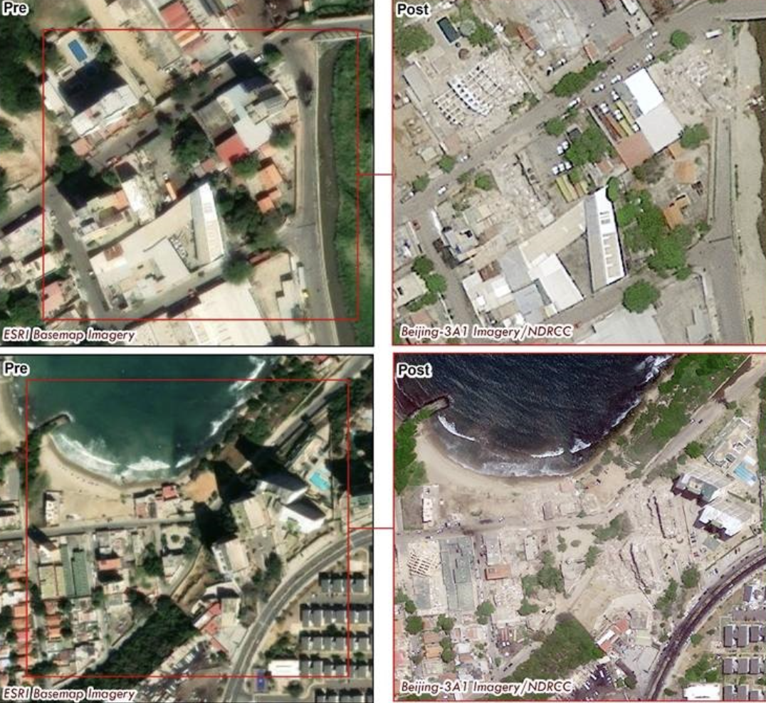
The satellite imagery procured and disseminated by UN-SPIDER served not merely as raw data, but fed directly into damage and change assessments over the most severely affected areas - including Caracas, La Guaira, Valencia, Puerto Cabello, and the surrounding coastline. In concrete terms:
- High-resolution SAR, tasked from multiple commercial providers, enabled post-event building and infrastructure change monitoring, particularly valuable given the persistent cloud cover that limited optical acquisitions. One analysis flagged that apparent "low damage" in central Valencia may in fact conceal severe damage due to radar masking over rubble, a caveat that directly informs prioritisation decisions.
- Cross-sensor corroboration: A hyperspectral anomaly detected over the La Lucha area was independently cross-checked against high-resolution optical imagery (pre- and post-event), with both sources pointing to an affected building. This item was flagged as a verification case, not a confirmed finding.
- The imagery complemented, rather than duplicated, the products delivered through the International Charter and Copernicus EMS, filling critical gaps — including additional areas of interest, all-weather SAR coverage, and contributions from providers outside those mechanisms.
Through this coordinated effort, satellite imagery was shared with the Charter Project Manager (ABAE), the United Nations Global Service Centre (UNGSC), the UNDAC team deployed to Venezuela immediately after the earthquake, the OCHA-led A&A Cell and its Satellite Imagery Analysis Subgroup, as well as technical partners within the UN-SPIDER Regional Support Office (RSO) network, including the Agustín Codazzi Geographic Institute (IGAC) in Colombia. All imagery and derived products were distributed on a best-effort basis to support ongoing analysis and operational decision-making. As the availability of pre-event imagery remained limited for parts of the affected area, analysis results should be interpreted with appropriate caution.
The Importance of Satellite Imagery in Earthquake Response
Satellite imagery plays a critical role in earthquake response by providing a rapid and objective overview of the affected area, particularly during the first hours and days following a disaster.
In the case of the Venezuela earthquake, satellite data supported the identification of damaged buildings, affected transport corridors, and critical infrastructure, helping humanitarian actors prioritize response efforts and allocate resources efficiently. Where access to affected communities remained challenging and field assessments required time to organize, Earth observation data provided an invaluable source of situational awareness, complementing information collected on the ground and supporting evidence-based decision-making.
Response efforts remain ongoing as humanitarian partners continue to support affected communities and assess the full extent of the damage. UN-SPIDER will continue working closely with UN OCHA, particularly the UNDAC team on the ground, as well as with satellite data providers and technical partners, to facilitate access to timely satellite imagery and geospatial information in support of the international humanitarian response. Further updates will be shared as the operation evolves.
Following the initial search-and-rescue phase, UN-SPIDER continues to provide dedicated geospatial support at the request of the UNDAC team, in close coordination with IOM, focusing on operational needs around the La Guaira OSOCC. By facilitating access to high-resolution satellite imagery over the area, UN-SPIDER is enabling on-site partners such as MapAction to produce tailored shelter camp mapping products that help humanitarian actors assess camp layouts, infrastructure, population density, and access routes. This sustained support ensures that coordination teams on the ground have access to up-to-date, decision-relevant geospatial information as the operation transitions from life-saving interventions to shelter, site planning, and broader humanitarian coordination.
ANNEX
Satellite image acquisition by UN-SPIDER:
Following the earthquake affecting the coastal region of Venezuela, multiple international and commercial satellite operators provided imagery to UN-SPIDER to support rapid damage assessment. Approximately 120 satellite images were contributed by 10 key data providers, covering optical, multispectral, hyperspectral, and SAR modalities:
- Axelspace
- China National Space Administration, China Centre for Resources Satellite Data and Application (CNSA, CRESDA)
- National Disaster Reduction Center of China (NDRCC)
- Aerospace Information Research Institute under the Chinese Academy of Sciences
- National Earth Observation Data Center (NODA)
- Chang Guang Satellite Technology Co.,Ltd. (CGSTL)
- Open Cosmos
- Spacety
- STAR.AI GROUP
- Synspective
- Wuhan University
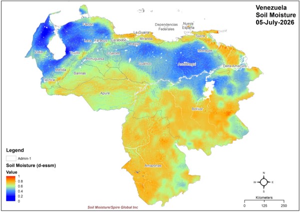
- Spire Global Inc
Table 1: Type of satellites and sensors by key data providers
| Provider | Axelspace | CGSTL | NDRCC | OpenCosmos | Spacety | STAR.AI Group | Synspective | Wuhan University |
| Satellite | GRUS-1B | Jilin-1 satellite | Beijing-3A1 | Accenture-1, Hammer | Shenqi-02 | Lanjing-3 II | StriX-3 | ** |
| Sensor | Optical | Optical | Optical | Hyperspectral | SAR | Optical | SAR | ** |
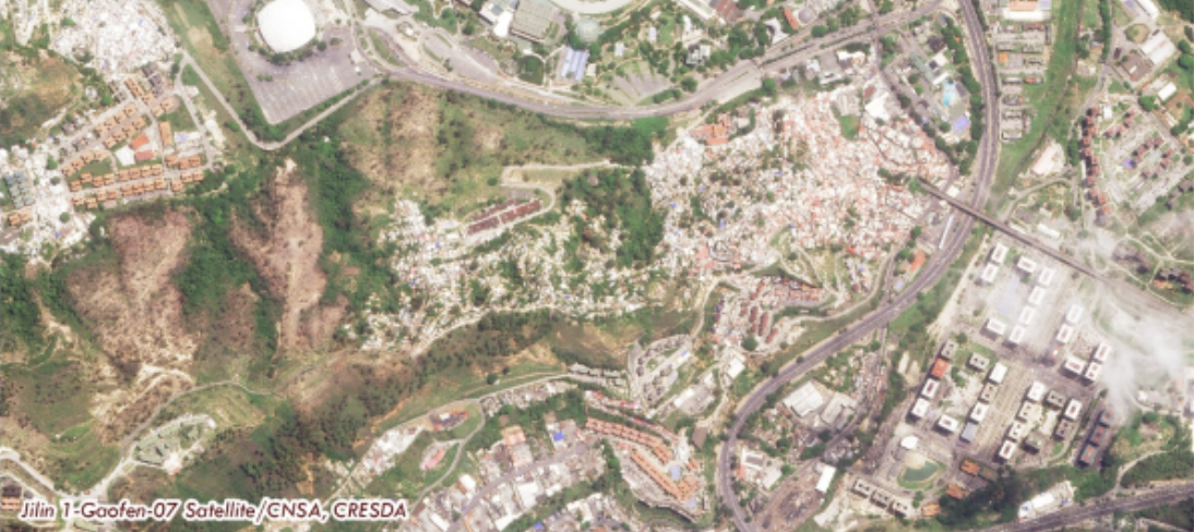
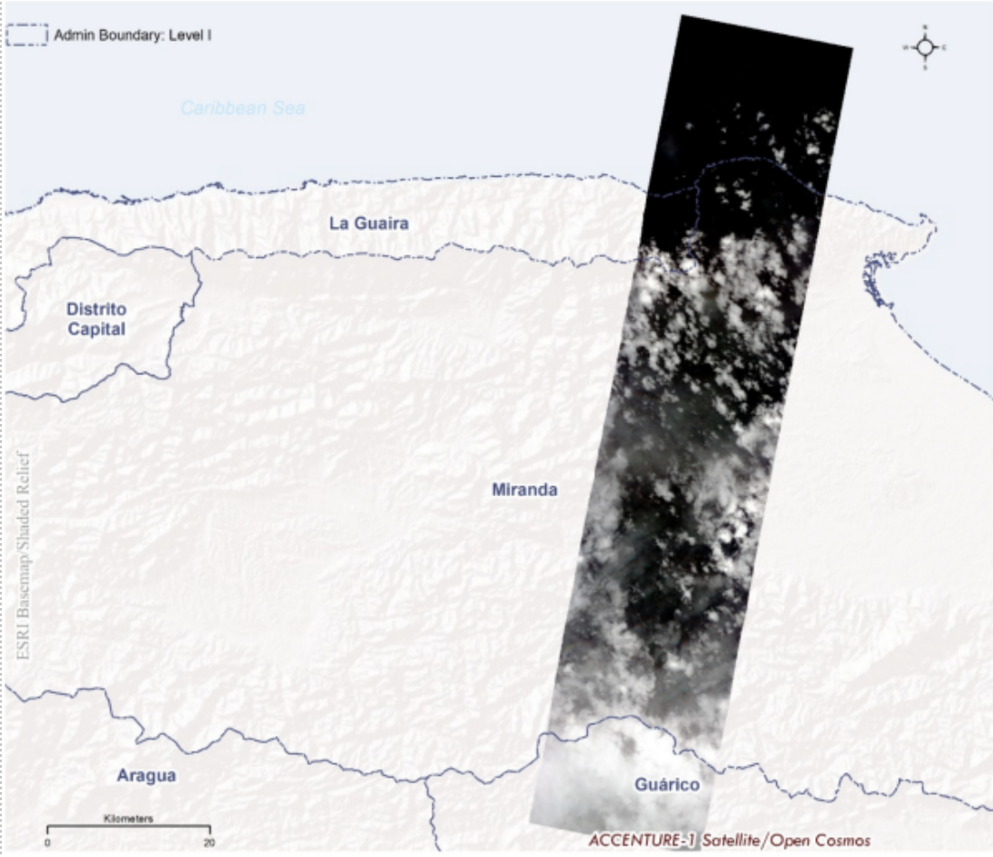
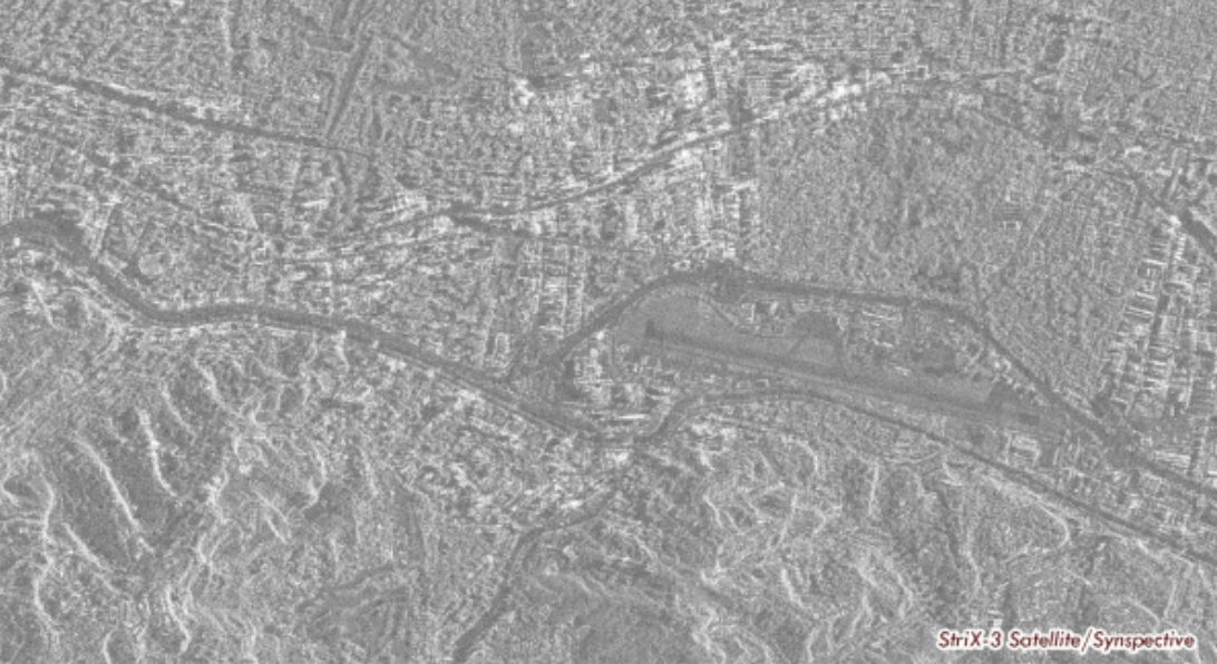
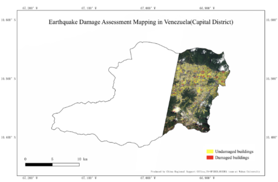
| Provider / Operator | NDRCC | CGSTL | STAR.AI GROUP | Axelspace | OpenCosmos | Spacety | Synspective |
| Satellite | Beijing-3A1 | Jilin-1 satellite | LJ3II | GRUS-1B | Accenture-1, Hammer | Shenqi-02 | StriX-3 |
| Product | L4 Pan-sharpened | L3D Pan-sharpened | L1A | L1C | L1C | SLC | SLGRD |
| Spatial Resolution | 0.5 m | 0.5 m | 0.65 m (PAN), 2.6 m (MSS) | 2.5 m (PAN), 5 m (MS) | 5 m | ~3 m pixel spacing (SLC) | 0.95 m |
| Spectral / Polarization | RGB | RGB | PAN + MSS | PAN + MSS | 32 hyperspectral bands (440–883 nm) | VV | VV |
