Asia Pacific

country taxonomy block

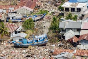
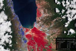
In September 2018, the Indonesian island of Sulawesi was hit by a 7.5 magnitude earthquake. The impact, combined with the tsunami, landslides, and soil liquefaction that followed, “... claimed well over 2000 lives, destroyed homes, buildings, infrastructure and farmland in several districts,” according to the European Space Agency (ESA)

Ten months later, response efforts are now moving into the recovery and rebuilding phase, with satellite information offering important insights to local officials. For example, through a collaboration with the Asian Development Bank, ESA is providing Indonesian officials with hazard-mapping tools derived from Earth observation data, and training in how to most effectively use these resources. “The main purpose of sharing these information products is to help the…

more
Publishing date 06/08/2019

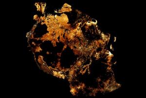
Facebook has published new population density maps covering most of the African continent and countries of the Asia-Pacific region in June 2019. Using artificial intelligence (AI), these maps help organizations to respond to natural disasters, and scientists to assess the impact of climate change and urbanization on people’s lives. As soon as almost the entire world population is covered by the project, population distribution in remote areas will be better determinable by humanitarian agencies. In that way, health workers will be able to better reach households and relief workers to better distribute aid. 

For its population density maps, Facebook used a combination of machine learning techniques, high resolution satellite imagery and population data; no Facebook data was used nor did the census and satellite data used contain any personal data. The satellite maps used were created using DigitalGlobe'…

more
Publishing date 16/07/2019

Building upon a history of successful Earth observation satellite launches, the Indian Space Research Organization (ISRO) sent its RISAT-2B radar imaging satellite into orbit on 22 May 2019. Launched from the Satish Dhawan Space Centre in Sriharikota, India, the satellite has the capacity to benefit the disaster management, agriculture, and forestry sectors by capturing detailed images of the Earth’s surface, with a resolution of about 1 metre.

With its X-band synthetic aperture radar, RISAT-2B can view the Earth’s surface during day and night, including under cloudy conditions. ISRO Chairman Dr. K. Sivan, as quoted in an…

more
Publishing date 22/05/2019

From 27 February to 2 March 2017, World Vision, Oxfam, the University of Auckland in New Zealand and the National Disaster Management Office of the Solomon Islands organized the “Information Management in Disaster Risk Management Decision Making” workshop in Honiara, Solomon Islands. It was hosted by National Disaster Management Office (NDMO) of the Solomon Islands.  The event was conducted by experts from World Vision Australia, Oxfam New Zealand, UN-SPIDER, UNOCHA, Civil Registration & Vital Statistics (CRVS), the Secretariat of the Pacific Community (SPC), and NDMO.  Sixty five participants attended the activity, including government officials, NGOs, UN agencies, and stakeholders from communities and the private sector. It addressed ways to effectively extract information from available sources and how information is used in the disaster management cycle. The topic of “Integration of Climate Change Adaptation and Disaster Risk Reduction in the…

more
Publishing date 21/03/2017

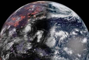
The Japan Aerospace Exploration Agency (JAXA) together with the private sector launched the Himawari-9 on 2 November 2016 from the JAXA’s Tanegashima Space Center in Japan’s southwestern Kagoshima prefecture. It will join Himawari-8 that was launched on October 2014, to complete the next-generation of Geostationary Meteorological Satellites (GMS) that aim to improve meteorological services in the Asia Pacific region, especially giving complete and opportune images of storms, clouds and other weather systems.  Himawari-9’s position will be fixed at 140 degrees east longitude and the mission will serve the Japan Meteorological Agency during the following 15 years.

The old meteorological satellites MTSAT 1R and MTSAT 2, which were launched on 2005 and 2006 respectively, will be replaced by Himawari-8 and Himawari-9. The old satellites were taking update images of East Asia and the Western Pacific every 30 minutes, while the new ones provide up to dated…

more
Publishing date 05/11/2016

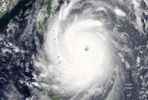
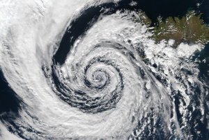
A super-typhoon called Nepartak made landfall in Taiwan (POC) in the morning of the 7th of July 2016. According to the Taiwan’s Central News Agency, at least 69 people were injured.  The cyclone is expected to lead to heavy rainfall across the island before heading to China. 

The Moderate Resolution Imaging Spectroradiometer (MODIS) of the National Aeronautics and Space Administration’s Aqua Satellite (NASA) captured space-based imagery of the cyclone on the 6th of July. The NASA’s International Space Station-Rapid Scatterometer (ISS-RapidScat) observed the storm as well and provided a map showing winds narrowing into a vortex.

Read more about it: https://www.theguardian.com/world/2016/jul/08/super-typhoon-nepartak-landfall-taiwan-china

more
Publishing date 08/07/2016

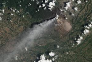
Mount Sinabung, located in the North Sumatra province in Indonesia, erupted on 21st of May 2016, killing seven people in the village of Gembar, which is located on its foothills. The volcano last erupted in 2014, and in October of that year the National Disaster Management Agency of Indonesia established a 4 kilometer danger zone as a way to minimize the number of people exposed to the impacts of subsequent eruptions. 

The International Charter Space and Major Disasters was activated on 23 May 2016 by the Asian Disaster Reduction Center (ADRC) on behalf of the National Institute of Aeronautics and Space (LAPAN) of Indonesia.   LAPAN was designated by the Charter as the project manager for this activation.

Search and rescue teams continue to search the affected area to find any other victims of the eruption but it is still unclear how many people might have been affected by the eruption. 

Publishing date 31/05/2016

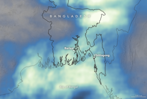
Cyclone Roanu reached Bangladesh on 21 May 2016, leaving 26 people and affecting hundreds of thousands others. The storm caused heavy rains which led to floods and landslides across the coast of the country, affecting fifteen districts.

In order to respond to this disaster, the International Charter of Space and Major Disasters was activated on the 25th of May at the request of the Asian Disaster Reduction Center (ADRC) on behalf of the Bangladesh Space Research and Remote Sensing Organization (SPARRSO). The Asian Institute of Technology has been designated as the project manager for this activation.

During the side-event conducted by the British NGO Practical Action and entitled “Science for climate risk management and climate justice” on the 26th of May 2016 in the Bonn International Conference Center, Mr. Saleemul Huq, Senior Fellow in the Climate Change Group at the International Institute for Environment and Development (IIED), indicated that…

more
Publishing date 31/05/2016

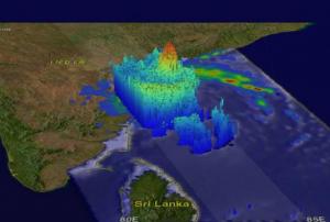
On 18 May 2016, the National Aeronautics and Space Administration (NASA) and its associated agencies captured Global Precipitation Measurement (GPM) images of tropical cyclone Roanu in the Bay of Bengal. The hazard had negative effects on Sri Lankan and Southern Indian regions.  Although the storm was a relatively weak, it provoked landslides and heavy flooding, increasing the death toll to 75 people in Sri Lanka as thousands of homes remain inundated. Nearly 22 of Sri Lanka’s 25 districts have been affected by the rains according to disaster officials. More than 120 people are still missing.

The International Charter Space and Major Disasters was activated at the request of the Asian Disaster Reduction Center (ADRC) on behalf of the International Water Management Institute (IWMI) which is based in Sri Lanka.  The Asian Institute of Technology has been designated by the Charter to serve as project manager in this activation. 

Civilian volunteers as well…

more
Publishing date 25/05/2016

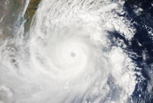
The National Aeronautics and Space Administration (NASA) captured on Friday 20 May 2016 an image of the tropical cyclone Roanu using the Suomi NPP satellite. The cyclone was moving parallel to the northeastern coast of India, triggering heavy rains, gusty winds and storm surges. 

The Indian Ocean is exposed every year to various types disasters, including tropical cyclones. Images of the Tropical Cyclone Roanu were taken from the Visible Infrared Imaging Radiometer (VIIRS) instrument aboard NASA-NOAA-DOD’s Suomi NPP satellite. This information was then relayed to the Joint Typhoon Warning Center (JTWC) to alert local authorities and population.

The Tropical Cyclone Roanu reached the coast of Bangladesh on Saturday 21 May 2016, causing heavy winds and rains, inundations and various damages.

In an interview to CNN, Dalil Uddin, who is a member of the Disaster Management Ministry commented:  “We have confirmed 21 deaths in six districts so far”. While the…

more
Publishing date 23/05/2016

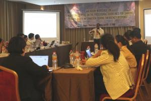
UN-SPIDER, UNESCAP and the Indonesian Space Agency (LAPAN) jointly organized the 4th ASEAN workshop entitled “Simulation exercise on the procedural guidelines for sharing space-based information during emergency response”. The workshop, conducted from 19 to 21 April 2016 in Bogor, Indonesia, was supported by the AHA Centre and UNOSAT. It targeted 33 participants from 10 countries, including NDMOs, space agencies, technical agencies, regional organizations and UN organizations.

This workshop was built on the outcomes of the 1st and 2nd ASEAN workshops on the “Development of mechanisms for acquisition and utilization of space-based information during emergency response”, which were conducted in April 2014 and June 2015 respectively, and the 3rd ASEAN workshop entitled “Workshop to finalize the procedural guidelines for requesting space-based information during emergency response in ASEAN”, which was conducted in December 2015.

During…

more
Publishing date 09/05/2016

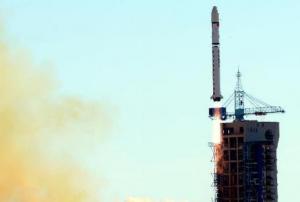
On November 8, China launched the remote sensing satellite Yaogan 28 from the Taiyuan space center in the Shanxi Province, located in northern China. As the state-run Xinhua news agency reported, the government-owned satellite “will be used for experiments, land surveys, crop yield estimates and disaster relief.” 

Yaogan 28 was launched on November 8 at 3:06 p.m., Beijing time. After the liftoff on a 150-foot-tall Long March 4B rocket, Yaogan 28 is now orbiting Earth at an elevation of 290 miles. 

The launch of satellite Yaogan 28 represents the 27th successful launch of a Long March 4B rocket since 1999, for in the context of China it marks the 14th space launch in 2015.

 
Publishing date 10/11/2015

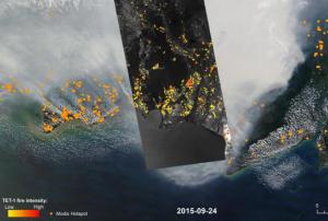
So far, more than two million hectares of Indonesian forest area have been lost due to the forest fires that broke out on 21 June 2015. The National Space and Aviation Agency of Indonesia (LAPAN) expects losses to grow, as large forest areas and peat lands, especially in Kalimantan and Sumatra, are still affected by fires.   

Parwati Sofan, a senior official in LAPAN, stated at a press conference which was held at the Natural Disaster Mitigation Agency headquarters in Central Jakarta on 30 October 2015 that “Even though the satellite has helped us [collect the data], bear in mind that it cannot scan the forest areas that are covered in thick haze and clouds (…). We expect the size of burnt area to increase as the data collection is still underway. We will update the data on the burnt area every ten days."

Meanwhile, a German research…

more
Publishing date 09/11/2015
Regional Support Offices mentioned:

This year’s Asia Pacific Disaster Report 2015 – 'Disasters without borders: regional resilience for sustainable development', released by the United Nations Economic and Social Commission for Asia and the Pacific (ESCAP), provides an overview of disaster-risk resilience in the Asia-Pacific region. Furthermore, the report introduces new emerging risks for the region and its different sectors. 

The report focalizes on cross-border disasters, among them earthquakes, droughts, tropical cyclones and floods, which can be only effectively dealt with cooperation. The ESCAP Executive Secretary Shamshad Akhtar stated, “Ours is the most disaster-prone region, so building resilience is not a choice, but rather a collective imperative (…) Disaster risk reduction is a core development priority of Asia and the Pacific.”

Besides cross-border disasters, the Asia-Pacific Disaster Report 2015 highlights specific areas of…

more
Publishing date 02/11/2015

The second meeting of the Inter-agency and Expert Group on Sustainable Development Goal Indicators (IAEG-SDGs) was held at the United Nations Conference Center in Bangkok, Thailand from 26 to 28 October. The aim of the convention was to review the possible global indicators of the framework needed for the monitoring of the goals and targets of the post-2015 development agenda at the global level, and support its implementation. The event was broadcasted life to the public during the three days.

Measuring development indicators at national levels is traditionally being performed by national statistical offices. Space technology capabilities and space-based information can be used to support the Sustainable Development Goals Indicators and Monitoring Framework, as an objective measuring tool which enables a spatially consistent monitoring of the Earth.

As an example, the Indicator “number of deaths, missing people, injured, relocated or evacuated due to…

more
Publishing date 30/10/2015

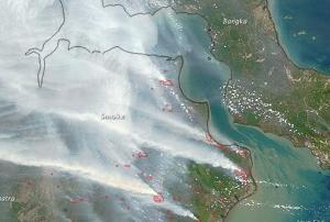
Since weeks Indonesia experiences severe forest fires in Sumatra and Kalimantan, Indonesia's half of Borneo island. Social Minister Khofifah Indar Parawansa officially confirmed the death of 19 people, as a cause of the effects of the fire haze. Due to heavy rainfall within the last days, the number of fire hot spots decreased from 1.578 to 291 on 28 October. 

Pollution levels advanced from "unhealthy" to "moderate" in Riau province on Sumatra island. Overall, more than half a million Indonesians suffer from the effects of the haze. This year’s fires had been worsened by El Niño, which further caused severe dryness in Indonesia. 

In the past, Indonesia had been impacted by several fires due to the common practice of "slash and burn agriculture", in which rainforest is burned to clear the ground for the growing of crops, like oil palm and acacia pulp, and the grazing of animals. Often fires smolder under the surface of Indonesia, continuing for a long time…

more
Publishing date 29/10/2015

Four satellites were launched for harvest assessment, geological disaster prevention and resource surveys. Jilin-1 is called the mission led by China, which used a Long March-2D vehicle from the 603 Launch Pad at the Jiuquan Satellite launch Center’s LC43.

Jilin-1 includes four satellites to produce high-definition images that will contribute forecasting and mitigate geological disasters, among other purposes. The province aims to launch 60 satellites by 2020 and 138 until 2030. By 2019, 16 satellites are expected to be in orbit as a part of a network for remote sensing. This initiative will reach coverage on the entire globe, able to provide updated data every three to four hours.

The four satellites are: Jilin-1 to operate on a 656 km sun synchronous orbit; Lingqiao-A and Lingqiao-B meant to capture videos with a 4K ultra-clear video resolution; and the micro-satellite LQSat for technology demonstration designed by CIOMP.

more
Publishing date 14/10/2015

UN SPIDER’s Regional Support Office in Sri Lanka International Water Management Institute (IWMI) in association with Sentinel Asia System (SAS) and JAXA activated the charter on October 1 to generate satellite images covering the Southern Provinces in Sri Lanka.

The imagery was provided to use in emergency response and relief operation. Floods were mapped on 30 September and 1 October 2015, using IFMAN tool and covering the districts of Hambantota, Galle, Mantara, Monaragala and Ratnapura.

An area of 365 sq.km was inundated, as the images of satellite ALOS PALASAR reported on 30 September. Around 150 sq.km of paddy fields were flooded. According to the satellite information provided on 1 October, in total 15 divisions were affected with a maximum inundation of 89 sq.km of which paddy fields affected area is 47 sq.km.

To access the emergency support page for the Sri Lanka flood, please click…

more
Publishing date 05/10/2015
Regional Support Offices mentioned:

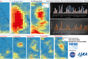
The International Water Management Institute (IWMI) released some imagery from the satellite rainfall estimates for the current flood disasters in Sri Lanka. The Global Precipitation Mission (GPM) and Tropical Rainfall Measuring Mission (TRMM) revealed that the extraordinary flooding in Sri Lanka was caused by unusually strong monsoonal rainfall over the period between 10 September and 30 September 2014.

Massive flooding was reported mainly in the Southern, North central and Uva Province of Sri Lanka. The accumulated rainfall almost tripled in comparison to the rainfall in the same period last year.

Satellite imagery helps to map the affected areas, as well as to compare information of similar periods and analyze the different natural behaviors or disaster events. For instance, the southern provinces districts received an average of accumulated rainfall of more than 100mm from 24 to 30 September this year, while 75mm in 2014.…

more
Publishing date 01/10/2015
Regional Support Offices mentioned:

Geo-referenced information Systems for Disaster Risk Management (Geo-DRM) is called the initiative launched by the United Nations Economic and Social Commission for Asia and the Pacific (ESCAP) to support the world’s most disaster prone countries build their capacities to recover from natural disasters.

Geographic Information System (GIS) applications for early warning and multi-hazard risk assessment are some of the offers to be found on the portal.

The online Geo-DRM platform is part of ESCAP’s efforts to advance regional implementation of the newly adopted Sendai Framework for Disaster Risk Reduction 2015-2030, according to the United Nations Under-Secretary-General and Executive Secretary of ESCAP, Dr. Shamshad Akhtar. "The main tenet of the Sendai Framework is that disaster risk reduction is an essential condition for achieving sustainable development,” explained Dr. Akhtar. “Over the past 45 years, natural disasters in Asia and the…

more
Publishing date 10/09/2015

The International Charter: Space and Major Disasters has been triggered to provide satellite-based emergency maps in response to floods and landslides caused by heavy rains in the north and central regions of Bangladesh. The mechanism was activated yesterday, 7 September 2015, at 09:13 (UTC+02:00) by the…

more
Publishing date 08/09/2015

The Bureau of Meteorology informed that the new satellite, called Himawari 8, will provide updated images every ten minutes. The aircraft, developed by the Japanese Meteorological Agency, is able to generate full color and better resolution imagery that will led to more accurate forecast to issue weather warning.

The head of the weather bureau, Dr. Andrew Tupper, explained that Himawari 8 will allow a closer monitoring and better understanding of weather events. "Just about everything we do in terms of real time weather we'll be able to see better with this satellite; thunderstorms, cold fronts, cool changes, fires and it will be really useful for hot spot monitoring. Even volcanic eruptions, we've already seen with some major eruptions to our north that the satellite can sense them more quickly and distinguish the ash more accurately, and of course there's tropical cyclones," he affirmed.

Early warning is one of the benefits this new technology…

more
Publishing date 07/09/2015

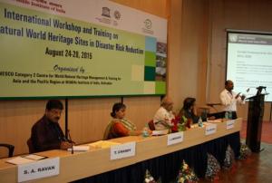
The International Workshop on the Role of World Natural Heritage (WHS) Sites in Disaster Risk Reduction (DRR) was organised by UNESCO Category 2 Centre (C2C) World Natural Heritage Management and Training for Asia and the Pacific Region based at Wildlife Institute of India. The event was performed in Dehradun city on 24 and 25 August. The main objectives of the workshop were:

·         To identify and assess Natural and man-made disaster risks at World Heritage properties in the Asia-Pacific Region,

·         To raise awareness about the need to integrate special concern for Natural and Mixed World Heritage properties into national disaster reduction policies and develop an Action plan for Disaster Risk Reduction in World Heritage Management plans;

·         Carry out training for managers of natural and mixed World Heritage…

more
Publishing date 02/09/2015

The UN-SPIDER, the UNDP and the Department of Disaster Management (DDM) (Ministry of Home and Cultural Affairs) conducted follow up activities and training workshop as a next step after the UN-SPIDER Technical Advisory Mission (TAM) to Bhutan, offered in June 2014. The activities were executed from 17 to 21 August, 2015.

Soon after the TAM was conducted, the UN Resident Coordinator secured funding to implement the recommendations of the TAM through the UN joint project titled “Recovery Preparedness and Resilience-building in Bhutan”. Through this funding, 19 officials from Bhutan visited the UN Affiliated Centre for Space Science Technology Education in Asia and the Pacific in India to attend one week training programme titled “Response and recovery preparedness” in April 2015. This training provided general…

more
Publishing date 02/09/2015

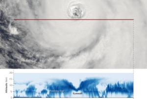
Stunning images of the Atsani typhoon have been captured by CloudSat and Aqua satellites on August 19. The first space artifact passed near its eye and collected information about the inside of the typhoon through its cloud-penetrating radar. For its part, the MODIS web on the Aqua satellite passed above Atsani capturing an image of the storm's eyewall where the the red line is the north-to-south track that CloudSat took.

CloudSat's record displays what the storm would look like if it had been sliced near the middle and viewed from the side: the darkest blues indicate regions where clouds and rain were the strongest. It also shows the event’s outward sloping eyewall, intense convection and rainfall, and cloud structure. The blue horizontal line across the data is the freezing line: ice particles were registered above it and raindrops below it.

Atsani is the most…

more
Publishing date 21/08/2015