América del Norte

country taxonomy block

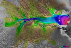
Heavy rains, sea level rise, flash floods, and coastal floods are expected to increase further the frequency and severity around the coastal areas of the United States. Since 2000, at least one flood has occurred in the U.S. on average on nearly 300 days per year. The NOAA database also shows that all 50 states and the District of Columbia were affected by flooding in 2021.

Flooding continues to be the country's most common and costly natural disaster, with flood-related disasters causing more than $85 billion in damage and economic losses in 2021 alone. According to Census Bureau, data collected earlier this year, natural disasters forced an estimated 3.4 million people in the U.S. to leave their homes in 2022, underscoring how climate-related weather events are already changing American communities.

NASA has recently developed a Flooding Analysis Tool to allow practitioners and decision-makers to assess how sea level rise and other factors...

more
Publishing date 16/03/2023

Global warming has been impacting the planet in recent decades and is leading to more frequent and intense hydrometeorological events such as storms, floods, heatwaves, and droughts. Eastern Canada experienced a very strong heatwave in the spring, California, Greece, Algeria, Russia and other countries saw extreme forest fires while other countries like Germany faced the challenges of responding to floods and debris flows with an estimated period of return of nearly 800 years.

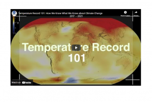
According to scientists from the National Oceanographic and Atmospheric Administration (NOAA) and the National Aeronautics and Space Administration (NASA) of the United States; 2021 equaled 2018 as being the sixth warmest year since 1880. They used data from the Atmospheric Infrared Sounder (AIRS) on board the Aqua satellite and in-situ data from ground stations as well as from ships and buoys at sea. Additional information from NOAA on this topic is available...

more
Publishing date 14/01/2022

On 12 June 2019, a trio of identical Canadian Earth observation satellites, which will help monitor climate change and save lives during natural disasters, among other applications, were successfully launched into space from a SpaceX Falcon 9 rocket.  

The satellites, collectively referred to as the RADARSAT Constellation Mission (RAM), follow the legacy of over two decades of Canadian RADARSAT satellites that have provided important insights about the Earth’s surface. RAM builds upon this foundation and will provide increased information for researchers to better understand our planet. According to a news release from the Canadian Space Agency, “The constellation of three satellites will provide daily images of...

more
Publishing date 21/06/2019

The Canadian Space Agency and the Canada Centre for Mapping and Earth Observation have released 36,500 RADARSAT-1 images, which are available at no cost on the Government of Canada’s Earth Observation Data Management System. Having aided relief operations in 244 disaster events through the images it captured, the Canadian RADARSAT-1 satellite now has the opportunity to reach a broad pool of researchers, industry members, and the general public with its photos of the Earth’s surface.  

Launched in November 1995, RADARSAT-1 was Canada’s first Earth...

more
Publishing date 27/05/2019

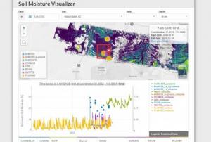
An integrated data platform has been created to bring together a wide variety of in situ and remotely-sensed soil moisture data sets to better inform disaster response planners, climate scientists and meteorologists, farmers, and others. The Soil Moisture Visualizer (SMV) is provided as an open and free data access tool from the NASA Oak Ridge National Laboratory Distributed Active Archive Center (ORNL DAAC).

Accurate and timely information on soil moisture is critical for research in agriculture, flooding, forest health, water quality, and modeling of the global carbon and water cycles, as well as being able to alert farmers to crop stress.

Data from in situ sensor networks have high temporal and spatial resolution, however they cover limited areas, whereas remote sensing and data assimilation methods provide information across broad spatial scales, but with higher uncertainty. Combining data...

more
Publishing date 18/02/2019
Regional Support Offices mentioned:

Geo Week is the next step in the evolution of the International Lidar Mapping Forum (ILMF), SPAR 3D Expo & Conference and AEC Next. The combined conference program and tradeshow floor will feature commercial applications of 3D technologies, innovations and case studies in the built environment, advanced airborne and terrestrial remote sensing solutions, smart products for a full project team and much more!

In 2023, the Geo Week conference programme will showcase real-world use cases and highlight emerging trends in technology and processes. Session topics include the democratization of reality capture, the expanding “toolbox” for surveyors, the readiness of the AEC industry to adopt new technologies, how workflows can be seamlessly integrated, and how lidar and geospatial information can be used towards meeting sustainability goals and reducing inefficiency and waste.

Created in...

more