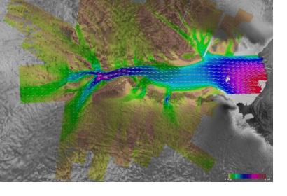
The Canadian Space Agency and the Canada Centre for Mapping and Earth Observation have released 36,500 RADARSAT-1 images, which are available at no cost on the Government of Canada’s Earth Observation Data Management System. Having aided relief operations in 244 disaster events through the images it captured, the Canadian RADARSAT-1 satellite now has the opportunity to reach a broad pool of researchers, industry members, and the general public with its photos of the Earth’s surface.
Launched in November 1995, RADARSAT-1 was Canada’s first Earth observation satellite. The satellite’s use of synthetic aperture radar (SAR) meant that images could be captured day and night, and in cloudy conditions, as opposed to optical Earth observation satellites, which can only obtain high-quality images in favourable lighting and weather conditions. As a result, RADARSAT-1 was able to consistently observe the Earth’s surface in its 17 years of operation and 90,828 orbits around the Earth, making it a valuable resource for monitoring environmental change.
The satellite’s value in this regard was highlighted by the Canadian Space Agency in a news release about the RADARSAT-1 images that are now publicly available. The Agency asserted that, “Access to these images will allow Canadians to make comparisons over time, for example, of sea ice cover, forest growth or deforestation, seasonal changes and the effects of climate change, particularly in Canada's North.” Along with these benefits, Prashant Shukle, Director General of the Canada Centre for Mapping and Earth Observation emphasized the ability of RADARSAT-1 images to “improve disaster mitigation.”
RADARSAT-1, which was active until 2013, joined several Earth observation satellites that use SAR and provide important information for disaster management purposes such as the European Space Agency’s Sentinel-1 and the Indian Space Research Organisation’s RISAT-1.

