Americas

country taxonomy block

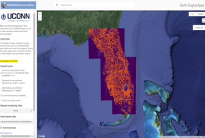
Researchers at the University of Connecticut Global Environmental Remote Sensing (GERS) Laboratory have been making progress on achieving near real-time post-disaster monitoring and evaluation. For the last few years, they have been developing a tool that uses machine learning to identify land disturbances around the continental United States.

Using decades worth of Landsat data, the researchers are able to train the tool to filter out the visual noise and seasonal change that occurs over large scales throughout a year, and then identify areas of notable change and possible damage. The outputs and training provided by older datasets can be then used to create a model to recognize land disturbances earlier, and help to inform emergency response. These techniques and the platform of which they are showcased in have been previously used in the days following hurricane Ian,...

more
Publishing date 15/04/2024

The first edition of the Key Recommendations for a Strengthened use of Science and Technology in Disaster Risk Reduction in the Americas and the Caribbean, presents the findings regarding the effect and significant role of scientific and technological research on strengthening the implementation and formulation of sound DRR policies.  

In recent years, countries in Latin America and the Caribbean substantially improved their disaster response capacity. However, given the need to further place DRR at the center of the sustainable development agenda / the need to effectively address the underlying factors of risk, efforts should instead focus on the creation and implementation of integrated disaster risk management strategies. To such end, widespread consensus within the international DRR community points towards the need for comprehensive and sustained use of science and technology (S&T) in practice and policymaking.

The recently developed Regional...

more
Publishing date 08/02/2022

In order to discuss and promote the use of space technologies in addressing natural hazards such as forest fires and landslides in Latin America, UN-SPIDER conducted a virtual regional expert meeting on the topic of “Space-based Solutions for Disaster Risk Reduction and Emergency Response in Latin America” from 22 to 24 September 2020. The meeting was jointly organized with UN-SPIDER Regional Support Offices from Argentina (National Space Activities Commission, CONAE), Brazil (Federal University of Santa Maria, UFSM), Colombia (Geographic Institute Agustin Condazzi, IGAC), and Mexico (Mexican Space Agency, AEM).

In Latin America, UN-SPIDER and its Regional Support Offices have regularly carried out regional expert meetings, training courses and other joint efforts since 2011. The last Regional Expert Meeting took place in 2017 in Mexico.

The meeting, which consisted of three two-hour-long sessions, brought together a total of over 200 disaster management stakeholders...

more
Publishing date 28/09/2020

En décadas recientes muchas comunidades en América Latina y el Caribe han experimentado desastres ocasionados por inundaciones, sequías, deslizamientos, terremotos, erupciones volcánicas y maremotos o tsunamis que han erosionado los logros asociados a procesos de desarrollo. Además, en este año 2020 la pandemia ocasionada por el virus COVID-19 ha impactado a muchos países del mundo, forzando a los gobiernos, al sector privado, a la sociedad civil y a organismos regionales e internacionales a modificar sus planes de trabajo. De manera paralela, varios países del Este de África, del Sudoeste de Asia y de América Latina están experimentando los impactos de la plaga de langosta.  

Convencidos que las tecnologías espaciales pueden jugar un papel preponderante en apoyar los esfuerzos que llevan a cabo las instituciones en materia de gestión para la reducción de riesgos, la preparación, la respuesta y la recuperación en caso de desastres; la Asamblea General de las...

more