![]()
United
Nations
Incendio
, processed by ESA, CC BY-SA 3.0 IGO.")
Definition
Facts and figures
Further information
UN-SPIDER Regional Support Offices with hazard-specific expertise
Related content on the Knowledge Portal
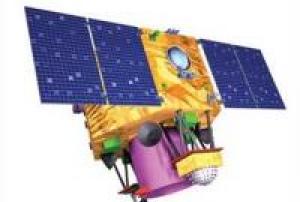
Cartosat-2 is an advanced remote sensing satellite with a single panchromatic camera (PAN) capable of providing scene-specific spot imageries for cartographic applications. The camera is designed to provide imageries with better than one meter spatial resolution and a swath of 10 km. The satellite will have high agility with capability to steer along and across the track up to + 45 degrees. It will be placed in a sun-synchronous polar orbit at an altitude of 630 km. It will have a revisit period of four days. The re-visit can be improved to one day with suitable orbit manoeuvres.
Several new technologies like two mirror on axis single camera, Carbon Fabric Reinforced Plastic based electro optic structure, lightweight, large size mirrors, JPEG like data compression, advanced solid state recorder, high-torque reaction wheels and high performance star sensors are being employed in Cartosat-2.
Instrument: PAN (...
read more12/07/2010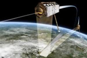
The TanDEM-X mission will survey all 150 million square kilometres of Earth's land surface several times over during its three-year mission. Apart from its high measuring-point density (a 12-metre grid) and high vertical accuracy (better than two metres), the elevation model generated by TanDEM-X will have another unrivalled advantage – being entirely homogenous, it will serve as a basis for maps that are globally consistent. Conventional maps are often fragmented along national borders, or difficult to reconcile as they are based on different survey methods or because of time lags between survey campaigns. Together TanDEM-X and TerraSAR-X are form the first configurable synthetic aperture radar interferometer in space. Besides this primary goal, the mission has several secondary objectives based on new and innovative methods such as along-track interferometry, polarimetric synthetic aperture radar interferometry, digital beamforming and bistatic radar. The TanDEM-X...
read more21/06/2010
WorldView-2 (WV2) is a commercial imaging satellite of DigitalGlobe Inc. of Longmont, CO, USA (follow-on spacecraft to WorldView-1). The overall objective is to meet the growing commercial demand for high-resolution satellite imagery (0.46 cm Pan, 1.8 m MS at nadir - representing one of the highest available spaceborne resolutions on the market).
In the fall of 2003, DigitalGlobe had received a contract from NGA (National Geospatial-Intelligence Agency) of Washington DC to provide high-resolution imagery from the next-generation commercial imaging satellites. The contract award was made within NGA's NextView program. The NGA requirements called for imagery with a spatial resolution of 0.5 m panchromatic and 2 m MS (Multispectral) data.
The WorldView-2 sensor provides a high resolution panchromatic band and eight (8) multispectral bands; four (4) standard colors (red, green, blue, and near-infrared 1) and four (4) new bands (coastal,...
read more08/10/2009
The Deimos-1 mission is fully owned and operated by Deimos Imaging (DMI), an UrtheCast company. Deimos-1 satellite was successfully launched on 29 July 2009 from the Baikonur Launch Complex (Kazakhstan) in the Russian-Ukrainian Dnepr launcher. The mission is fully dedicated to Earth Observation and captures images all around the world. Thus, currently the Deimos-1 system provides capabilities well above and beyond the design goals.
The payload is a three-band multispectral imager system with 22m Ground Sample Distance (GSD) at nominal altitude (663 km) with 625 km swath, 8 or 10 bits radiometric depth available. Imager delivers data in three spectral bands, very close to the Near-Infrared (NIR), Red (R) and Green (G) bands in the Landsat series of US satellites. The satellite payload is a dual bank linear CCD push broom imager, so that banks are mounted at an angle to provide a wide imaging swath, one of the most characteristics Deimos-1 features.Instrument:...
read more29/07/2009
UK-DMC2 is based on the SSTL-100 satellite platform and was launched in 2009 for the commercial imaging company, DMCii (a subsidiary of SSTL). It provides high resolution (22m) imagery from a sun-synchronous orbit over very large areas (650km swath, 2000km along track), with a daily revisit to global targets.
The UK-DMC2 satellite carries a multispectral optical instrument with a spatial resolution of 22 m with three spectral bands (red, green, NIR) and a wide swath of more than 600 km. UK-DMC2 operates within the Disaster Monitoring Constellation, the first Earth observation constellation of low cost small satellites providing daily images for applications including global disaster monitoring. The Disaster Monitoring Constellation is coordinated by DMC International Imaging Ltd (DMCii) for disaster response within the International Charter: Space & Major Disasters.Instrument: SLIM6-22
read more
- compact imager with 22m GSD at 686km orbital height...29/07/2009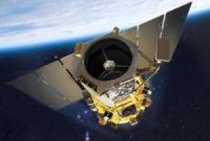
The GeoEye-1 satellite sensor was successfully launched on September 6, 2008. The satellite, which was launched at Vanderberg Air Force Base, California, provides a resolution of 0.46 meters.
GeoEye-1 is capable of acquiring image data at 0.46 meter panchromatic (B&W) and 1.84 meter multispectral resolution. It also features a revisit time of less than three days, as well as the ability to locate an object within just three meters of its physical location.
read more
The GeoEye-1 satellite sensor features the most sophisticated technology ever used in a commercial remote sensing system. This sensor is optimized for large projects, as it can produce over 350,000 square kilometers of pan-sharpened multispectral satellite imagery every day.
GeoEye-1 has been flying at an altitude of about 681 kilometers and is capable of producing imagery with a ground sampling distance of 46 centimeters, meaning it can detect objects of that diameter or greater.
During late summer of...06/09/2008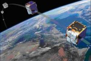
RapidEye is a full end-to-end commercial Earth Observation system comprising a constellation of five minisatellites, a dedicated SCC (Spacecraft Control Center), a data downlink ground station service, and a full ground segment designed to plan, acquire and process up to 5 million km2 of imagery every day to generate unique land information products.
read more
The system is owned and operated by BlackBridge. MDA (MacDonald, Dettwiler and Associates Ltd) was the mission prime contractor and was responsible for the delivery of the space and ground segments, launch of the constellation, and on-orbit commissioning and camera calibration. The two major subcontractors to MDA were SSTL (Surrey Satellite Technology Ltd.) for the spacecraft bus, SCC and spacecraft AIT (Assembly, Integration and Test) services, as well as Jena Optronik GmbH (JOP) who provided the 5-band multispectral imager (RGB, red edge, and near IR bands).
The RapidEye constellation represents a major milestone...29/08/2008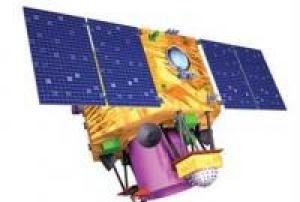
Cartosat-2 is an advanced remote sensing satellite with a single panchromatic camera (PAN) capable of providing scene-specific spot imageries for cartographic applications. The camera is designed to provide imageries with better than one meter spatial resolution and a swath of 10 km. The satellite will have high agility with capability to steer along and across the track up to + 45 degrees. It will be placed in a sun-synchronous polar orbit at an altitude of 630 km. It will have a revisit period of four days. The re-visit can be improved to one day with suitable orbit manoeuvres.
Several new technologies like two mirror on axis single camera, Carbon Fabric Reinforced Plastic based electro optic structure, lightweight, large size mirrors, JPEG like data compression, advanced solid state recorder, high-torque reaction wheels and high performance star sensors are being employed in Cartosat-2.
Instrument: PAN (...
read more28/04/2008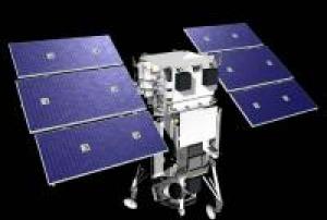
The WorldView-1 offers a high-capacity, panchromatic imaging system which features 0.46m resolution imagery.
Operating at an altitude of 496 kilometers, WorldView-1 satellite has an average revisit time of 1.7 days and is capable of collecting up to 750,000 square kilometers (290,000 square miles) per day of half-meter imagery. The satellite is also equipped with state-of-the-art geo-location capabilities and exhibits stunning agility with rapid targeting and efficient in-track stereo collection.
WorldView-1 satellite sensor was successfully launched from Vandenberg Air Force Base, California, U.S.A., at 11:35 Hrs Pacific Daylight Time (PDT) on September 18th, 2007.
Instrument: WV60 (WorldView-60 camera)
read more
- spectral range 0.45 - 0.90 µm
- swath width: 17.6km at nadir
- pushbroom imager18/09/2007
TerraSAR-X is a German Earth-observation satellite. Its primary payload is an X-band radar sensor with a range of different modes of operation, allowing it to record images with different swath widths, resolutions and polarisations. TerraSAR-X thus offers space-based observation capabilities that were previously unavailable. The objective of the mission is to provide value-added SAR (Synthetic Aperture Radar) data in the X-band, for research and development purposes as well as scientific and commercial applications.
The successful launch of TerraSAR-X on 15 June 2007 at 08:14 local time from the Russian Baikonur Cosmodrome in Kazakhstan marked the start of a campaign to map the Earth at an unprecedented level of accuracy. The aim is to create new, high-quality radar images of the Earth’s surface.Instrument: SAR (Synthetic Aperture Radar)
read more
- the sensor operates in the X-band and in 3 different modes (Spotlight, Stripmap, ScanSAR)15/06/2007
Term Parents
UN-SPIDER Regional Support Offices with hazard-specific expertise
![]()