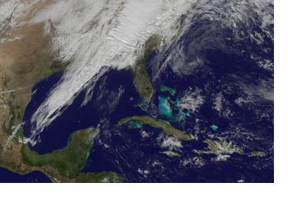
The Bureau of Meteorology informed that the new satellite, called Himawari 8, will provide updated images every ten minutes. The aircraft, developed by the Japanese Meteorological Agency, is able to generate full color and better resolution imagery that will led to more accurate forecast to issue weather warning.
The head of the weather bureau, Dr. Andrew Tupper, explained that Himawari 8 will allow a closer monitoring and better understanding of weather events. "Just about everything we do in terms of real time weather we'll be able to see better with this satellite; thunderstorms, cold fronts, cool changes, fires and it will be really useful for hot spot monitoring. Even volcanic eruptions, we've already seen with some major eruptions to our north that the satellite can sense them more quickly and distinguish the ash more accurately, and of course there's tropical cyclones," he affirmed.
Early warning is one of the benefits this new technology will offer. Because of the quick imagery processing, people’s response will also be able to improve and a better timing in the decision-making process.
Himawari 8 takes observations periodically and thanks to an upcoming weather bureau’s supercomputer is expected to contribute with a higher information processing power. According to experts, during the past 25 years, forecasting had radically improved; satellite imagery is one of the main sources.

