![]()
United
Nations
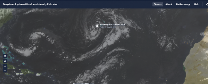
Deep Learning-based Hurricane Intensity Estimator (NASA)
| Data provided by: | National Aeronautics and Space Administration (NASA) |
| Data accessibility: | Datos estadísticos (ej. gráficos), Visualización de datos (ej. web SIG o monitoreo en tiempo real) |
| Link to the data: | |
| Data type: | Datos sobre amenazas específicas, Datos satelitales o imágenes aéreas |
| Hazard: | Severe Storm |
| Disaster cycle phase: | Gestión des Riesgo por Desastres, Respuesta, Recuperación |
| Satellites and Sensors: | GOES- 8-15 (IMAGER) |
| Spatial coverage: | Global |
| Spatial resolution: | 0.5 - 2 km |
| Temporal coverage: | Casi en tiempo real |
| Technical Specifications: | |
| Costs: | Gratis |
| Contact: | Feedback Platform |
Provider
![]()