![]()
United
Nations
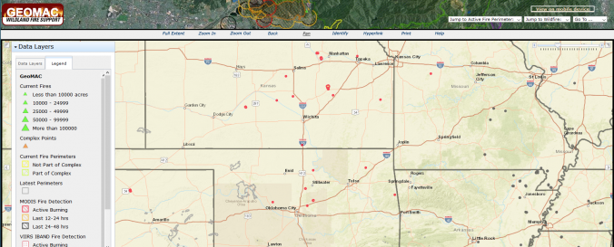
GEOMAC Wildland Fire Support (USGS)
| Data provided by: | United States Geological Survey (USGS) |
| Data accessibility: | Visualización de datos (ej. web SIG o monitoreo en tiempo real) |
| Link to the data: | |
| Data type: | Datos sobre amenazas específicas |
| Hazard: | Forest Fire |
| Disaster cycle phase: | Gestión des Riesgo por Desastres, Respuesta, Recuperación |
| Space-based Information: | The GEOMAC Wildland Fire Support includes layers on: point-layer of past years fires, fire boundaries/ perimeter, current firest, satellite-based fire detection: MODIS VIIRS HMS, wildland-urban interface, |
| Spatial coverage: | United States of America |
| Spatial resolution: | 250m, geolocated points |
| Temporal coverage: | Archivado, Casi en tiempo real |
| Content dates: | 2002-Present |
| Technical Specifications: | |
| Costs: | Gratis |
| Contact: | GEOMAC About |
Provider
![]()