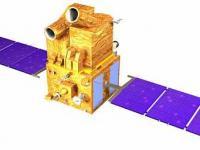
Cartosat-1 satellite sensor was built by ISRO (Indian Space Research Organization) which is mainly intended for cartographic applications was launched by the PSLV on May 5, 2005 at Sriharikota, India.
Prior to launch, ISRO renamed the IRS-P5 spacecraft to CartoSat-1, to describe more aptly the application spectrum of its observation data. In this mission, the high resolution of the data (2.5 m GSD) is being traded at the expense of multispectral capability and smaller area coverage, with a swath width of 30 km. The data products are intended to be used in DTM (Digital Terrain Model)/DEM (Digital Elevation Model) generation in such applications as cadastral mapping and updating, land use as well as other GIS applications.
Instrument: PAN (Panchromatic Camera)
- high resolution optical imager
- max swath: 30km
