Computer Requirements
To perform the step-by-step procedure, it is required to install Quantum GIS (3.6.0-Noosa or newer version).
Required Datasets
- Digital Elevation Model (e.g. WorldDEMTM a product of Airbus Defence and Space, please refer to this website for the study area
- Coastline vector (e.g. WorldDEMTM Ocean Shoreline a product of Airbus Defence & Space, please refer to this website for further information
In case you want to test the Recommended Practice with WorldDEMTM data, please get in contact with Airbus through the contacts mentioned on the overview page.
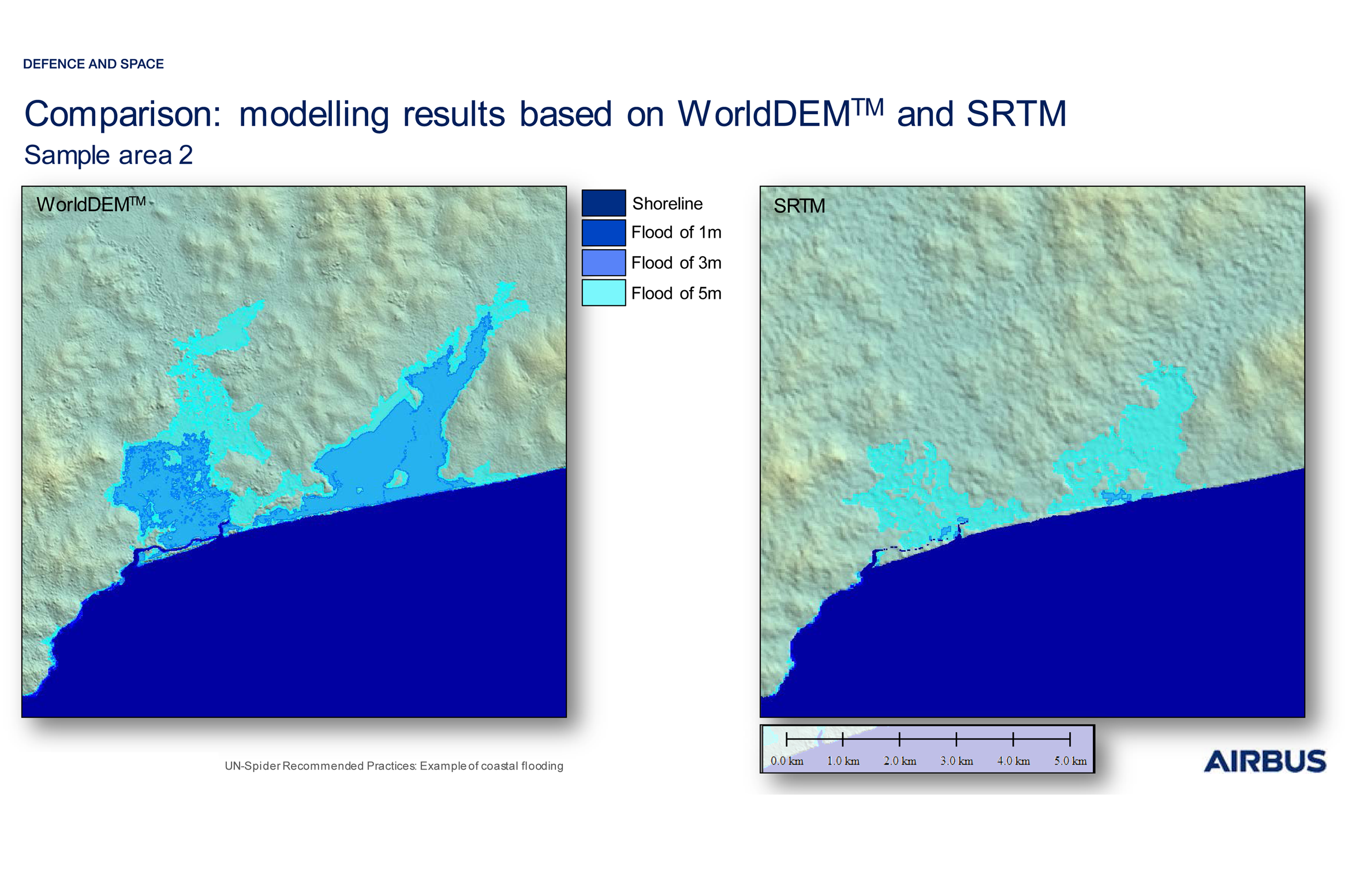
The precision and reliability of the results of modelling strongly depend on the quality and resolution of the Digital Elevation Model (DEM) used as basis for the analysis. The high resolution and level of detail provided by WorldDEMTM data allows an accurate delineation of the water distribution and of potential water streams between structures and buildings.
The Airbus Defence and Space elevation data WorldDEMTM is more sensitive to the distribution of water than the SRTM DEM: the use of the WorldDEMTM can lead to a more precise estimation of the effect of coastal flooding caused by e.g. storm surges or tidal waves.

Figure 1: Comparison between WorldDEMTM results vs SRTM results. SRTM shows completely different results.
Develop scenarios of impacts of storm surges in specific coastal areas;
Conduct an initial assessment of risk associated with storm surges;
Improve storm surge early warning systems using scenarios of the extent of coastal flooding.
Strengths:
- Can be used in all coastal areas of the world, the WorldDEMTM data is available globally
- Free and open-source software can be used (e.g. Quantum GIS)
WorldDEMTM:
- Resolution: 0.4 arcsec (approx. 12m)
- Absolute vertical accuracy: < 4m (90% linear error)
- Relative vertical accuracy: < 2m (slope <= 20%) / < 4m (slope <= 40%)
Limitations and Restrictions:
The WorldDEMTM data is globally available. However, for some regions there are restrictions regarding geographic availability. Consult with Airbus Defence and Space to determine whether data can be supplied for your region of interest.

- Airbus Defence and Space (2018): WorldDEM™ Technical Product Specification. Issue 1.0, Version 2.4. July 2018. Available at: https://www.intelligence-airbusds.com/files/pmedia/public/r51492_9_2019-04_worlddem_technicalspecs_version2.5_i1.0.pdf
- World Meteorological Organization (2011). Guide to Storm Surge Forecasting. Publication No. 1076. Geneva, Switzerland, 2011. Available at: https://library.wmo.int/pmb_ged/wmo_1076_en.pdf
- DLR Document: TD-GS-PS-0021 (2016). TanDEM-X Ground Segment - DEM Products Specification Document, Issue 3.1, 05.08.2016. Available at https://tandemx-science.dlr.de/pdfs/TD-GS-PS-0021_DEM-Product-Specification_v3.1.pdf
