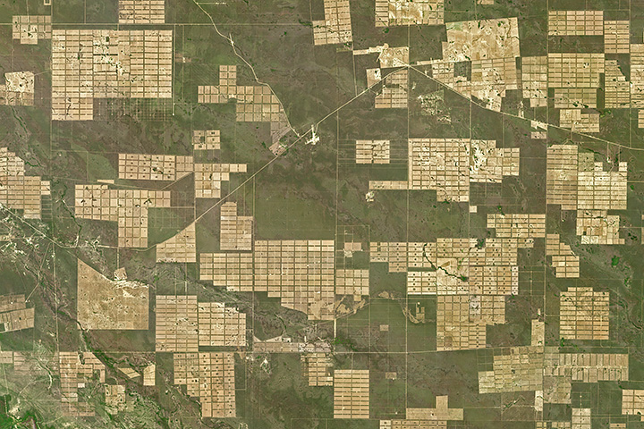
A new programme aims to prevent and countermand the loss of tropical forests by facilitating the global availability of high-resolution satellite imagery. Launched by Norway’s Ministry of Climate and Environment in partnership with satellite imagery providers Kongsberg Satellite Services, Planetand Airbus, the Imagery Programme makes use of space-based information to combat the devastating effects of climate change, mitigate disasters and facilitate disaster management efforts worldwide.
Trees are vital for upholding an environmental equilibrium and deforestation causes a disruption with devastating effects on our climate. Meaningfully, the positive correlation between deforestation and global warming is widely recognized. The impact of deforestation on the environment can be two-fold. Deforestation by burning, which is a common practice, releases harmful gases generated from burning biomass into the atmosphere. Further, when trees perishas a result of deforestation, they release greenhouse gases stored inside them, like carbon dioxide, into the atmosphere.
As a direct contributing factor to climate change, deforestation also amplifies the risk and severity of disasters.This relationship is especially noticeable in the case of floods. The explanation of this can be traced to the role of the forest as a natural protector from flooding. According to the European Environment Agency, “forests can soak up excess rainwater, preventing run-offs and damage”. Without tree cover, the land also suffers soil erosion which arrives at the river beds and increases the level of the water severely. These combining factors caused by deforestation increase the risk and vulnerability of the landscape to flooding. The detrimental effect of deforestation on the environment highlights the need to conserve tropical forests globally. Satellite technology is a useful tool in this regard as it allows us to monitor deforestation and gain valuable knowledge of the impact on tropical forests globally. With this information, it is possible to more efficiently mobilise efforts to stop deforestation and protect the environment. Therefore, it also proves useful to combat the effects of climate change, mitigate natural disasters and facilitate disaster management support efforts worldwide.

This is the reason that the launch of the NICFI Imagery Program is so significant. The cooperation between three providers of satellite imagery raises global forest monitoring to a new level. Each organisation has its part to play in the NICFI Imagery Program. Planet, an American private Earth imaging company,provides high-resolution basemaps of tropical forests in over 64 developing countries that are updated on a monthly basis. Aerospace corporation Airbus grants its large archive of SPOT high resolution imagery to the programme. Kongsberg Satellite Services, a data and satellite communication services provider, will offer technical support. For more information about the partnership, click here.
With these joint technical capabilities at its core, the NICFI Imagery Program can offer global access to high-resolution satellite imagery of the tropics. The programme provides access to around 45 million square kilometres of land, located between 30 degrees latitude South and 30 degrees latitude North at a spatial resolution of 4,77 metres. In detail, the public can access two types of data: archived and monitoring. Archived data represents imagery from December 2015 - August 2020 with a bi-annual cadence. Monitoring data represents imagery from September 2020 - September 2022 with a monthly cadence. More information on the type of data captured by the NICFI Imagery Program can be found in this webinar.
This data access will facilitate global efforts to prevent deforestation and, in doing so, contribute to mitigating natural disasters worldwide. The information will allow disaster risk professionals the ability to gain better insight about areas of deforestation and draw vital conclusions that will allow them to better manage a natural disaster before, during and after it takes place.

