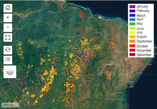
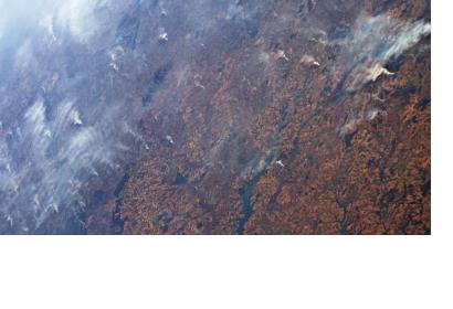
Increasing in frequency and severity, wildfires have had a devastating impact in several areas around the world in recent years. The effects of wildfires pose a particular risk to the environment and communities in the Latin America and Caribbean (LAC) region. In order to mitigate the effects of wildfires and support wildfire risk management in the region, the Joint Research Centre (JRC) of the European Commission (EC) recently launched country profiles under the Global Wildfire Information System (GWIS).
A wildfire refers to “an unplanned, unwanted wild land fire”. Wildfires are both caused by man-made activity (slash/burn land clearing) and natural events (lightning or extreme drought). The likelihood of a wildfire increases dramatically in the dry season and during high winds. Wildfires can have a devastating impact on the environment and communities. According to the World Health Organization, wildfires trigger “a deterioration of the air quality, and loss of property, crops, resources, animals and people''. The use of Earth observation (EO) data is essential for monitoring wildfires, managing their risks and supporting all phases of the disaster management cycle.
GWIS is a joint initiative of the Group on Earth Observations (GEO), Copernicus and the National Aeronautics and Space Administration (NASA) that uses EO data to support “enhanced wildfire prevention, preparedness and effectiveness in wildfire management”. As the need to address the risks of wildfires both supports climate change mitigation and disaster management globally, GWIS corresponds with the Paris Agreement on Climate Change and the Sendai Framework for Disaster Risk Reduction 2015-2030. With support from the NASA Earth Science and Applied Sciences GEO GWIS program and in collaboration with the University of Idaho and Michigan State University, the JRC of the EC recently launched country profiles integrated into GWIS which supply historical and near real-time “information on the geographic distribution of wildfires, burnt areas and emissions, and assess wildfire regimes and impacts at country and sub-country level”.

Although available for every continent, the action by the JRC is part of a holistic strategy by the European Union to “support conservation and sustainable development of the Amazon forests” that includes over 50 initiatives. The European Commission, for example, recently started a project that makes use of the country profiles under GWIS to support wildfire risk management in the LAC region. In detail, the project wants to foster knowledge and information exchange on wildfire risk management in the region by establishing a LAC expert group on wildfires and fostering the intra-regional dissemination of GWIS country data respectively. More details on the project can be found here.
Additional information:

