
UN-SPIDER Programme, United Nations Office for Outer Space Affairs (UNOOSA)
Pacific GIS and Remote Sensing Council (PGRSC)
Preparing for the Pacific Islands GIS and Remote Sensing User Conference 2026
Space Technologies, GeoAI, and Digital Twin for Disaster Resilience in the Pacific
9 September 2026 (Wednesday) | 16:00 Fiji Time (FJT, UTC+12) | 60 minutes | Online - live broadcast and recording
Organized by UN-SPIDER (UNOOSA) in collaboration with the Pacific GIS and Remote Sensing Council (PGRSC)
Registration
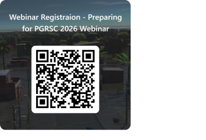
Register to attend the webinar: https://forms.cloud.microsoft/e/sRTXWGE00f
Registration is free and open to all. The webinar will be recorded and made available on the PGRSC Members' Section.
About the Webinar
This webinar is organized ahead of the Pacific Islands GIS and Remote Sensing User Conference 2026, hosted by PGRSC, taking place 30 November to 4 December 2026 in Suva, Fiji. It gives participants an introduction to the topics that will be covered in the UN-SPIDER hands-on workshop at the PGRSC User Conference on 4 December (afternoon) to 5 December (morning).
The webinar presents the Japan-funded project "Pacific Digital Twin for Disaster Resilience: Data-Driven Planning with IoT and Satellite Solutions", implemented by UNOOSA through UN-SPIDER. The project applies satellite imagery, digital twins, and GeoAI to strengthen disaster preparedness in Pacific Island countries.
Background
Disaster Risk in the Pacific
Pacific Island countries face serious risks from natural hazards, including cyclones, flooding, volcanic eruptions, and sea-level rise. Many countries also lack the geospatial data needed for effective disaster planning, such as building information, elevation data, and real-time weather monitoring.
The project is funded by the Government of Japan through its supplementary budget programme. It focuses on the Cook Islands, the Kingdom of Tonga, and the Republic of Palau, and responds to the growing frequency of climate-related disasters in the region.
The project builds on UN-SPIDER's earlier work in Tonga, including the CEOS-UNOOSA Tonga Disaster Preparedness Pilot Project. Under that project, a 3D digital twin of Tongatapu was developed using 30cm satellite imagery and AI-based building detection. It allowed users to simulate sea-level rise and flooding scenarios. The platform is now used by Tonga's National Disaster Risk Management Office (NDRMO) for disaster preparedness and planning.
Learn more about the Tonga Pilot Project: https://un-spider.org/projects/TongaPilotProject
Webinar Topics
- Satellite-derived DSM and DTM, and digital twin development using generative AI and super-resolution
- GeoAI tools including Geospatial Vision Language Models and Agentic AI for disaster risk management
- IoT weather monitoring and its integration into a WebGIS disaster platform
- Perspectives from the Cook Islands on disaster risk needs and project expectations
- The Digital Earth Pacific programme (SPC) and regional collaboration opportunities
Speakers
Jumpei Takami Moderator and Main Presenter | Associate Expert in Remote Sensing for Disaster Management, UN-SPIDER Programme, UNOOSA. Lead project manager for the Japan-funded Pacific Digital Twin for Disaster Resilience project. |
Brad Eichelberger Welcome Remarks | Chair of the Pacific Islands GIS and Remote Sensing User Conference. |
John Strickland Speaker | Director, Emergency Management Cook Islands (EMCI), Office of the Prime Minister, Rarotonga, Cook Islands. |
Andiswa Mlisa Speaker | Programme Manager, Digital Earth Pacific, Pacific Community (SPC), Noumea, New Caledonia. |
About the Pacific Islands GIS and Remote Sensing User Conference 2026
The Pacific Islands GIS and Remote Sensing User Conference, hosted by PGRSC, takes place from 30 November to 4 December 2026 at the Japan USP-ICT Hall in Suva, Fiji. It is the largest geospatial event in the Pacific region, bringing together over 300 participants from government, universities, research institutions, regional organizations, space agencies, and industry. The conference includes presentations, workshops, and networking events.
This webinar gives prospective participants a preview of the technologies and themes that will be covered at the conference, including the UN-SPIDER hands-on workshop on 4 and 5 December. The workshop will offer practical training on digital twin development, GeoAI, JAXA satellite tools, and the WebGIS Disaster Risk Management platform.
Register for the PGRSC User Conference 2026: https://pgrsc.org/conference-registration/
More information: https://pgrsc.org/pacific-gis-rs-users-conference/
Contact
For questions about the webinar, please contact Jumpei Takami at jumpei.takami [at] un.org (jumpei[dot]takami[at]un[dot]org) (UN-SPIDER Programme, UNOOSA).
For questions about the Pacific Islands GIS and Remote Sensing User Conference, hosted by PGRSC, please contact pgrsc [at] pgrsc.org (pgrsc[at]pgrsc[dot]org).
